Reports of Investigations
-
Books & Reports
- Reports of Investigations
- Guidebooks
- Udden Series
- Geological Circulars
- Down To Earth
- Atlases of Major Oil and Gas Reservoirs
- Texas Memorial Museum Publications
- Environmental Geologic Atlas of the Texas Coastal Zone
- Mineral Resource Circulars
- Other Reports
- Seminars and Workshops
- Handbooks
- Submerged Lands of Texas
- Symposia
- Annual Reports
- Open File Reports
-
Maps & Cross Sections
- Thematic Maps
- Miscellaneous Maps, Charts & Sections
- Geologic Atlas of Texas
- STATEMAP Project Maps
- Geologic Quadrangle Maps
- Cross Sections
- Highway Geology Map
- Energy and Mineral Resource Maps
- Shoreline Change and Other Posters
- Wilcox Group, East Texas, Geological / Hydrological Folios
- Bouguer Gravity Atlas of Texas
- River Basin Regional Studies
- Featured Maps
- Posters
- Teachers & the Public
-
Geological Society Publications
- Gulf Coast Association of Geological Societies
- Alabama Geological Society
- Austin Geological Society
- Corpus Christi Geological Society
- Houston Geological Society
- Lafayette Geological Society
- Mississippi Geological Society
- New Orleans Geological Society
- South Texas Geological Society
- GCS SEPM Publications
- Historic BEG & UT Series
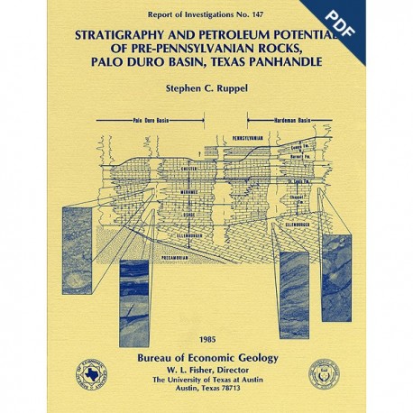
Stratigraphy and Petroleum Potential of... Rocks, Palo Duro Basin, Texas Panhandle. Digital Download
RI0147D
A free, digital version of this publication can be found on: Texas ScholarWorks
To purchase a print version (if available): RI0147
RI0147D. Stratigraphy and Petroleum Potential of Pre- Pennsylvanian Rocks, Palo Duro Basin, Texas Panhandle, by S. C. Ruppel. 81 p., 64 figs., 5 tables, 4 appendices, 1985. doi.org/10.23867/RI0147D. Downloadable PDF.
To purchase this publication in book format, please order RI0147.
ABSTRACT
Pre-Pennsylvanian rocks in the Palo Duro Basin include (1) basal transgressive marine Cambrian(?) sandstones deposited over Precambrian basement, (2) overlying Lower Ordovician dolomites of the Ellenburger Group that formed when shallow seas covered much of the North American continent, and(3) Mississippian limestones and dolomites deposited when the area was inundated again after middle Paleozoic uplift and erosion. A generally similar stratigraphic sequence exists in the adjacent Dalhart and Hardeman Basins. Mississippian deposits, the most widespread and best known pre-Pennsylvanian rocks, exhibit considerable facies and paleoenvironmental diversity throughout the Texas Panhandle. The lowermost Mississippian "Osage" contains cherty and shaly dolomites and limestones. In the eastern Palo Duro Basin and in the Hardeman Basin further to the east, these rocks are interbedded carbonate mudstones and limestone turbidites that were deposited below wave base in relatively deep, quiet water. Westward, the "Osage" includes progressively shallower water facies.
"Meramec" limestones are remarkably similar throughout the Texas Panhandle. These coarse-grained, light-colored, skeletal (bryozoan/echinoderm) grainstones record the establishment during the middle to late Meramecian of a widespread, shallow-water, carbonate sand shoal. However, before this shoal developed in the Hardeman Basin, numerous local carbonate buildups formed (Chappel Formation).
The uppermost Mississippian "Chester" contains interbedded ooid grainstones and shales that attest to (1) the maintenance of shallow-water marine conditions and (2) the development of terrigenous clastic source areas associated with early phases of Late Carboniferous tectonic activity. Uppermost "Chester" shales (Barnett Formation) and limestones (Comyn Formation) in the Hardeman Basin to the east are not present in the Palo Duro Basin owing to facies change or erosion or both.
All pre-Pennsylvanian units contain sufficient porosity and permeability, at least locally, to be hydrocarbon reservoirs. Potential structural and stratigraphic traps are plentiful throughout the area. Carbonate buildups are productive in the nearby Hardeman Basin; similar buildups may exist in at least the eastern part of the Palo Duro Basin. However, suitable top seals may be lacking in the Palo Duro Basin.
Although the quality of organic matter contained in the pre-Pennsylvanian deposits in the Palo Duro Basin is good, there is probably too little organic carbon for these rocks to be hydrocarbon sources. The "Osage" of the eastern Palo Duro Basin contains the highest amounts of organic matter. The Barnett Formation, which contains organic-matter-rich shales in the Hardeman Basin to the east, does not extend into the Palo Duro Basin.
Calculations of thermal maturity based on vitrinite reflectance indicate that although pre-Pennsylvanian rocks in the Palo Duro Basin are substantially less mature than those in the Hardeman Basin, most have attained at least the minimum degree of heating necessary to produce hydrocarbons. Thermal maturity in the area generally correlates with the present-day geothermal gradient, which increases toward the east.
Petroleum potential of the pre-Pennsylvanian rocks of the Palo Duro Basin is relatively low. Future exploration in these rocks should concentrate on areas where source rock quality, maturity, and reservoir conditions are optimum. The extreme southern and eastern parts of the basin appear to offer the greatest promise.
Keywords: source rocks, Mississippian, Ordovician, Palo Duro Basin, Hardeman Basin, thermal maturity, stratigraphy, petroleum potential, Ellenburger Group, Chappel Formation
CONTENTS
ABSTRACT
INTRODUCTION
GENERAL SETTING
METHODS
STRUCTURAL SETTING
STRATIGRAPHY
Basal (Cambrian?) siliciclastics
Lower Ordovician Ellenburger Group
The Mississippian System
Hardeman Basin
Palo Duro Basin
"Kinderhook"
"Osage"
"Meramec"
"Chester"
The Mississippian/Pennsylvanian boundary
Age relationships
POROSITY AND PERMEABILITY
Estimates of porosity
Porosity types
Permeability
SOURCE ROCK POTENTIAL
Organic matter content
Organic matter type
Thermal maturity
Pre-Pennsylvanian carbonates as source rocks
Other potential hydrocarbon sources
POTENTIAL TRAPS AND TRENDS
SUMMARY AND CONCLUSIONS
ACKNOWLEDGMENTS
REFERENCES
APPENDICES
A. Wells referenced in this report
B. Total organic carbon data from the Texas Panhandle
C. Organic matter index
D. Thermal alteration index
Figures
1. Map of the Texas Panhandle indicating major subsurface features and cored wells
2. Schemes of stratigraphic nomenclature applied by previous workers to pre-Pennsylvanian rocks in the Texas Panhandle
3. Structure-contour map on the top of the Ellenburger Group (Lower Ordovician)
4. Structure-contour map on the top of the Mississippian System
5. Typical pre-Pennsylvanian sections in the Dalhart, Palo Duro, and Hardeman Basins
6. Thickness map, basal Cambrian(?) siliciclastic deposits
7. Thickness map, Ellenburger Group (lower Ordovician)
8. Aphanitic dolomite containing parallel planar laminations, Ellenburger Group, Hardeman Basin
9. Burrowed aphanitic dolomite, Ellenburger Group, Hardeman Basin
10. Cryptalgally laminated aphanocrystalline dolomite, Ellenburger Group, Hardeman Basin
11. Breccia horizon developed at the top of the Ellenburger Group
12. Mississippian subcrop
13. Thickness map, Mississippian System
14. West-east cross section of pre-Pennsylvanian strata through the Palo Duro and Hardeman Basins
15. Map showing thickness and distribution of the Barnett Formation in the Texas Panhandle
16. Map showing thickness of basal Mississippian sandstones ("Kinderhook") in the Texas Panhandle
17. Map showing thickness and distribution of basal Mississippian shales in the Palo Duro Basin
18. Map showing thickness of the "Osage"
19. Dolomite-percent map, "Osage"
20. Mississippian section and core intervals in the Childress 10 well
21. Core description of the lower "Osage" (lower Chappel), Childress 10 well
22. Core description of the "Meramec" and upper "Osage," Childress 10 well
23. Alternating layers of skeletal lime-silt grainstone and dark-colored wackestone typical of lower "Osage," Childress 10 well
24. Alternating layers of grainstone and wackestone
25. Photomicrograph of skeletal wackestone
26. Photomicrograph of dark-brown, laminated skeletal wackestone
27. Skeletal lime-sand grainstone having contorted laminations and mud-lined truncation surfaces
28. Burrow-mottled, skeletal lime-sand grainstone with disrupted wackestone laminations
29. Breccia bed composed of clasts of lime-silt grainstone and silicified, laminated grainstone in matrix of partly laminated skeletal wackestone
30. Breccia bed containing clasts of silicified grainstone and interbedded grainstone and wackestone
31. Photomicrograph of dark-gray spiculitic wackestone containing sponge spicules and rare skeletal debris
32. Pre-Pennsylvanian section and cored interval in the Donley 3 well
33. Description of "Osage" core in the Donley 3 well
34. lnterbedded spiculitic dolomite and skeletal grainstone
35. Photomicrograph of skeletal grainstone
36. Laminated and heavily burrowed, argillaceous, spiculitic dolomite
37. Photomicrograph of spiculitic dolomite
38. Thickness map, "Meramec"
39. Dolomite-percent map, "Meramec"
40. lnterlayered skeletal grainstone, wackestone, and mudstone common near the base of the "Meramec,'' Childress 10 well
41. Crossbedded skeletal grainstone
42. Photomicrograph of skeletal grainstone containing abundant echinoderms and fenestrate bryozoans
43. Thickly bedded to massive, poorly sorted skeletal grainstone common in upper part of "Meramec"
44. Layer of dark, thinly laminated skeletal wackestone
45. Thickness map, "Chester"
46. Map showing percent siliciclastics in the "Chester"
47. Revised stratigraphy of the Mississippian System in the Palo Duro and Hardeman Basins
48. Average porosity of the "Osage"
49. Thickness of "Osage" rocks having greater than 10 percent porosity
50. Average porosity of the "Meramec
51. Porosity in the Ellenburger Group as shown by photomicrographs of intercrystalline porosity and of small vugs and moldic porosity
52. Photomicrograph showing intraparticle porosity developed in zooecia of fenestrate bryozoans in skeletal lime-sand grainstone
53. Photomicrograph showing secondary interparticle porosity associated with dolomitization of skeletal lime-sand grainstone
54. Photomicrograph showing primary intraparticle porosity in bryozoan zooecia
55. Distribution of oil and gas shows and producing wells and fields in the Ellenburger Group, Texas Panhandle
56. Distribution of oil and gas shows and producing wells and fields in Mississippian rocks of the Texas Panhandle
57. Wells in the Ellenburger Group sampled for geochemical analysis
58. Wells in the Mississippian System sampled for geochemical analysis
59. Distribution of total organic carbon (TOC) in the "Osage"
60. Distribution of organic matter index (OMI) values in the "Osage"
61. Geothermal gradients in the Palo Duro, Dalhart, Hardeman, and Hollis Basins
62. Plot of vitrinite reflectance (Ro) data versus depth, Palo Duro Basin
63. Plot of vitrinite reflectance (Ro) versus temperature in the Palo Duro Basin
64. Plot of conodont alteration index (CAI) with depth
Tables
1. Average well porosities in the pre-Pennsylvanian sequence, Palo Duro Basin
2. Permeability data, Palo Duro Basin
3. Summary of total organic carbon data
4. Kerogen data, Palo Duro and Dalhart Basins
5. Kerogen data, Hardeman Basin
Citation
Ruppel, S. C., 1985, Stratigraphy and Petroleum Potential of Pre-Pennsylvanian Rocks, Palo Duro Basin, Texas Panhandle: The University of Texas at Austin, Bureau of Economic Geology, Report of Investigations No. 147, 81 p.
