Reports of Investigations
-
Books & Reports
- Reports of Investigations
- Guidebooks
- Udden Series
- Geological Circulars
- Down To Earth
- Atlases of Major Oil and Gas Reservoirs
- Texas Memorial Museum Publications
- Environmental Geologic Atlas of the Texas Coastal Zone
- Mineral Resource Circulars
- Other Reports
- Seminars and Workshops
- Handbooks
- Submerged Lands of Texas
- Symposia
- Annual Reports
- Open File Reports
-
Maps & Cross Sections
- Thematic Maps
- Miscellaneous Maps, Charts & Sections
- Geologic Atlas of Texas
- STATEMAP Project Maps
- Geologic Quadrangle Maps
- Cross Sections
- Highway Geology Map
- Energy and Mineral Resource Maps
- Shoreline Change and Other Posters
- Wilcox Group, East Texas, Geological / Hydrological Folios
- Bouguer Gravity Atlas of Texas
- River Basin Regional Studies
- Featured Maps
- Posters
- Teachers & the Public
-
Geological Society Publications
- Gulf Coast Association of Geological Societies
- Alabama Geological Society
- Austin Geological Society
- Corpus Christi Geological Society
- Houston Geological Society
- Lafayette Geological Society
- Mississippi Geological Society
- New Orleans Geological Society
- South Texas Geological Society
- GCS SEPM Publications
- Historic BEG & UT Series
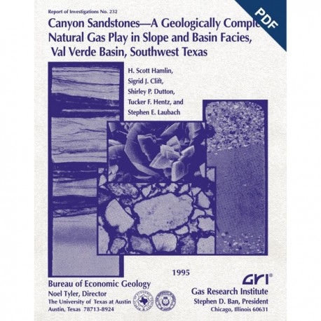
Canyon Sandstones--A Geologically Complex Natural Gas Play ..Val Verde Basin, Southwest Texas. Digital Download
RI0232D
For a print version: RI0232.
RI0232D. Canyon Sandstones--A Geologically Complex Natural Gas Play in Slope and Basin Facies, Val Verde Basin, Southwest Texas, by H. S. Hamlin, S. J. Clift, S. P. Dutton, T. F. Hentz, and S. E. Laubach. 74 p., 68 figs., 7 tables, 3 appendices, 1995. doi.org/10.23867/RI0232D. Downloadable PDF.
To purchase this publication in book format, please order RI0232.
ABSTRACT
Canyon sandstones form a prolific low-permeability gas play in the Val Verde Basin of southwest Texas. Exploration and development activity is at a high level, but little published information on Canyon geology is available. Although several geographically and stratigraphically distinct "Canyon" intervals (Upper Pennsylvanian-Lower Permian) are productive, our study focused on characterizing the stratigraphy, diagenesis, and natural fractures of Sonora Canyon sandstones in Sutton County and Ozona Canyon sandstones in Crockett County. These Canyon intervals are composed of hundreds to thousands of feet of thinly interbedded sandstone and mudstone, which formed in slope and basin depositional systems.
Because outcrops are not present in the Sonora and Ozona intervals and seismic data were not available, well logs and cores formed the data base for this study. Sandstone distribution was mapped regionally and locally in Sutton County, where dense well control and core allowed field-scale facies characterization. Sonora sandstones lie in a wedge-shaped interval along the southwest margin of the Eastern Shelf, whereas the more tabular Ozona interval occupies a basin-floor position adjacent to the south margins of the Ozona Arch and the Central Basin Platform. Other Canyon or "Wolfcamp" sandstone intervals lie adjacent to the Ouachita orogenic belt in the south and west parts of the Val Verde Basin.
Sonora and Ozona sandstones were deposited in deep-water, turbidite systems. Several depositional facies were identified in core: conglomeratic sandstone, thick- and thin-bedded turbidites, chaotic facies, and hemipelagic mudstone. These facies recur in characteristic associations to form the elements of submarine fans: slope channel, proximal channelized fan lobe, distal lobe, and lobe fringe. Individual fan lobes are a few hundred feet thick and a few miles wide, and fan channels are less than 100 ft (< 30 m) thick and less than 1 mi (< 1.6 km) wide. Channel and lobe depositional elements are complexly interbedded and laterally coalesced. Regionally, Canyon fans form multiple-sourced, strike-elongate submarine ramps and slope aprons.
Most Sonora and Ozona sandstones are fine- to medium-grained litharenites. Chertand sedimentary and low-rank-metamorphic rock fragments are the predominant lithic grains. Original porosity and permeability were largely destroyed by compaction and by cementation by quartz and carbonate minerals. Pervasive diagenetic modification masked the expected relationship between depositional facies and reservoir quality. In Sonora sandstones, however, early siderite cementation preserved some intergranular porosity by inhibiting mechanical compaction and precipitation of quartz cement. Although siderite-cemented layers developed preferentially in Bouma T, turbidite divisions, predicting siderite-enhanced porosity will require more comprehensive investigations.
Natural fractures in Canyon core were mapped and described to determine their attributes and orientations. Ozona and Sonora fractures are typically subvertical extension fractures that terminate at the boundaries of beds or cementation zones. Clay-filled fractures in siderite-cemented zones form the most common fracture class in Sonora sandstones but may be flow barriers. Although quartz- and carbonate-cemented fractures are less common in core, fracture porosity is preserved locally along their traces. Spacing between larger, more permeable fractures could not be observed directly but is probably comparable to the thickness of the quartz-cemented intervals that contain the fractures-several feet to tens of feet. A wide range in fracture strike was observed in oriented Sonora core, but subsurface fractures trending generally northeastward are most prone to be open because of in situ stress conditions.
Complexly interacting geologic variables determine the intrinsic attributes of Canyon gas reservoirs. Although depositional environment controls reservoir shapes, dimensions, and internal compartmentalization, our findings suggest that diagenesis and natural fractures exert equal or greater influence on reservoir quality and gas productivity.
Keywords: Canyon sandstone, diagenesis, fractures, natural gas, reservoir properties, stratigraphy, submarine fan, Texas
CONTENTS
Abstract
Introduction
Methods and Data
Reservoir Attributes
Val Verde Basin
Stratigraphic Framework
Sonora Canyon
Regional Sandstone Distribution
Ozona Canyon
Regional Sandstone Distribution
Depositional Facies
Depositional Elements
Miers Area
Sonora Area
Sandstone Composition and Diagenesis
Framework Grains
Cements and Replacive Minerals
Porosity
Siderite in Sonora Sandstones
Controls on Siderite Distribution
Natural Fractures
Fracture Description
Fracture Classes
Timing of Fracturing
Fracture Networks
Fracture Prediction
Summary: Geologic Controls on Reservoir Attributes
Acknowledgments
References
Appendix A: Sources of Canyon Sandstone Core Data
Appendix B. Sonora Maps and Cross Sections
Appendix C. Ozona Maps and Cross Sections
Figures
1. Principal Late Pennsylvanian-Early Permian tectonic elements, Central and West Texas
2. Relative proportions of tight-gas production, new completions, and reserves in existing wells for formations in non-Appalachian, continental United States basins
3. Sonora and Ozona Canyon gas fields
4. Typical well logs from the Sonora trend in Sutton County and the Ozona trend in Crockett County
5. Southwest-northeast schematic cross section showing Late Pennsylvanian-Early Permian depositional topography, northeastern Val Verde Basin
6. Upper Pennsylvanian-Lower Permian stratigraphy, Val Verde Basin and Eastern Shelf
7. Annual gas production and net new completions for Canyon reservoirs, Val Verde Basin
8. Index map of subsurface data
9. Southwest-northeast schematic cross section of the Val Verde Basin showing contrasting tectonic settings and depositional styles
10. Map of the Val Verde Basin showing Canyon sandstone intervals
11. Structure map, contoured on top of pre-Canyon carbonates, northern Val Verde Basin
12. Structure map, contoured on top of Ozona Canyon interval
13. Southwest-northeast regional cross section extending from southwest margin of Eastern Shelf into the deep Val Verde Basin and showing structural and stratigraphic configurations of major Canyon sandstone intervals
14. lsopach map, interval between Strawn limestone and top of Sonora Canyon
15. West-east Sonora stratigraphic cross section B-B' oriented approximately parallel to depositional dip and showing gamma-ray logs
16. Net sandstone thickness map, lower Sonora Canyon map unit
17. Sonora Canyon sandstone depocenters and inferred shelf-edge positions
18. lsopach map, Ozona Canyon interval
19. Southwest-northeast Ozona stratigraphic cross section F-F' oriented along the axis of the Ozona trend and showing gamma-ray logs
20. West-east schematic cross section showing stratigraphic relationships along the north margin of the Val Verde Basin
21. Ozona Canyon sandstone depocenters
22. Simplified submarine-fan model showing depositional elements and typical gamma-ray log responses
23. Photograph of conglomeratic sandstone facies, Sonora Canyon
24. Typical facies characteristics and vertical associations in Sonora core
25. Photographs of thick-bedded and thin-bedded turbidites, Sonora Canyon
26. Photograph of conglomeratic mudstone facies, Sonora Canyon
27. Structure map, contoured on top of Sonora Canyon
28. Net sandstone thickness map, middle Sonora Canyon map unit, Miers field area, south-central Sutton County
29. West-east stratigraphic cross section K-K', Miers field area, showing gamma-ray logs
30. lsopach map, lower Sonora Canyon map unit, Sonora area
31. South-north stratigraphic cross section L-L' connecting the GRI cooperative wells
32. lsopach map, combined middle and upper Sonora Canyon map units
33. Net sandstone map, lower Sonora Canyon map unit, Sonora area
34. Maximum sandstone map, lower Sonora Canyon map unit, Sonora area
35. QFR ternary diagram illustrating detrital components of Sonora and Ozona sandstone samples
36. SEM photograph of siderite and chlorite cement rimming detrital quartz grains in Sonora Sandstone
37. Photomicrograph showing quartz cementation in Sonora Sandstone in the absence of early siderite cementation
38. Photomicrograph of Sonora sandstone showing thick, continuous siderite rims around quartz grains and intergranular porosity
39. Photomicrograph of Ozona sandstone showing plagioclase grains partially replaced by ankerite cement
40. SEM photograph of a cluster of siderite rhombs in Sonora sandstone
41. Typical distribution of fractures in Sonora sandstone core
42. Fracture width versus depth of Sonora sandstones
43. Fracture height versus depth of Sonora sandstones
44. Photographs of fractures in Sonora core
45. Map of initial potentials from wells completed in Sonora interval in the Sonora area
46. Porosity and permeability relationship of Sonora Canyon facies
Tables
1. Canyon sandstone production data, reservoir properties, and engineering parameters
2. Characteristics of Canyon depositional facies
3. Petrographic analyses of Sonora and Ozona Canyon sandstones
4. Comparison of siderite-poor and siderite-rich Sonora Canyon sandstones
5. Summary of fracture-class attributes
Appendix Figures
B1. Net sandstone thickness map, middle Sonora Canyon map unit
B2. Net sandstone thickness map, upper Sonora Canyon map unit
B3. West-east stratigraphic cross section A-A' oriented approximately parallel to depositional dip
B4. West-east stratigraphic cross section C-C' oriented approximately parallel to depositional dip
B5. Northwest-southeast stratigraphic cross section D-D' oriented approximately parallel to depositional strike
B6. Northwest-southeast stratigraphic cross section E-E' oriented approximately parallel to depositional strike
C1. Net sandstone thickness map, Ozona zone 1
C2. Net sandstone thickness map, Ozona zone 2
C3. Net sandstone thickness map, Ozona zone 3
C4. Net sandstone thickness map, Ozona zone 4
C5. Maximum sandstone map, Ozona zone 1
C6. Maximum sandstone map, Ozona zone 2
C7. Maximum sandstone map, Ozona zone 3
C8. Maximum sandstone map, Ozona zone 4
C9. Log facies map, Ozona zone 1
C10. Log facies map, Ozona zone 2
C11. Log facies map, Ozona zone 3
C12. Log facies map, Ozona zone 4
C13. Northwest-southeast stratigraphic cross section G-G' oriented perpendicular to the main Ozona trend
C14. Northwest-southeast stratigraphic cross section H-H' oriented perpendicular to the main Ozona trend
C15. Northwest-southeast stratigraphic cross section I-I' oriented perpendicular to the main Ozona trend
C16. Northwest-southeast stratigraphic cross section J-J' oriented perpendicular to the main Ozona trend
Appendix Tables
A1. Gas Research Institute cooperative wells
A2. Canyon core intervals from older wells
Citation
Hamlin, H. S., Clift, S. J., Sutton, S. P. Hentz, T. F., and Laubach, S. E., 1995, Canyon Sandstones--A Geologically Complex Natural Gas Play in Slope and Basin Facies, Val Verde Basin, Southwest Texas: The University of Texas at Austin, Bureau of Economic Geology, Report of Investigations No. 232D, 74 p. doi.org/10.23867/RI0232D.
