Reports of Investigations
-
Books & Reports
- Reports of Investigations
- Guidebooks
- Udden Series
- Geological Circulars
- Down To Earth
- Atlases of Major Oil and Gas Reservoirs
- Texas Memorial Museum Publications
- Environmental Geologic Atlas of the Texas Coastal Zone
- Mineral Resource Circulars
- Other Reports
- Seminars and Workshops
- Handbooks
- Submerged Lands of Texas
- Symposia
- Annual Reports
- Open File Reports
-
Maps & Cross Sections
- Thematic Maps
- Miscellaneous Maps, Charts & Sections
- Geologic Atlas of Texas
- STATEMAP Project Maps
- Geologic Quadrangle Maps
- Cross Sections
- Highway Geology Map
- Energy and Mineral Resource Maps
- Shoreline Change and Other Posters
- Wilcox Group, East Texas, Geological / Hydrological Folios
- Bouguer Gravity Atlas of Texas
- River Basin Regional Studies
- Featured Maps
- Posters
- Teachers & the Public
-
Geological Society Publications
- Gulf Coast Association of Geological Societies
- Alabama Geological Society
- Austin Geological Society
- Corpus Christi Geological Society
- Houston Geological Society
- Lafayette Geological Society
- Mississippi Geological Society
- New Orleans Geological Society
- South Texas Geological Society
- GCS SEPM Publications
- Historic BEG & UT Series
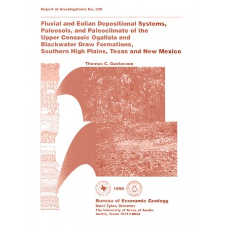
Fluvial and Eolian Depositional Systems, Paleosols, and Paleoclimate of the Upper Cenozoic Ogallala and Blackwater Draw
RI0239
For a downloadable, digital version: RI0239D.
RI0239. Fluvial and Eolian Depositional Systems, Paleosols, and Paleoclimate of the Upper Cenozoic Ogallala and Blackwater Draw Formations, by T. C. Gustavson. 62 p., 42 figs., 2 tables, 4 oversize cross sections, 1996. Print.
To purchase this publication as a downloadable PDF, please order RI0239D.
About This Publication
This report summarizes results of a study based on outcrop and subsurface data that establishes a regional stratigraphic framework for assessments of the Ogallala and related aquifers. Results are broadly applicable to water resources investigations and efforts to remediate contaminated areas of the aquifer as well as to the understanding of depoisitonal environments, paleoclimate, and soil development during the late Tertiary and Quaternary.
ABSTRACT
The upper Tertiary Ogallala Formation contains the Ogallala (High Plains) aquifer, which is the major source of water for agricultural and domestic use on the Southern High Plains of Texas and New Mexico. Locally, perched aquifers overlie the Ogallala aquifer. This study, based on outcrop and subsurface data, provides a regional stratigraphic framework for assessments of the Ogallala and related perched aquifers. The results of this study are broadly applicable to water resource investigations and efforts to remediate contaminated areas of the aquifer as well as to the understanding of depositional environments, paleoclimate, and soil development during the late Tertiary and Quaternary in the High Plains of Texas and New Mexico.
Deposition of the basal fluvial sediments of the Ogallala Formation in northwestern Texas and eastern New Mexico was controlled by the topography of the underlying erosional surface. Paleovalley-fill facies consist of heterogeneous gravelly and sandy ephemeral-stream deposits and sandy to clayey overbank deposits interbedded with and overlain by eolian sediments deposited as sand sheets and loess. Uplands on the pre-Ogallala erosional surface are overlain by similar eolian sediments. Buried calcic soils consisting mostly of CaCO, nodules and filaments are found throughout the eolian facies.
The Caprock calcrete, which represents a long period of landscape stability, separates the Ogallala Formation from eolian sediments of the overlying Blackwater Draw Formation. The Caprock calcrete in the east part of the Southern High Plains, which is buried by a thick section of Quaternary Blackwater Draw sediments containing numerous buried calcic soils, is 1.5 to 2 m thick (5 to 6.5 ft) and is not usually brecciated or pisolitic. The stage IV or V Caprock calcrete here apparently formed under a stable landscape and is probably late Pliocene in age. A thicker (4 to 10 m [13 to 33 ft]), complexly brecciated, pisolitic, stage VI Caprock calcrete is widespread beneath large areas of the western High Plains in which the Blackwater Draw is only a few decimeters thick. In these areas of thin Blackwater Draw, the accumulations of CaCO, normally found in about 10 buried calcic soils and the surface calcic soil of full sections of the Blackwater Draw have apparently been welded onto the uppermost Ogallala calcrete. Part of the Caprock calcrete is thus locally coeval with the Blackwater Draw Formation and is Quaternary in age. Elsewhere, inliers of Cretaceous limestone and Triassic mudstone that crop out on the High Plains are capped by as much as 9.6 m (32 ft) of complexly brecciated, pisolitic calcrete (stage VI). The thick calcretes that formed on these topographic highs are apparently equivalent to the CaCO, that accumulated as buried calcic soils in complete sections of the Ogallala and Blackwater Draw Formations. These isolated areas of the Caprock calcrete are probably late Miocene to late Quaternary in age.
Blackwater Draw eolian sediments are similar to Ogallala eolian sediments and also contain numerous buried calcic soils. Eolian facies in both formations, which preserve numerous superposed calcic soils and calcretes and contain common fine root traces, reflect slow episodic aggradation on a stable grass-covered landscape under mostly semiarid to subhumid climatic conditions. The change from fluvial to mostly eolian sedimentation probably resulted from diversion of streams (Panhandle, Clovis, and Slayton paleorivers) that deposited fluvial sediments of the Ogallala Formation to form the Pecos and Canadian Rivers. Source areas for most of these eolian sediments initially may have been floodplains of Ogallala streams and later floodplains of the newly formed Pecos and Canadian Rivers. Buried soils in Tertiary and Quaternary sediments of the Southern High Plains reflect cycles of eolian sedimentation followed by periods of landscape stability and minimal sedimentation in which pedogenesis occurred. Cycles of sedimentation and soil development probably resulted from cyclic decreases and increases in available moisture and vegetative cover in sediment source areas to the west. Eolian sediments were eroded from source areas such as the Pecos valley during dry periods when vegetation was sparse. During more humid periods, more abundant vegetation probably protected source areas from deflation.
These investigations illustrate the heterogeneity and potential for vertical and lateral compartmentalization of the Ogallala and local overlying perched aquifers. For example, at least five fine-grained low-conductivity zones, including the aquitard at the base of a contaminated perched aquifer, exist in lower Ogallala sediments beneath the Pantex Plant in western Carson County.
Keywords: Blackwater Draw Formation, calcrete, eolian, fluvial, High Plains, New Mexico, Ogallala Formation, paleoclimate, paleosol, Quaternary, Tertiary, Texas
CONTENTS
Abstract
Introduction
Geologic Setting
Structural and Depositional History
Ogallala Formation
Caprock Calcrete
Blackwater Draw Formation
Geomorphology
Climate
Soils
Vegetation
Methods
Middle Tertiary Erosional Surface
Salt Dissolution and the Origin of the Panhandle Paleovalley
Regional Stratigraphy of the Ogallala Formation
Gravel Lithofacies
Sand and Gravel Lithofacies
Sand Lithofacies
Fine Sand and Mud Lithofacies
Ground-Water Calcrete
Laminated Fine Sand and Silt and Laminated to Massive Clay Lithofacies
Sand (Eolian) Lithofacies
Fine Sand to Coarse Silt Lithofacies
Age of Ogallala Sediments
Caprock Calcrete
Development and Age of the Caprock Calcrete
Climate during Deposition of the Caprock Calcrete
Regional Stratigraphy of the Blackwater Draw Formation
Very Fine to Fine Sand Lithofacies
Sandy Mud Lithofacies
Laminated Very Fine Sand, Silt, and Clay Lithofacies
Clay Lithofacies
Age of the Blackwater Draw Formation
Buried Soil Development
Transportation and Depositional Environment of Eolian Lithofacies
Stratigraphy of the Ogallala and Blackwater Draw Formations, Western Carson County
Perching Horizon(s) and Perched Aquifer
Stratigraphic and Structural Heterogeneities of the Ogallala and Blackwater Draw Formations
Stratigraphic Heterogeneities
Structural Heterogeneities
Paleoclimate
Paleontologic Evidence
Pedogenic Evidence
Stratigraphic Evidence
Summary and Conclusions
Acknowledgments
References
Figures
1. Geologic map of the Tertiary Ogallala and Quaternary Blackwater Draw Formations
2. Major structural elements. Texas Panhandle and surrounding areas
3. Stratigraphic nomenclature for Permian through Quaternary strata in the Texas Panhandle and eastern New Mexico
4. Regional soil texture map
5. Average monthly precipitation, wind speed, and dust frequency
6. Hourly observations of winds 40 kmph and stronger
7. Resultant winds for December and March
8. Regional structure-contour map on the pre-Ogallala erosional surface
9. Structure-contour map on the middle Tertiary erosional surface
10. Structure-contour map on the Permian Tubb Formation
11. Salt thickness map of the Permian Seven Rivers, San Andres, and Glorieta Formations
12. Structure-contour map on the Permian Alibates Formation
13. Stratigraphic section of the Ogallala Formation exposed along the Gerhardt Valley Road, New Mexico
14. Stratigraphic section of the Ogallala Formation exposed in the Caprock Escarpment south of Tucumcari, New Mexico
15. Photograph of gravel lithofacies of the Ogallala Formation
16. Ogallala section exposed in the Caprock Escarpment at Lyons Ranch, New Mexico
17. Ogallala section exposed in the Caprock Escarpment north of Bellview, New Mexico Photograph of mud balls, armored mud balls, and lithoclasts
18. Ogallala section exposed in the Caprock Escarpment west of the Texas-New Mexico border
19. Micritic CaCO3 nodules
20. Stratigraphic section of Ogallala and Blackwater Draw Formations interpreted from core from the BEGIPTX No. 2 well
21. Ogallala section exposed in the Caprock Escarpment west of Lovington, New Mexico
22. Composite stratigraphic section of the Ogallala Formation exposed in the
23. Caprock Escarpment east of Silverton, Texas
24. Photograph of exposure of Ogallala sediments in the Caprock Escarpment
25. Photographs of pedogenic CaCO3 nodules composing buried stage I1 calcic horizon and multiple buried soils having stage Ill calcic horizons
26. Photograph of rhizocretions in the fine sand to coarse silt lithofacies
27. Photographs illustrating open root tubules, root traces, and modern roots
28. Sand, silt, and clay distribution of the Ogallala Formation
29. Sediment texture distribution for samples of Ogallala fine sand to coarse silt lithofacies
30. Approximate maximum ages of Ogallala sections
31. Stratigraphic section exposed at the Buffalo Lake National Wildlife Refuge
32. Photographs of polished sections of pisolitic and brecciated Caprock calcrete
33. Stratigraphic section exposed in the eastern Caprock Escarpment, northwest Borden County, Texas
34. Stratigraphic section exposed in the western Caprock Escarpment, western Quay County, New Mexico
35. Schematic model illustrating the distribution of sediments and calcic soils inthe Tertiary Ogallala and Quaternary Blackwater Draw Formations
36. Sand, silt, and clay distribution in upper and lower Blackwater Draw Formation sediments
37. Description of core of the Quaternary Blackwater Draw Formation from the BEG Olton No. 1 well
38. Description of core of the Quaternary Blackwater Draw Formation from the BEGRDCJ No. 5 well
39. Photograph of the characteristic roll front of an approaching dust storm
40. Location map of stratigraphic cross sections A-A', B-B', C-C', D-D', and E-E'
41. Stratigraphic section of Ogallala and Blackwater Draw Formations interpreted from core of the BEGIPTX No. 3 well
42. Cross section E-E'
Tables
1. Ogallala Formation lithofacies and interpreted depositional environments
2. Blackwater Draw Formation lithofacies and interpreted depositional environments
Plates
1. Stratigraphic cross section A-A'
2. Stratigraphic cross section B-B'
3. Stratigraphic cross section C-C'
4. Stratigraphic cross section D-D'
Citation
Gustavson, T. C., 1996, Fluvial and Eolian Depositional Systems, Paleosols, and Paleoclimate of the Upper Cenozoic Ogallala and Blackwater Draw Formations: The University of Texas at Austin, Bureau of Economic Geology Report of Investigations No. 239, 62 p.
