Reports of Investigations
-
Books & Reports
- Reports of Investigations
- Guidebooks
- Udden Series
- Geological Circulars
- Down To Earth
- Atlases of Major Oil and Gas Reservoirs
- Texas Memorial Museum Publications
- Environmental Geologic Atlas of the Texas Coastal Zone
- Mineral Resource Circulars
- Other Reports
- Seminars and Workshops
- Handbooks
- Submerged Lands of Texas
- Symposia
- Annual Reports
- Open File Reports
-
Maps & Cross Sections
- Thematic Maps
- Miscellaneous Maps, Charts & Sections
- Geologic Atlas of Texas
- STATEMAP Project Maps
- Geologic Quadrangle Maps
- Cross Sections
- Highway Geology Map
- Energy and Mineral Resource Maps
- Shoreline Change and Other Posters
- Wilcox Group, East Texas, Geological / Hydrological Folios
- Bouguer Gravity Atlas of Texas
- River Basin Regional Studies
- Featured Maps
- Posters
- Teachers & the Public
-
Geological Society Publications
- Gulf Coast Association of Geological Societies
- Alabama Geological Society
- Austin Geological Society
- Corpus Christi Geological Society
- Houston Geological Society
- Lafayette Geological Society
- Mississippi Geological Society
- New Orleans Geological Society
- South Texas Geological Society
- GCS SEPM Publications
- Historic BEG & UT Series
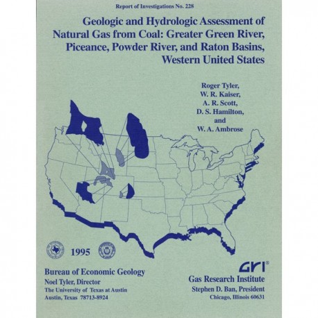
Geologic and Hydrologic Assessment of Natural Gas from Coal
RI0228
For a downloadable, digital version: RI0228D.
RI0228. Geologic and Hydrologic Assessment of Natural Gas from Coal: Greater Green River, Piceance, Powder River, and Raton Basins, Western United States, by Roger Tyler, W. R. Kaiser, A. R. Scott, D. S. Hamilton, and W. A. Ambrose. 219 p., 131 figs., 4 tables, 4 appendices, 1995. Print.
To purchase this publication as a downloadable PDF, please order RI0228D.
ABSTRACT
Five coal basins in the Rocky Mountain Foreland of the western United States--San Juan, Greater Green River, Piceance, Powder River, and Raton--contain, by virtue of their tremendous coal tonnage, 522 Tcf (14.7 Tm3) coalbed gas resources, or 77 percent of the nation's total of 675 Tcf (19.1 Tm3), and each is attractive in terms of coalbed methane exploration and development. Only in the San Juan Basin (84 Tcf; 2.38 Tm3), however, are these coalbed resources being extensively exploited to meet the nation's demand for natural gas. In this report we assess the natural gas (coalbed methane) exploration and production potential in the Rocky Mountain Foreland and, using the technology acquired and experience gained from previous studies in the San Juan and Sand Wash Basins, summarize the geologic and hydrologic occurrence of natural gas from coal beds in the Greater Green River, Piceance, Powder River, and Raton Basins. We describe the factors that were found to influence high gas productivity in coal seams in the San Juan and Sand Wash Basins, such as tectonic and structural setting, coal distribution and thickness, coal rank, gas content, and basin hydrodynamics-ground-water flow and permeability. These insights advance the understanding of the controls on and occurrences of areas having high coalbed methane potential and will guide exploration and development in other United States and international coal basins.
Of the four basins studied, the Greater Green River Basin has secondary potential for coalbed methane exploration and development. The basin is divided into four subbasins (Green River, Great Divide, Washakie, and Sand Wash Basins) by the Rock Springs Uplift and Wamsutter and Cherokee Arches. Whereas Upper Cretaceous and lower Tertiary strata offer numerous coalbed methane targets, vitrinite-reflectance profiles indicate that the eastern Greater Green River Basin has greatest coalbed methane potential. Coal rank ranges from subbituminous to semianthracite, and typical gas contents range from 50 to 400 scf/ton (1.4 to 12.5 m3/t). Permeable, normally pressured, and artesian coal seams occur at depths to 7,000 ft (2,140 m) above regional overpressure. Although the coalbed methane resource is at least 314 Tcf (8.89 Tm3), this basin is largely an untested, frontier basin, having a low cumulative production of 134 MMcf (3.8 MM3), mostly from Mesaverde and Fort Union coal beds in the Sand Wash Basin.
The Piceance Basin, bounded by the Uinta Mountain Uplift, Axial Arch, White River Uplift, and Elk Mountains, has primary potential for coalbed methane exploration and production. Coals in the Cameo coal group (Mesaverde Group) are the major coalbed methane targets, and coal rank ranges from high-volatile C bituminous to semianthracite, whereas gas contents range from 200 to 450 scf/ton (5.8 to 13.12 m3/t). The basin is dominated by underpressure and hydrocarbon-related overpressure, indicating low overall permeability. The Cameo coal group contains 65 Tcf (1.84 Tm3 coalbed methane resources of a total 84 Tcf (2.38 Tm3) in the basin. Cumulative coalbed methane production is 21,022 MMcf (594.9 MMm3).
The Powder River Basin has the least potential for coalbed methane exploration and production of the four basins studied. Bounded by the Big Horn, Laramie, and Black Hills Uplifts, the basin has a primary coalbed methane target in the Tongue River Member of the Fort Union Formation, where coal seams are large aquifers, difficult to dewater. Coal rank is lignite to subbituminous and locally to high-volatile C bituminous. Gas contents are less than 100 scf/ton (<2.9 m3/t), and although coalbed methane resource estimates range from 16 to 103 Tcf (0.453 to 2.9 Tm3) cumulative coalbed methane production is only 2,625 MMcf (74.3 MMm3). On the other hand, shallow drilling depths (average completion depth 500 ft [152 m]) are attractive to smaller operators.
The Raton Basin has secondary potential for coalbed methane exploration and production. Bounded by the Sangre de Cristo Mountains, the Apishapa and Las Animas Arches, and the Sierra Grande Uplift, the basin's main coal-bearing units are the Vermejo and Raton Formations. Coals of high gas content (200 to 500 scf/ton [5.8 to 14.2 m3/t]) ranging from high-volatile C bituminous to low-volatile bituminous in rank occur at shallow depths. The basin is regionally underpressured, reflecting insulation from recharge and coal-seam lenticularity, and the coalbed methane resource is estimated at between 8.4 and 12.1 Tcf (226 and 340 Bm3). Only 53.9 MMcf (1.5 MMm3) of coalbed methane has been produced because most of the basin’s wells are currently shut-in, pending construction of an interstate gas pipeline. On the basis of controls assessed in this report, we found that the Piceance Basin has the greatest potential for making a significant near-term contribution to the nation's gas supply. This basin has large gas resources, high-rank coals, high gas content, and established coalbed methane production. The Piceance has several Cretaceous coalbed methane targets, coal-seam permeability, and areas that are hydrologically favorable for production, although low coal-seam permeability may limit deep methane exploration. We judged the Greater Green River, Powder River, and Raton Basins to have secondary potential. Low gas production and minimal industrial activity limit the near-term production potential of the Greater Green River and Raton Basins. Furthermore, coal beds in the Greater Green River and Powder River Basins, generally thermally immature, have produced large volumes of water. The Raton Basin's shallow, high-permeability, thermally mature coal beds, moreover, although attractive coalbed methane targets, have a limited pipeline infrastructure, limiting the basin's near-term potential.
Keywords: basin comparison; coalbed gas; coal rank, gas content, hydrology, coalbed methane production, resources, and exploration fairways; Greater Green River, Piceance, Powder River, and Raton Basins; tectonic and stratigraphic setting: thermal maturity, Upper Cretaceous-lower Tertiary coal beds
CONTENTS
Abstract
Introduction
Tectonic and Structural Setting
Stratigraphic and Depositional Setting
Thermal Maturity
Origin of Coalbed Gases
Hydrology
Resources and Production
Summary
Greater Green River Basin
Geologic Overview
Tectonic and Stratigraphic Setting
Geometry and Age of Intrabasin Uplifts and Subbasins
Intrabasin Uplifts
Subbasins
Structural Setting of Coal-Bearing Formations
Faults and Folds
Natural Fracture Attributes in Coal
Cleat Strike
Cleat Spacing
Cleat Mineralization
Stress Regime
Stratigraphic and Depositional Setting of Coal-Bearing Formations
Upper Cretaceous Coal-Bearing Units
Frontier Formation
Rock Springs Formation
Iles Formation
Williams Fork Formation
Almond Formation
Lance Formation
Lower Tertiary Coal-Bearing Units
Fort Union Formation
Wasatch Formation
Thermal Maturity
Coal Rank and Burial History
Vitrinite-Reflectance and Coal-Rank Trends
Thermal Maturity of the Mesaverde Group
Thermal Maturity of the Fort Union Formation
Gas Content of Cretaceous and Tertiary Coals
Gas Content in Mesaverde Group
Gas Content in Fort Union Formation
Composition of Cretaceous and Tertiary Coalbed Gases
Mesaverde Group Coalbed Gas Composition
Fort Union Formation Coalbed Gas Composition
Origin of Coalbed Gases
Hydrology
Hydrodynamics
Regional Flow
Coalbed Methane Resources
Coalbed Methane Production
Sand Wash Basin
Rock Springs Uplift
Exploration Fairways
Mesaverde Group
Fort Union Formation
Piceance Basin
Geologic Overview
Tectonic and Stratigraphic Setting
Basin Margin and Intrabasin Uplifts
Fracture Systems and Cleat in Coal Stress Orientation
Stratigraphic and Depositional Setting of Coal-Bearing Formations
Black Diamond Coal Group (Iles Formation)
Cameo and Coal Ridge Coal Groups (Williams Fork Formation)
Cameo Coal Group (Bowie Shale Member)
Lower Coal Ridge Coal Group (Paonia Shale Member)
Upper Coal Ridge Coal Group (Upper Williams Fork Formation)
Coal Rank and Gas Composition
Coal Rank
Gas Composition
Hydrology
Coalbed Methane Production
Coalbed Methane Resources and Production Targets
Gas and Water Production
Drilling History
Exploration Fairways
Powder River Basin
Geologic Overview
Tectonic and Stratigraphic Setting
Geometry and Age of Basin Margin Uplifts
Fracture Systems and Cleat in Coal
Other Faults and Reactivated Basement Structures
Stress Orientation
Stratigraphic and Depositional Setting of Coal-Bearing Formations
Mesaverde, Meeteetse, and Lance Formations
Fort Union Formation
Wasatch Formation
Coal Rank
Gas Composition
Hydrology
Coalbed Methane Production
Coalbed Methane Resources and Production Targets
Gas and Water Production
Drilling History
Coalbed Methane Potential
Raton Basin
Geologic Overview
Tectonic and Stratigraphic Setting
Fracture Systems and Cleat in Coal
Stress Orientation Stratigraphic and Depositional Setting of Coal-Bearing Formations
Vermejo Formation
Raton Formation
Coal Rank and Gas Composition
Coal Rank
Gas Composition
Hydrology
Coalbed Methane Production
Coalbed Methane Resources and Production Targets
Gas and Water Production
Drilling History
Exploration Fairways
Conclusions
Tectonic and Structural Setting
Stratigraphic and Depositional Setting
Thermal Maturity
Hydrology
Coal and Gas Resources and Production History
Basin Comparison
Summary
Acknowledgments
References
Appendices
A. Cumulative coalbed gas and water production, Greater Green River Basin
B. Cumulative coalbed gas and water production, Piceance Basin
C. Cumulative coalbed gas and water production, Powder River Basin
D. Cumulative coalbed gas and water production, Raton Basin
Figures
1. Coal basins and coalbed methane resources of the United States
2. Basins and uplifts of the Rocky Mountain Foreland, western United States 3. Synergistic interplay of the geologic and hydrologic controls critical to coalbed methane producibility
4. Vitrinite-reflectance profiles and gas-generation thresholds, Greater Green River, Piceance, Powder River, and Raton Basins
5. Location and physiography of the Greater Green River Basin
6. Tectonic map of southwestern Wyoming and adjacent states showing the major tectonic elements of the Greater Green River Basin
7. Coal-bearing stratigraphic and hydrologic confining units, Greater Green River Basin
8. Structural map contoured on various marker beds within the Upper Cretaceous Mesaverde Group and lower Tertiary Fort Union Formation, Greater Green River Basin
9. Structural map contoured on the base of the lower Tertiary Fort Union Formation, top of the Massive Cretaceous and Tertiary (K-T) sandstone unit . Greater Green River Basin
10. West-east structural cross section A-A', Wyoming-Idaho Overthrust Belt, the Green River Basin, and the Wind River Uplift
11. Southwest-northeast structural cross section B-B', showing relationship between structure and top of regional overpressure
12. Southwest-northeast structural cross section C-C', Great Divide Basin, showing relationships among structure, stratigraphy, and top of regional overpressure 13. West-east structural cross section D-D', Washakie Basin, showing relationships among structure, stratigraphy, top of regional geopressure, and ground-water flow
14. North-south structural cross section E-E', Great Divide, Washakie, and Sand Wash Basins, showing relationships among structure, stratigraphy, and top of regional overpressure
15. Face-cleat strikes in Upper Cretaceous and lower Tertiary coal seams
16. Maximum horizontal compressive stress orientations of the western United States
17. Location plan of Mesaverde and Fort Union stratigraphic cross sections F-F' through M-M' and type logs, Greater Green River Basin
18. West-east stratigraphic cross section F--F', Mesaverde Group of the Green River Basin, Rock Springs Uplift, and Great Divide Basin
19. Northwest-southeast stratigraphic cross section G-G', Mesaverde Group from the west edge of the Rock Springs Uplift to the southeastern Sand Wash Basin
20. North-south stratigraphic cross section H-H', Mesaverde Group and the Great Divide, Washakie, and Sand Wash Basins
21. Genetic stratigraphy of the upper Mesaverde Group, eastern Greater Green River Basin
22. Plan view showing the updip (western) limits of Mesaverde shale markers and unconformities
23. Type log showing location of coal and stratigraphic nomenclature of the Upper Cretaceous Mesaverde Group and Paleocene Fort Union Formation, southeastern Greater Green River Basin
24. South-north stratigraphic cross section 1-1', Green River Basin, Greater Green River Basin, illustrating operationally defined stratigraphic units
25. West-east stratigraphic cross section J-J', Great Divide Basin, Greater Green River Basin, illustrating operationally defined stratigraphic units
26. Northwest-southeast stratigraphic cross section K-K', Great Divide and Washakie Basins,
Greater Green River Basin, illustrating operationally defined stratigraphic units
27. South-north stratigraphic cross section L-L', Sand Wash Basin, Greater Green River Basin, illustrating operationally defined stratigraphic units
28. Depth to top of the Mesaverde Group, Greater Green River Basin
29. Net-coal-thickness map, Rock Springs Formation
30. Depositional setting of three types of coal beds in the Rock Springs Formation, Rock Springs Uplift
31. Schematic section and characteristics of coal beds and sandstones in major coal-bearing units at the Rock Springs Uplift, Greater Green River Basin
32. Schematic section and characteristics of coal beds and sandstones in major coal-bearing units in the Sand Wash and Washakie Basins, Greater Green River Basin
33. Net-coal-thickness map, Williams Fork Formation
34. Type log on the Moxa Arch illustrating the occurrence of the Pine Ridge unconformity
35. Net-sandstone map of unit 1, Williams Fork Formation
36. Net-sandstone map of unit 2, Williams Fork Formation
37. Percent-sandstone map of unit 3, Williams Fork Formation
38. Percent-sandstone map of unit 4, Williams Fork Formation
39. Net-coal-thickness map of unit 1, Williams Fork Formation
40. Net-coal-thickness map of unit 2, Williams Fork Formation
41. Net-coal-thickness map of unit 3, Williams Fork Formation
42. Net-coal-thickness map of unit 4, Williams Fork Formation
43. Paleogeography of the upper Almond Formation and lower Lewis Shale, east half of the Greater Green River Basin
44. Net-coal-thickness map, Almond Formation
45. Percent-sandstone map, Almond Formation
46. Type log showing location of coal and stratigraphic nomenclature of the Paleocene Fort Union Formation, southeastern Greater Green River Basin
47. Type log showing location of coal and stratigraphic nomenclature of the Paleocene Fort Union Formation, northwestern Greater Green River Basin
48. Net-sandstone-thickness map of the lower coal-bearing unit, Fort Union Formation, Sand Wash Basin
49. Net-coal-thickness map of the lower coal-bearing unit, Fort Union Formation, Sand Wash Basin
50. Net-coal-thickness map of the lower coal-bearing unit, Fort Union Formation, Greater Green River Basin
51. Map of Greater Green River Basin showing the five areas in which vitrinite-reflectance profiles were used to estimate coal-rank trends
52. Vitrinite-reflectance profiles showing depth versus vitrinite-reflectance values of areas II through V
53. Vitrinite-reflectance profile of the eastern and western Greater Green River Basin
54. Coal-rank map, top of the Mesaverde Group
55. Coal-rank map, base of the Fort Union Formation
56. Histograms of gas-content values, upper Mesaverde Group, lower Mesaverde Group, and Fort Union Formation
57. Gas-content profile of the upper Mesaverde Group, Sand Wash Basin
58. West-east cross section M-M', showing changes in gas content and gas composition between different Mesaverde coal beds
59. Gas-content profile, northern Rock Springs Uplift
60. Schematic west-east cross-sectional ground-water flow, Rock Springs Formation, Rock Springs Uplift
61. Gas-content profile, Fort Union coals, Sand Wash Basin
62. Composition of Mesaverde coalbed gases
63. Variation of carbon dioxide content with the gas-dryness index (C1,/C,1-5, values)
64. Annual precipitation and topographic gradients, Rocky Mountain Foreland, western United States coal basins
65. Mean annual precipitation, Greater Green River Basin
66. Upper Mesaverde potentiometric-surface map, eastern Greater Green River Basin
67. Mesaverde pressure-depth plot, Washakie and Great Divide Basins
68. Schematic cross-sectional ground-water flow, Washakie Basin
69. Map of total dissolved solids, Mesaverde Group, eastern Greater Green River Basin
70. Initial water potentials, Williams Fork and Fort Union coals
71. Coalbed methane tests by operator, Greater Green River Basin
72. Geologic and hydrologic characterization of the Mesaverde Group, Greater Green River Basin
73. Mesaverde Group and Fort Union Formation exploration fairways, Greater Green River Basin
74. Major Mesaverde oil and gas fields, eastern Greater Green River Basin
75. Geologic and hydrologic characterization of the Fort Union Formation, Greater Green River Basin
76. Structure map contoured on top of the Rollins-Trout Creek Sandstone Members, Piceance Basin
77. Northwest-southeast cross section N-N', Piceance Basin
78. Coal-bearing stratigraphic and confining units, Piceance Basin
79. Face-cleat strike, Piceance Basin
80. Schematic stratigraphic column of principal coal-bearing units, Piceance Basin, showing inferred depositional environments and reservoir characteristics
81. Schematic section and characteristics of coal beds and sandstones, in major coal-bearing units in the Piceance Basin
82. Net coal thickness, Black Diamond coal group, and depth to base of the Black Diamond coal group
83. Shoreline trends of the Corcoran and Cozzette Sandstones, southeast part of the Piceance Basin
84. Net coal thickness, Cameo coal group and depth to base, Cameo coal group
85. Coal-rank map, Cameo coal group, from measured and calculated vitrinite data
86. Coal-rank map, Coal Ridge coal group
87. Coal-rank map, Black Diamond coal group
88. Cameo coalbed gases, gases produced from tight sandstones in the Williams Fork Formation, and gases from the Iles Formation
89. The delta 13C of methane and carbon dioxide content of gases from Cameo coals, Williams Fork and Iles Formations
90. Map of pressure regime in Mesaverde coals
91. Present-day Mesaverde temperatures, top of the Rollins-Trout Creek Sandstones
92. Gas in place, Cameo coal group
93. IP of gas and water from Cameo coal beds in the Piceance Basin
94. Cumulative gas:water ratio in coalbed methane fields, Piceance Basin
95. Total coalbed methane wells drilled by exploration, development, and/or operating companies in the Piceance Basin, February 1990-May 1991
96. Powder River Basin and adjacent structural features
97. Coal-bearing stratigraphic and confining units, Powder River Basin
98. Structure map, top of the Tullock Member, Fort Union Formation
99. Schematic east-west cross section of Powder River Basin showing slightly tilted, troughlike structure in older sedimentary rocks
100. Tectonic map of the south end of Powder River Basin, showing the complex thrust-fault relations
101. Face-cleat strikes superimposed on the Fort Union structural contour map, Powder River Basin
102. Schematic stratigraphic section and characteristics of coal beds and sandstones in major coal-bearing units, Powder River Basin 103.Net,coal,thickness, maximum, coal thickness, and coal-isopleth maps of the Tongue River Member of the Fort Union Formation, Powder River Basin
104. Lacustrine deltas and coal depocenters in the Tongue River Member, Fort Union Formation, Powder River Basin
105. Vitrinite-reflectance profiles, Powder River Basin
106. West-east dip cross section O-O', Powder River Basin, at T45N
107. Potentiometric-surface map of the Tertiary (Fort Union-Wasatch) aquifer, Powder River Basin
108. Ground-water flow in Fort Union coal seams
109. Initial potential of gas and water from Fort Union coal beds, Powder River Basin
110. Cumulative gas:water ratio in coalbed methane fields, Powder River Basin
111. Total coalbed methane wells drilled by exploration, development, and/or operating companies in the Powder River Basin, February 1990-January 1993
112. Map of the Raton Basin and surrounding area showing regional structure
113. Structure map contoured on top of the Trinidad Sandstone
114. West-east cross section P-P', north part of the Raton Basin, showing relations between structure and stratigraphy
115. West-east cross section Q-Q', south part of the Raton Basin, showing relations between structure and stratigraphy
116. Generalized tectonic map, northern Raton Basin
117. Coal-bearing stratigraphic and confining units, Raton Basin
118. Face-cleat strike, Raton Basin
119. Net-sandstone-thickness map, Trinidad Sandstone
120. Schematic stratigraphic section and characteristics of coal beds and sandstones in major coal-bearing units in the Raton Basin
121. Net-coal-thickness map, Vermejo Formation
122. Net-coal-thickness map, Raton Formation
123. Depth to midpoint of the coal-bearing section, Raton Formation
124. Coal-rank map, base of the Vermejo Formation
125. Vitrinite-reflectance profiles, Raton Basin
126. Potentiometric-surface map, Vermejo-Raton aquifer, Raton Basin
127. IP of water from coal beds, southern Raton Basin
128. Gas content of Vermejo coal beds, Raton Basin
129. IP of gas and water from Vermejo coal beds, Raton Basin
130. Total coalbed methane wells drilled by exploration, development, and/or operating companies in the Raton Basin, February 1996--January 1994
131. Comparison by basin of the technical and economic criteria that influence coalbed methane potential
Tables
1. Types of coalbed gases produced during gas-generating stages
2. Equations determined from vitrinite-reflectance profiles
3. Coal and gas resources in the Greater Green River Basin
4. Summary of coalbed methane attributes critical for assessing coal basins of the western United States
Citation
Tyler, Roger, Kaiser, W. R., Scott, A. R., Hamilton, D. S., and Ambrose, W. A., 1995, Geologic and Hydrologic Assessment of Natural Gas from Coal: Greater Green River, Piceance, Powder River, and Raton Basins, Western United States: The University of Texas at Austin, Bureau of Economic Geology, Report of Investigations No. 228, 219 p.
