Reports of Investigations
-
Books & Reports
- Reports of Investigations
- Guidebooks
- Udden Series
- Geological Circulars
- Down To Earth
- Atlases of Major Oil and Gas Reservoirs
- Texas Memorial Museum Publications
- Environmental Geologic Atlas of the Texas Coastal Zone
- Mineral Resource Circulars
- Other Reports
- Seminars and Workshops
- Handbooks
- Submerged Lands of Texas
- Symposia
- Annual Reports
- Open File Reports
-
Maps & Cross Sections
- Thematic Maps
- Miscellaneous Maps, Charts & Sections
- Geologic Atlas of Texas
- STATEMAP Project Maps
- Geologic Quadrangle Maps
- Cross Sections
- Highway Geology Map
- Energy and Mineral Resource Maps
- Shoreline Change and Other Posters
- Wilcox Group, East Texas, Geological / Hydrological Folios
- Bouguer Gravity Atlas of Texas
- River Basin Regional Studies
- Featured Maps
- Posters
- Teachers & the Public
-
Geological Society Publications
- Gulf Coast Association of Geological Societies
- Alabama Geological Society
- Austin Geological Society
- Corpus Christi Geological Society
- Houston Geological Society
- Lafayette Geological Society
- Mississippi Geological Society
- New Orleans Geological Society
- South Texas Geological Society
- GCS SEPM Publications
- Historic BEG & UT Series
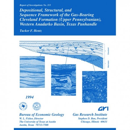
Depositional, Structural, and Sequence Framework of the Gas-Bearing Cleveland Formation ...Western Anadarko Basin, Texas
RI0213
For a downloadable, digital version: RI0213D.
RI0213. Depositional, Structural, and Sequence Framework of the Gas-Bearing Cleveland Formation (Upper Pennsylvanian), Western Anadarko Basin, Texas Panhandle, by T. F. Hentz. 73 p., 34 figs., 9 tables, 1994. Print.
To purchase this publication as a downloadable PDF, please order RI0213D.
ABSTRACT
Low-permeability ("tight") reservoir sandstones of the lower Missourian Cleveland formation produced more than 435 billion cubic feet (Bcf) of natural gas through December 1990, mostly from Ochiltree and Lipscomb Counties in the northeastern Texas Panhandle. Although large-scale gas production started in1956, the regional stratigraphic, depositional, and structural setting of the Cleveland is poorly known. This report summarizes findings of a study conducted in a 5,100-mi2, 7-county area in the western Anadarko Basin using log suites from more than 860 evenly spaced wells, 4 cores from 4 wells, and numerous lithologic sample logs. The Cleveland formation, a subsurface unit in the study area, is well defined by regionally continuous, thin, radioactive, black shale marker beds that bound the unit.
Most facies, including reservoir rocks, of the dominantly siliciclastic Cleveland formation accumulated as a series of eastward-prograding deltas consisting of prodelta, distal delta-front, and proximal delta-front deposits (in ascending sequence). Locally, sandstone-rich distributary channels incise delta-front facies. A regional fluvial system occurs in one stratigraphic zone in the middle to upper Cleveland throughout most of the study area and also composes reservoir rock. Four dominant sandstone trends exist in the producing area: three north-south-oriented, arcuate thicks consisting of stacked delta-front facies at inferred stabilized paleoshoreline positions and one east-west trend representing superimposed fluvial-channel incision after a pronounced drop in regional base level.
Distinctive formation-thickness trends help document Cleveland paleophysiography and provide evidence of syndepositional faulting, flexure, and differential subsidence that markedly affected relative sea level. The unit thickens eastward toward the deep Anadarko Basin and reaches a maximum thickness of about 590 ft in southwestern Hemphill County. Depositional patterns were controlled by (1) a paleohigh in the west part of the study area (east flank of the Cimarron Arch) that separates siliciclastic facies from carbonate-dominated Cleveland of the Kansas Shelf, (2) subsidence of two subbasins within a northwest-trending half graben bounded by a syndepositional fault system on its south edge and a monoclinal flexure to the north, and (3) an irregular (stepped) depositional shelf controlled by differential subsidence of an underlying Oswego limestone buildup.
The Desmoinesian Oswego limestone and Marmaton Group (undivided) and the Missourian Cleveland and Kansas City Formations were examined in the context of their sequence stratigraphic framework. Parasequences of the component systems tracts were correlated only for the Marmaton Group (undivided) and the Cleveland formation. This mostly siliciclastic interval can be subdivided into three sequences, at least one of which (Marmaton Group [undivided]/lower Cleveland formation) is bounded by type 1 sequence boundaries. The Marmaton Group siliciclastics are inferred to form a lowstand systems tract (prograding coastal wedge) and overlying transgressive systems tract in the study area; a regionally prominent marine-condensed section (black radioactive shale) caps the Marmaton interval. The Cleveland formation, the focus of the study, contains 10 parasequences (P) in the study area: (1) PI-P3 compose a progradational parasequence set of seaward-stepping deltaic facies deposited during a highstand of relative sea level, (2) P4, the middle Cleveland fluvial deposit, is a lowstand systems tract incised-valley fill that extends eastward beyond the inferred Cleveland depositional shelf break, (3) P5 and P6 are landward-stepping deltaic facies of a transgressive systems tract, and (4) P7-P10 consist of several thin, relatively poorly defined systems tracts. Source areas for all Marmaton and Cleveland systems tracts in the study area were to the northwest to southwest. Syntectonic effects and eustatic variation profoundly influenced late Paleozoic sedimentation in the western Anadarko Basin, although their respective control on relative sea-level change is not clearly resolvable.
Keywords: Anadarko Basin, Cleveland formation, fluvial-deltaic depositional system, Late Pennsylvanian, low-permeability gas reservoir, regional geology, reservoir characteristics, sequence stratigraphy, Texas Panhandle
CONTENTS
Abstract
Introduction
Objectives
Regional Tectonic and Paleogeographic Setting
Stratigraphic Nomenclature
Previous Work
Data Base and Methods
Lithostratigraphy
Cleveland Formation
Formation Boundaries
Base of Cleveland Formation
Top of Cleveland Formation
Thickness
Lithology
Sandstone
Carbonates
Shale
Granite Wash
Coal
Adjacent Formations
Oswego Limestone
Marrnaton Group (Undivided)
Kansas City Formation
Paleontology and Age of Cleveland Formation
Structural Framework.
Present Structure
Regional Perspective
Faults
Folds
In Situ Stress and Neotectonics
Syndepositional Tectonics and Paleophysiography
Regional Perspective
Emergent Areas and Paleohighs
Physiographic Shelf Platform and Basin
Effects of Faulting and Differential Subsidence on Deposition
Depositional Facies
Deltaic Facies
Prodelta
Distal Delta Front
Proximal Delta Front
Distributary Channel
Fan Delta Facies..
Fluvial Facies
Distal Shelf Facies
Sequence Stratigraphy
Systems Tracts and Sequence Boundaries
Marmaton Group
Oswego Limestone
Marmaton Group (Undivided)
Skiatook Group
Cleveland Formation
Kansas City Formation
Source Areas of Systems Tracts
Marmaton Group (Undivided)
Cleveland Formation
Kansas City Formation
Cleveland Formation and Late Pennsylvanian Eustasy
Regional Hydrocarbon Distribution
Summary andConclusions
Acknowledgments
References
Appendix: Wells Used in Cross Sections
Figures
1. Regional geologic setting of the Cleveland formation study area, western Anadarko Basin
2. Middle and Upper Pennsylvanian stratigraphy of the Anadarko Basin
3. Map of study area showing well control, cross-section lines, and Cleveland core locations
4. Representative shelf-to-basin cross section of the Oswego limestone, Marmaton Group (undivided), Cleveland formation and Kansas City Formation
5. Core log of upper Marmaton Group (undivided) and lower and middle Cleveland formation from the Maxus Glasgow No. 2 well in east-central Ochiltree County
6. Isopach map of Cleveland formation and generalized paleogeography during Cleveland deposition
7. Core log of middle Cleveland formation from the Maxus Carl Ellis "E” No. 3 well in east-central Ochiltree County
8. Core log of middle Cleveland formation from the Maxus Shrader No. 3 well in south-central Ochiltree County
9. Core log of middle Cleveland formation from the Maxus Tubb "D" No. 3 well in south-central Lipscomb County
10. QFR ternary diagram illustrating detrital components of Cleveland sandstone samples
11. Net-sandstone map of Cleveland formation, western Anadarko Basin
12. Percent-sandstone map of Cleveland formation, western Anadarko Basin
13. Net-carbonate map of Cleveland formation, western Anadarko Basin
14. Structure map contoured on top of Cleveland formation, western Anadarko Basin
15. Paleophysiographic/paleotectonicmap of Cleveland formation
16. Core photographs of lower distal delta-front facies
17. Core photograph of upper distal delta-front facies
18. Core photographs of proximal delta-front facies
19. Core photograph of carbonate grainstone in uppermost part of distal shelf facies
20. Representative well logs of siliciclastic Marmaton Group (undivided) and Cleveland formation
21. Regional dip-oriented cross section A-A' of north part of study area
22. Regional dip-oriented cross section B-B' of central part of study area
23. Regional dip-oriented cross section C-C' of south part of study area 24. Regional strike-oriented cross section 1-1'
25. Regional strike-oriented cross section 2-2'
26. Regional strike-oriented cross section 3-3'
27. Regional strike-oriented cross section 4-4'
28. Areal distribution of component parasequences of Marmaton lowstand systems tract and transgressive systems tract
29. Schematic dip-oriented cross section illustrating interpreted sequence-stratigraphic architecture of Marmaton and Cleveland siliciclastic strata in the western Anadarko Basin
30. Lithology, paleontology, and inferred oxygen gradient within top-of-Marmaton marine-condensed section of the Maxus H. T. Glasgow No. 2 core
31. Areal distribution of component parasequences of Cleveland highstand systems tract
32. Areal configuration of Cleveland fluvial system occupying incised valley formed during middle to late Cleveland time
33. Areal distribution of component parasequences of Cleveland transgressive systems tract
34. Map of major Cleveland hydrocarbon fields superimposed on structure-contour map of top of Cleveland
Tables
1. Cleveland lithology from sample logs in the north, central, and south parts of the study area
2. Petrographic analyses of Maxus Glasgow No. 2 Cleveland formation samples
3. Petrographic analyses of Maxus Shrader No. 3 Cleveland formation samples
4. Petrographic analyses of Maxus Tubb "D" No. 3 Cleveland formation samples
5. Faunal content of limestone at the top of the Marmaton Group in the Maxus Glasgow No. 2 well
6. Vertical succession of faunal assemblages in the Maxus Glasgow No. 2 core
7. Producing Cleveland gas fields of the Texas Panhandle
8. Producing Cleveland oil fields of the Texas Panhandle
9. Trap types of selected Cleveland oil and gas fields
Citation
Hentz, T. F., 1994, Depositional, Structural, and Sequence Framework of the Gas-Bearing Cleveland Formation (Upper Pennsylvanian), Western Anadarko Basin, Texas Panhandle:The University of Texas at Austin, Bureau of Economic Geology, Report of Investigations No. 213, 73 p.
