Reports of Investigations
-
Books & Reports
- Reports of Investigations
- Guidebooks
- Udden Series
- Geological Circulars
- Down To Earth
- Atlases of Major Oil and Gas Reservoirs
- Texas Memorial Museum Publications
- Environmental Geologic Atlas of the Texas Coastal Zone
- Mineral Resource Circulars
- Other Reports
- Seminars and Workshops
- Handbooks
- Submerged Lands of Texas
- Symposia
- Annual Reports
- Open File Reports
-
Maps & Cross Sections
- Thematic Maps
- Miscellaneous Maps, Charts & Sections
- Geologic Atlas of Texas
- STATEMAP Project Maps
- Geologic Quadrangle Maps
- Cross Sections
- Highway Geology Map
- Energy and Mineral Resource Maps
- Shoreline Change and Other Posters
- Wilcox Group, East Texas, Geological / Hydrological Folios
- Bouguer Gravity Atlas of Texas
- River Basin Regional Studies
- Featured Maps
- Posters
- Teachers & the Public
-
Geological Society Publications
- Gulf Coast Association of Geological Societies
- Alabama Geological Society
- Austin Geological Society
- Corpus Christi Geological Society
- Houston Geological Society
- Lafayette Geological Society
- Mississippi Geological Society
- New Orleans Geological Society
- South Texas Geological Society
- GCS SEPM Publications
- Historic BEG & UT Series
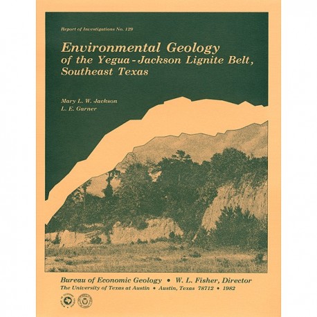
Environmental Geology of the Yegua-Jackson Lignite Belt, Southeast Texas
RI0129
Environmental Geology of the Yegua-Jackson Lignite Belt, Southeast Texas, by M. L. W. Jackson and L. E. Garner, assisted by R. D. Sharpe. 36 p., 15 figs., 4 tables, 5 map sheets, 1982. ISSN: 0082335X: Print Version.
A free, digital version of this publication can be found on: Texas ScholarWorks
RI0129. Environmental Geology of the Yegua-Jackson Lignite Belt, Southeast Texas, by M. L. W. Jackson and L. E. Garner, assisted by R. D. Sharpe. 36 p., 15 figs., 4 tables, 5 map sheets, 1982. ISSN: 0082335X: Print.
To purchase this publication as a downloadable PDF, please order RI0129D.
ABSTRACT
Environmental geologic maps of the Texas lignite belt were prepared in response to renewed production of lignite in Texas and enactment of Federal and State laws governing coal and lignite surface mining. The map area of this report encompasses the outcrop of the Yegua Formation and Jackson Group from south-central Texas to the Texas-Louisiana border. Yegua sediments are fluvial in outcrop, and deltaic in the deeper subsurface. Jackson deposits are predominantly of deltaic origin.
Mapping involved interpretation of black-and-white, large-scale aerial photographs and extensive field work. Each of the 32 map units is defined in terms of substrate, soil, geomorphology, geologic process, vegetation, and land use. Additional information presented on the maps includes active and abandoned lignite mines and lignite resource blocks mapped by Kaiser and others (1980). Floodprone areas, vegetation assemblages, and soil types presented on the maps provide basic data useful in mine planning. Correlation of sand outcrops with subsurface sand maps helps locate hydrologically sensitive areas that need careful consideration during lignite development. Environmental geologic maps can also aid public and private agencies in land use planning and land resource management.
Keywords: coal, environmental geologic maps, environmental geology, geologic maps, Jackson Group, mapping, land resources, land use, southeast Texas, Yegua Formation
Contents
ABSTRACT
INTRODUCTION
PREVIOUS WORK
PHYSICAL SETTING
Physiography
Geology
Topography and geomorphology
Climate
Soils
Vegetation
Hydrology
Land use
Lignite resources
Structural geology
MAPPING PROCEDURES
ENVIRONMENTAL GEOLOGIC UNITS
Definition
Geomorphic units
Bottomland units
River terrace units
Miscellaneous geomorphic units
Substrate units
Sand and mud units
Mud unit
Sand units
Blacksoil units
Miscellaneous substrate units
Man-made units
Modifications of environmental geologic units
Additional information presented on environmental geologic maps
Mines
Lignite resource APPLICATIONS OF IMPORTANT
ENVIRONMENTAL GEOLOGIC UNITS
Laws governing surface mining of lignite
Recognition of flood prone land
Native vegetation and reclamation
Distribution of topsoil and prime farmland
Hydrology and environmental sensitivity
State law and applications to hydrology
Surface geometry of water-bearing units
Correlation of sand outcrops with subsurface sand trends
Additional applications
SUMMARY
ACKNOWLEDGMENTS
REFERENCES
Figures
1. Environmental geologic maps by the Bureau of Economic Geology
2. Physiographic regions of Central and East Texas
3. Generalized geologic section, Yegua-Jackson interval
4. Geologic map of the Yegua-Jackson trend
5. Relation between topography and geology along the Yegua-Jackson outcrop
6. Climatic data for Central and East Texas
7. Vegetation assemblages of southeast Texas
8. Major aquifer zones in southeast Texas
9. Schematic diagram showing the interchannel swamps from which Yegua lignite formed
10. Schematic diagram showing a marsh, from which Jackson lignite formed, overlying an abandoned deltaic lobe
11. Regional structural features in East Texas
12. Jordan Creek-Cummins Creek lignite surface mine area, proposed by the Lower Colorado River Authority
13. Sand outcrops and near-surface lignite resources in the Yegua-Jackson trend, southeast Texas
14. Sand outcrops and subsurface sand percent of the Yegua Formation, southeast Texas
15. Sand outcrops and subsurface maximum sand-body thickness of the Jackson Group in southeast Texas, excluding the Whitsett Formation
Tables
1. Characteristics of environmental geologic units, Yegua-Jackson trend, southeast Texas
2. Environmental geologic units and alphanumeric symbols used in the Yegua-Jackson trend, southeast Texas
3. Abandoned, active, and proposed lignite mines and lignite-fired power plants in the Yegua-Jackson trend, southeast Texas
4. Prime farmland soils in the Yegua-Jackson trend, southeast Texas
Maps (in envelope accompanying book version): Southeast Texas lignite belt environmental geology, Yegua-Jackson trend, map sheets 1 through 5
Citation
Jackson, M. L. W., and Garner, L. E., 1982, Environmental Geology of the Yegua-Jackson Lignite Belt, Southeast Texas: The University of Texas at Austin, Bureau of Economic Geology, Report of Investigations No. 129, 36 p.
