Reports of Investigations
-
Books & Reports
- Reports of Investigations
- Guidebooks
- Udden Series
- Geological Circulars
- Down To Earth
- Atlases of Major Oil and Gas Reservoirs
- Texas Memorial Museum Publications
- Environmental Geologic Atlas of the Texas Coastal Zone
- Mineral Resource Circulars
- Other Reports
- Seminars and Workshops
- Handbooks
- Submerged Lands of Texas
- Symposia
- Annual Reports
- Open File Reports
-
Maps & Cross Sections
- Thematic Maps
- Miscellaneous Maps, Charts & Sections
- Geologic Atlas of Texas
- STATEMAP Project Maps
- Geologic Quadrangle Maps
- Cross Sections
- Highway Geology Map
- Energy and Mineral Resource Maps
- Shoreline Change and Other Posters
- Wilcox Group, East Texas, Geological / Hydrological Folios
- Bouguer Gravity Atlas of Texas
- River Basin Regional Studies
- Featured Maps
- Posters
- Teachers & the Public
-
Geological Society Publications
- Gulf Coast Association of Geological Societies
- Alabama Geological Society
- Austin Geological Society
- Corpus Christi Geological Society
- Houston Geological Society
- Lafayette Geological Society
- Mississippi Geological Society
- New Orleans Geological Society
- South Texas Geological Society
- GCS SEPM Publications
- Historic BEG & UT Series
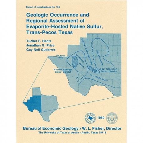
Geologic Occurrence and Regional Assessment of Evaporite-Hosted Native Sulfur, Trans-Pecos Texas
RI0184
For a downloadable, digital version: RI0184D.
RI0184. Geologic Occurrence and Regional Assessment of Evaporite-Hosted Native Sulfur, Trans-Pecos Texas, by T. F. Hentz, J. G. Price, and G. N. Gutierrez. 70 p., 51 figs., 7 tables, 1 plate, 1989. ISSN: 0082335X: Print.
To purchase this publication as a downloadable PDF, please order RI0184D.
ABSTRACT
In the western Delaware Basin and southern Central Basin Platform of Trans-Pecos Texas, Upper Permian (Ochoan) evaporite strata host locally voluminous but notoriously unpredictable, sporadic deposits of biogenic native sulfur. The two sulfur-bearing regions, the Rustler Springs (Culberson and Reeves Counties) and Fort Stockton (Pecos County) sulfur districts, encompass about 2,000 State-owned tracts that are widely distributed throughout the two districts. This study was initiated to provide the General Land Office of Texas (GLO) with a regional assessment of sulfur potential of the Trans-Pecos, thus enabling more effective land management. Specific goals were to (1) investigate the presumed geologic controls on sulfur occurrence by detailing the structural and stratigraphic context of sulfur within the sulfur districts, (2) provide details about biogenic sulfur formation, Ochoan evaporite lithology, radiation log expression, and geology of prominent mines---subjects either discussed in diverse sources or in industry sources not readily accessible to the public, (3) construct a computerized data base documenting formation tops and sulfur-bearing zones, and (4) provide a tract-by-tract sulfur assessment of State-owned lands.
Approximately 1,450 well logs from GLO files were the primary source of subsurface data. Stratigraphic correlation of Ochoan evaporites in the Rustler Springs sulfur district indicates that component formations (Castile, Salado, and Rustler) dip gently eastward toward the center of the Delaware Basin. However, strata are locally disrupted in the central and eastern parts of the district by small, uniformly northeast-trending graben systems and high-angle normal faults that probably formed during late-phase Basin and Range extension. Mineralization in two of the largest sulfur deposits in the district, the Pennzoil Culberson mine and the Texasgulf Phillips Ranch deposit, is restricted to dissolution-enhanced fault zones within the downfaulted blocks. Underexplored grabens detected on regional cross sections and structure-contour maps potentially contain commercial sulfur deposits. Photogeologic inspection of the Gypsum Plain in the western part of the Rustler Springs sulfur district reveals (1) a concentration of exposed northeast-trending grabens and normal faults representative of the subsurface structures and (2) east-trending, fracture-controlled dissolution troughs that are locally associated with commercial sulfur deposits. Computer-contoured isopach and structure maps of the districtwide sulfur-bearing zone reveal no distinct regional trends in orebody geometry but are invaluable in delineating areas of sulfur concentration.
In contrast, isopach and structure-contour maps of the Fort Stockton sulfur district define a trend of sulfur concentration in aligned culminations along the axis of a northwest-oriented anticline that locally affects bedding of Guadalupian and Ochoan evaporitic formations (Seven Rivers, Yates, Tansill, Salado, and Rustler) at the southern end of the Central Basin Platform. Associated faults, especially along the southwestern edge of the anticline, have high sulfur potential but have been poorly explored.
Summary maps of the two sulfur districts identify areas where significant sulfur potential exists, as determined by depth (shallowest sulfur occurrence), thickness (thickest sulfur-bearing zones), and concentration (densest surficial fractures and lineaments) limits. Areas where these criteria overlap define regions of highest sulfur potential.
Keywords: Central Basin Platform, Delaware Basin, evaporites, Fort Stockton sulfur district, Ochoan, resource assessment, Rustler Springs sulfur district, sulfur, Trans-Pecos Texas
CONTENTS
Abstract
Introduction
Objectives
Methods of Analysis
Subsurface Methods
Surficial Methods
Computerized Methods
Geophysical Methods
History of Sulfur Exploration
Mode of Sulfur Mineralization
Biochemical Conditions of Mineralization
Physical Conditions of Mineralization
Secondary Calcite
Geology of Sulfur-Bearing Strata of the Delaware Basin and Central Basin Platform
Geologic Setting
Stratigraphy of Ochoan Rocks
Rustler Springs Sulfur District
Castile Formation
Salado Formation
Rustler Formation
Dewey Lake Redbeds
Cox Sandstone and Undifferentiated Surficial Deposits
Fort Stockton Sulfur District
Seven Rivers Formation
Yates Formation
Tansill Formation
Salado Formation
Rustler Formation
Dewey Lake Redbeds
Undifferentiated Surficial Deposits
Structure of Ochoan Rocks
Regional Structure
Rustler Springs Sulfur District
Faults
Geometry
Dissolution Features
Solution-Subsidence Troughs and Depressions
Dissolution and Collapse Breccias
Breccia Pipes
Fort Stockton Sulfur District
Flexure Faults
Geologic Occurrence of Sulfur
Structure of Orebodies
Near-Surface Deposits
Local Geology of Mines
Culberson Mine
Phillips Ranch Deposit
Pokorny Deposit
Fort Stockton Mine
Regional Geometry of Sulfur Occurrences
Rustler Springs Sulfur District
Fort Stockton Sulfur District
Ore Fabrics
Assessment of Sulfur Potential
Definition of Geologically Favorable Areas
Segregation of Areas with High, Moderate, and Low Potential
Construction of Data Base
Summary
Acknowledgments
References
Figures
1. Location map of Rustler Springs and Fort Stockton sulfur districts, Trans-Pecos Texas
2. Distribution of sulfur-exploration drilling activity on State-owned tracts in the Rustler Springs sulfur district, 1967 to 1970
3. Distribution of sulfur-exploration drilling activity on State-owned tracts in the Fort Stockton sulfur district, 1967 to 1970
4. Cross-section lines superimposed on structure-contour map of top of the Bell Canyon Formation, Rustler Springs sulfur district
5. Cross-section lines superimposed on structure-contour map of top of the Rustler Formation, Fort Stockton sulfur district
6. Location of sulfur districts in relation to structural subdivisions of the Permian Basin of West Texas and southeastern New Mexico
7. Upper Permian stratigraphy in the Rustler Springs (Delaware Basin) and Fort Stockton (Central Basin Platform) sulfur districts
8. Geologic map of the Rustler Springs sulfur district and vicinity
9. Regional dip-oriented cross section A-A' of the northern area of well coverage, Rustler Springs sulfur district
10. Regional dip-oriented cross section B-B' of the central area of well coverage, Rustler Springs sulfur district
11. Regional dip-oriented cross section C-C' of the southern area of well coverage, Rustler Springs sulfur district
12. Regional strike-oriented cross section 1-1' of the central area of well coverage, Rustler Springs sulfur district
13. Subsurface limits of halite marker beds within the Castile and Salado
14. Representative radiation log and lithology of the Castile Formation, Rustler Springs sulfur district
15. Representative radiation log and lithology of the Salado and Rustler Formations and part of the Castile and Dewey Lake Formations, Rustler Springs sulfur district
16. Regional strike-oriented cross section 2-2' of the eastern area of well coverage, Rustler Springs sulfur district
17. Regional strike-oriented cross section 3-3' of the western area of well coverage, Rustler Springs sulfur district
18. Regional cross section A-A' coinciding approximately with the anticlinal axis of the western part of the Fort Stockton High, Fort Stockton sulfur district
19. Regional cross section B-B' oriented perpendicular to the anticlinal axis in the northwestern Fort Stockton sulfur district
20. Regional cross section C-C' oriented perpendicular to the anticlinal axis in the southeastern Fort Stockton sulfur district
21. Representative radiation log and lithology of the Yates, Tansill, Salado, and Rustler Formations and part of the Seven Rivers and Dewey Lake Formations, southeastern Fort Stockton sulfur district
22. Representative radiation log and lithology of a sandstone-rich Yates Formation characteristic of the northwestern Fort Stockton sulfur district
23. Regional cross section D-D' oriented perpendicular to the anticlinal axis in the central Fort Stockton sulfur district
24. Photomosaic of western edge of Gypsum Plain illustrating grabens and high-angle normal faults in outcrops of the uppermost Bell Canyon and lowermost Castile Formations
25. Structure-contour map of top of the Bell Canyon Formation. Rustler Springs sulfur district
26. Structure-contour map of top of the Castile Formation, Rustler Springs sulfur district
27. Structure-contour map of top of the Salado Formation, Rustler Springs sulfur district
28. Permian and pre-Permian oil fields of northeastern Culberson and northwestern Reeves Counties
29. Photomosaic of east-trending solution-subsidence troughs, the dominant linear geomorphic features of the western and central Gypsum Plain
30. Circular dissolution sinks containing vertically localized breccia cores in outcrops of the Rustler Formation
31. Structure-contour map of top of the Salado Formation, Fort Stockton sulfur district
32. Structure-contour map of top of the Rustler Formation, Fort Stockton sulfur district
33. Permian and pre-Permian oil fields of northern Pecos County
34. Areal perspective of sulfur mineralization within the Culberson mine
35. Cross section of the Pennzoil Culberson mine oriented perpendicular to the axis of the sulfur-bearing graben
36. Oblique cross section through the sulfur-bearing graben of the Phillips Ranch deposit
37. Cross sections of the Texasgulf Fort Stockton sulfur mine
38. Contour map of the shallowest occurrences of sulfur within each 1-mi2 section of the Rustler Springs sulfur district
39. Contour map of the deepest occurrences of sulfur within each 1-mi2 section of the Rustler Springs sulfur district
40. lsopach map of net thickness of sulfur, Rustler Springs sulfur district
41. lsopach map of gross thickness of sulfur, Rustler Springs sulfur district
42. lsopach map of net thickness of high-grade (greater than 5 percent) sulfur, Rustler Springs sulfur district
43. lsopach map of gross thickness of high-grade (greater than 5 percent) sulfur, Rustler Springs sulfur district
44. Contour map of shallowest occurrences of sulfur within each 1-mi2 section of the Fort Stockton sulfur district
45. Contour map of deepest occurrences of sulfur within each 1-mi2 section of the Fort Stockton sulfur district
46. lsopach map of net thickness of sulfur, Fort Stockton sulfur district
47. lsopach map of gross thickness of sulfur, Fort Stockton sulfur district
48. Maps of Rustler Springs sulfur district illustrating areas of sulfur favorability
49. Maps of Fort Stockton sulfur district illustrating areas of sulfur favorability
50. Final assessment map of Rustler Springs sulfur district showing where areas of favorability overlap
51. Final assessment map of Fort Stockton sulfur district showing where areas of favorability overlap
Tables
1. Survey of mineral commodities in Trans-Pecos sulfur districts
2. Data provided for each sulfur exploration well from the sulfur districts
3. Values used to construct computer-generated contour maps
4. Classification of native sulfur
5. Subsurface stratigraphy of the Rustler Formation in the Rustler Springs sulfur district
6. Depth and thickness limits used to delineate most geologically favorable areas of sulfur mineralization in the sulfur districts
7. Numerical scale used to evaluate State-owned tracts for sulfur and other geologic commodities
Plate (in inside back pocket of book)
Fractures and lineaments, Rustler Springs sulfur district
Citation
Hentz, T, F., Price, J. G., and Gutierrez, G. N., 1989, Geologic Occurrence and Regional Assessment of Evaporite-Hosted Native Sulfur, Trans-Pecos Texas: The University of Texas at Austin, Bureau of Economic Geology, Report of Investigations No. 184, 70 p.
