Reports of Investigations
-
Books & Reports
- Reports of Investigations
- Guidebooks
- Udden Series
- Geological Circulars
- Down To Earth
- Atlases of Major Oil and Gas Reservoirs
- Texas Memorial Museum Publications
- Environmental Geologic Atlas of the Texas Coastal Zone
- Mineral Resource Circulars
- Other Reports
- Seminars and Workshops
- Handbooks
- Submerged Lands of Texas
- Symposia
- Annual Reports
- Open File Reports
-
Maps & Cross Sections
- Thematic Maps
- Miscellaneous Maps, Charts & Sections
- Geologic Atlas of Texas
- STATEMAP Project Maps
- Geologic Quadrangle Maps
- Cross Sections
- Highway Geology Map
- Energy and Mineral Resource Maps
- Shoreline Change and Other Posters
- Wilcox Group, East Texas, Geological / Hydrological Folios
- Bouguer Gravity Atlas of Texas
- River Basin Regional Studies
- Featured Maps
- Posters
- Teachers & the Public
-
Geological Society Publications
- Gulf Coast Association of Geological Societies
- Alabama Geological Society
- Austin Geological Society
- Corpus Christi Geological Society
- Houston Geological Society
- Lafayette Geological Society
- Mississippi Geological Society
- New Orleans Geological Society
- South Texas Geological Society
- GCS SEPM Publications
- Historic BEG & UT Series
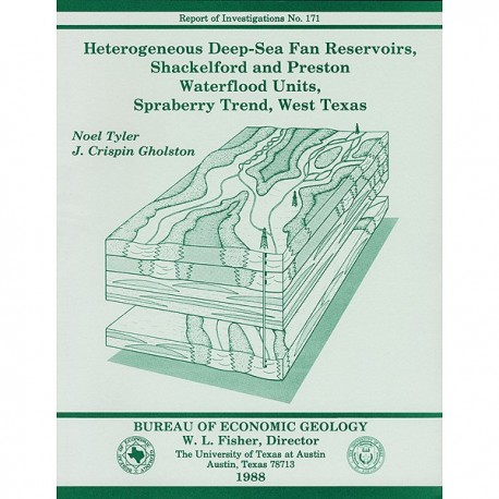
Heterogeneous Deep-Sea Fan Reservoirs, Shackelford and Preston Waterflood Units, Spraberry Trend, West Texas
RI0171
For a downloadable, digital version: RI0171D.
RI0171. Heterogeneous Deep-Sea Fan Reservoirs, Shackelford and Preston Waterflood Units, Spraberry Trend, West Texas, by Noel Tyler and J. C. Gholston. 38 p., 29 figs., 3 tables, 1988. ISSN: 0082335X: Print.
To purchase this publication as a downloadable PDF, please order RI0171D.
ABSTRACT
The Permian Spraberry Trend, once regarded as the world's largest uneconomic oil field, is a prime candidate for reserve growth through extended conventional recovery. More than 9.4 billion barrels (Bbbl) of oil was discovered in the trend, which is part of a giant oil play (10.5 Bbbl of in-place oil) that produces from submarine fan reservoirs of the Spraberry and Dean Formations in the Midland Basin, West Texas. Historically, development of the naturally fractured, very fine grained sandstone and siltstone reservoirs was based on the assumption that reservoirs were laterally continuous and that fractures would foster efficient drainage at 160-acre well spacings. Yet ultimate recovery of oil is estimated to average 6 percent of the original oil in place. Almost 10 Bbbl of oil will remain in Spraberry-Dean reservoirs at abandonment. Of this volume, 4 Bbbl is nonresidual mobile oil that awaits extended conventional recovery in untapped or poorly drained reservoir compartments. This unproduced mobile oil forms a major component of the target for Spraberry reserve growth.
Geological characterization of the Shackelford and Preston waterflood units (SPWU) in the central Spraberry Trend established that three separate submarine fans (two in the upper and one in the lower Spraberry), each characterized by a variety of midfan facies, are productive. Paleodip-oriented channels display a transition from braided in the updip parts of the SPWU to meandering downdip. Laterally, channels are flanked by levees that grade into upward-coarsening, unconfined distal-fan sediment. Investigation of facies-defined hydrocarbon saturations clearly shows that facies boundaries compartmentalize the reservoir, providing for interwell, stratigraphic entrapment of oil.
Fieldwide heterogeneity is pronounced. Stacking of channels in the upper Spraberry in the eastern half of the SPWU results in a dip-oriented belt of better reservoir quality. Wells completed in this axis have produced two to as much as six times the amount of oil produced from wells located off of the depositional axis. This swath of superior wells trends obliquely to the natural fracture orientation, suggesting that although fractures are important in early production, the contribution of matrix porosity is critical throughout the life of the reservoir.
Current economics dictates that reserve growth might best be attained by siting new strategic infill wells in the depositional axis and by selectively recompleting existing wells to produce bypassed oil in undrained reservoir compartments in areas of poorer reservoir quality.
Keywords: Midland Basin, Permian (Leonardian), Spraberry Trend, submarine fans, reservoir architecture, oil reserve growth, Texas, West Texas
CONTENTS
Abstract
Introduction
Reservoir characterization for improved recovery
Stratigraphic setting of the Spraberry Formation
Submarine fan depositional systems
Sedimentary Character of Spraberry Reservoirs
Shackelford and Preston Units, Central Spraberry Trend
Sandstone distribution and architecture of the upper Spraberry
Upper Spraberry operational unit 1
Upper Spraberry operational unit 2
Upper Spraberry operational unit 3
Upper Spraberry operational unit 4
Interpretation: upper Spraberry operational units 1, 2, 3,and 4-the Floyd submarine fan
Upper Spraberry operational units 5 and 6
Interpretation: upper Spraberry operational units 5 and 6-the Driver submarine fan
Sandstone distribution and architecture of the lower Spraberry
Lower Spraberry operational unit 1
Interpretation: lower Spraberry operational units 1 and 2-the Jo Mill submarine fan
Facies composition of Spraberry genetic reservoir units
Spraberry lithofacies
Nonreservoir lithofacies
Black, organic-rich claystone
Laminated siltstone
Reservoir lithofacies
Massive and laminated sandstone
Relation between lithofacies, log facies, porosity, and permeability
Spraberry log facies
Upper Spraberry unit 1b
Interpretation
Upper Spraberry unit 2.
Interpretation
Upper Spraberry unit 5
Interpretation.
Sedimentological Constraints on Oil Recovery from the Shackelford and Preston Waterflood Units
Development history of Spraberry waterflood units
Facies architecture and reservoir continuity
Vertical variability in oil saturation
Lateral variability in oil saturation between wells
Waterflood-unit-wide variability in reservoir architecture and relation to production
Sedimentary patterns
Production patterns
Fractures and production
Reservoir Architecture and the Potential for Reserve Growth
Conclusion
Acknowledgments
References .
Figures
1. Structure of the Permian Basin and location of the major Spraberry-Dean oil fields in the Midland Basin
2. Pie diagrams illustrating the relation between depositional systems and patterns of oil accumulation in and ultimate recovery from sandstone reservoirs
3. Spectrum of recovery efficiencies in typical sandstone reservoirs
4. Principal Spraberry waterflood units, central Midland Basin
5. Paleozoic stratigraphy of the Midland Basin
6. Submarine fan environmental model and hypothetical vertical profile of a prograded fan system
7. Divisions of the Spraberry Formation in the central trend area, TXL Oil Corporation Midland Fee B No. 1 well
8. Isopach and percent-sand maps of operational units 1 through 6 of the upper Spraberry
9. Net-sand and percent-sand maps of operational unit 1, upper Spraberry
10. Percent-sand maps of operational units 2 and 3
11. Net-sand map of operational unit 5, upper Spraberry
12. Percent-sand map of operational unit 1, lower Spraberry
13. Mudstone and fine-grained siltstone lithofacies of the Spraberry Formation
14. Reservoir lithofacies: massive sandstone with numerous vertical water escape pipes and massive sandstone grading vertically into laminated sandstone with dish structures
15. Relation between sediment character including vertical grain-size trends and corresponding gamma-ray log response, Magnolia Petroleum Company D. T. Bowles No. 5 DD well
16. Relation between gamma-ray log character, sediment character, and porosity and permeability, Mobil Preston No. 1 well
17. Log facies map and typical logs of unit l b of operational unit 1, upper Spraberry
18. Log facies map and typical logs of operational unit 2, upper Spraberry
19. Log facies maps and typical logs of lower and upper intervals of operational unit 5, upper Spraberry
20. Resistivity cross section A-A' showing the pronounced stratification of hydrocarbon-bearing intervals in the upper Spraberry
21. Detailed resistivity cross section B-B' of unit 1b of operational unit 1, upper Spraberry, showing strong interwell (macroscopic) heterogeneity
22. Sequential distribution of high-percent-sand axes, upper Spraberry
23. Upper Spraberry trunk axes determined by superposing channel-axis maps shown in figure 22
24. Cumulative production from all initial development (pre-1955) wells in the Shackelford and Preston waterflood units
25. Cumulative water-cut map showing percent water of all fluids produced to 1972
26. Naturally fractured fine-grained sandstone, upper Spraberry
27. Initial potential map showing the importance of fracture porosity in early production
28. Percent-sandstone cross sections of the upper Spraberry showing the pronounced vertical stratification and the strong lateral heterogeneity of Spraberry reservoirs
29. Schematic architecture of upper Spraberry submarine fan reservoirs in the central Spraberry Trend
Tables
1. Subdivisions of the Spraberry Formation
2. Morphology and dimensions of upper Spraberry submarine fan depositional axes and component channels, Spraberry Trend area
3. Shackelford and Preston Spraberry unit reservoir characteristics
Citation
Tyler, Noel, and Gholston, J. C., 1988, Heterogeneous Deep-Sea Fan Reservoirs, Shackelford and Preston Waterflood Units, Spraberry Trend, West Texas: The University of Texas at Austin, Bureau of Economic Geology, Report of Investigations No. 171, 38 p.
