Reports of Investigations
-
Books & Reports
- Reports of Investigations
- Guidebooks
- Udden Series
- Geological Circulars
- Down To Earth
- Atlases of Major Oil and Gas Reservoirs
- Texas Memorial Museum Publications
- Environmental Geologic Atlas of the Texas Coastal Zone
- Mineral Resource Circulars
- Other Reports
- Seminars and Workshops
- Handbooks
- Submerged Lands of Texas
- Symposia
- Annual Reports
- Open File Reports
-
Maps & Cross Sections
- Thematic Maps
- Miscellaneous Maps, Charts & Sections
- Geologic Atlas of Texas
- STATEMAP Project Maps
- Geologic Quadrangle Maps
- Cross Sections
- Highway Geology Map
- Energy and Mineral Resource Maps
- Shoreline Change and Other Posters
- Wilcox Group, East Texas, Geological / Hydrological Folios
- Bouguer Gravity Atlas of Texas
- River Basin Regional Studies
- Featured Maps
- Posters
- Teachers & the Public
-
Geological Society Publications
- Gulf Coast Association of Geological Societies
- Alabama Geological Society
- Austin Geological Society
- Corpus Christi Geological Society
- Houston Geological Society
- Lafayette Geological Society
- Mississippi Geological Society
- New Orleans Geological Society
- South Texas Geological Society
- GCS SEPM Publications
- Historic BEG & UT Series
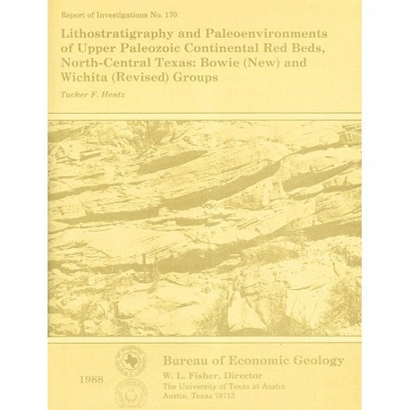
Lithostratigraphy and Paleoenvironments of Upper Paleozoic Continental Red Beds, North-Central Texas: Bowie (New)
RI0170
For a downloadable, digital version: RI0170D.
RI0170. Lithostratigraphy and Paleoenvironments of Upper Paleozoic Continental Red Beds, North-Central Texas: Bowie (New) and Wichita (Revised) Groups, by T. F. Hentz. 55 p., 24 figs., 3 tables, 1 appendix, 1 plate, 1988. ISSN: 0082335X: Print.
To purchase this publication as a downloadable PDF, please order RI0170D.
ABSTRACT
Approximately 2,200 ft (670 m) of principally continental and paralic rocks of late Virgilian, Wolfcampian, and early Leonardian age (late Pennsylvanian and early Permian) are exposed in an area of about 4,950 mi2 (12,800 km2) between the Brazos and Red Rivers in North-Central Texas. The stratigraphic complexity of these strata has impeded internal correlation and mapping ever since the rocks were first described by W. F. Cummins in the late 19th century. Precise correlation of this irregularly stratified fluvial sequence with well-defined, limestone-bounded fluvial-deltaic and marine formations to the south has been hampered because of (1) the gradational change in lithology that accompanies this facies transition, (2) a maximum shift in strike of approximately 65' that coincides with a change in facies tract, thus amplifying the stratigraphic complexity of the region, and (3) the generally poor exposure of the gently inclined strata.
The continental sequence comprises approximately 30 major and numerous minor upward-fining, principally fluviogenic cycles. Sandstone units mark the bases of these cycles and occur as regionally persistent zones with multistory and multilateral geometry. These generally resistant cuesta-forming units interfinger with limestone-bearing strata or are laterally separated from them along strike by broad intervening zones of red mudstone. The fine-grained upper part of each cycle is predominantly concretionary red mudstone, although gray and variegated claystone and mudstone lenses, thin siltstone and sandstone beds, and lenticular and channel-fill conglomerates are common.
Precise field and photogeologic mapping of continental sandstone units and their correlation with the northern terminations of persistent limestone marker beds have enabled a stratigraphic tie with the dominantly marine section exposed within the Colorado and Brazos River valleys. Continental and paralic rocks are divided into the Bowie (new) and Wichita (revised) Groups; equivalent marine and fluvial-deltaic strata are divided into the Cisco and Albany (revised) Groups, respectively. New formations of the continental sequence were defined to allow the maximum degree of correlation between groups of the continental and marine sections.
The continental sequence is composed of facies assemblages that delimit a broad coastal zone peripheral to the northeastern margin of the Eastern Shelf of the Midland Basin. Channel deposits of sandy braided rivers and mixed-load meandering rivers are interstratified in the easternmost region of exposure of the Bowie and lower Wichita Groups and define a piedmont to upper coastal plain physiographic province. Mixed-load meandering rivers with moderate sinuosity were the principal sediment transport routes across the upper coastal plain and are associated with concretionary overbank mudstones, thin crevasse splay sandstones, and gray and variegated lenticular claystones of small floodbasin ponds or marshes (backswamps). Upper coastal plain deposits are represented in the Bowie and lower to middle Wichita Groups. High-sinuosity, mud-rich meanderbelts of the middle and upper Wichita Group typified the broad low-relief lower coastal plain. Small sandy and conglomeratic channel systems of ephemeral streams occurred throughout the coastal plain but were more common in the lower region. Desiccation-cracked beds of tidal mud flats containing fossiliferous storm-berm conglomerates and sand-filled tidal or distributary channels are interstratified with shallow-water marine limestones and carbonaceous shales and claystones of shoreline marshes and supratidal ponds in southwestern exposures of the middle and upper Wichita Group.
Keywords: Bowie Group, continental sedimentation, Eastern Shelf, lithostratigraphy, Lower Permian, North-Central Texas, red beds, Upper Pennsylvanian, Wichita Group
CONTENTS
ABSTRACT
INTRODUCTION
Scope of Investigation
Geologic Setting
LITHOSTRATIGRAPHY
Stratigraphic Complexity
History of Nomenclature
Proposed Stratigraphic Framework
Rationale
Group division'
Formation division
Bowie Group (new)
Thrifty and Graham Formations (undivided; Cisco Group)
Stratigraphic range
Lithologic characteristics
Markley Formation (new)
Stratigraphic range
Stratotype and lithologic characteristics
Archer City Formation (new)
Stratigraphic range
Stratotype and lithologic characteristics
Wichita Group (revised)
Nocona Formation (new)
Stratigraphic range
Stratotype and lithologic characteristics
Petrolia Formation (new)
Stratigraphic range
Stratotype and lithologic characteristics
Waggoner Ranch Formation (new)
Stratigraphic range
Stratotype and lithologic characteristics
SOURCES OF SEDIMENT
GENETIC STRATIGRAPHY
Regional Overview
Piedmont and Upper Coastal Plain Facies
Fluvial-channel facies
Sand-rich braided systems
Fine-grained meanderbelt systems
Interchannel facies
Lower Coastal Plain Facies Fluvial-channel facies
Mud-rich meanderbelt systems
Ephemeral streams
Interchannel facies.
Floodbasin ponds
Tidal mud-flat facies
Storm-berm conglomerates
Coastal ponds and marshes
Tidal or distributary channels
Shallow-Shelf Facies
Nearshore lime muds
Nearshore terrigenous-clastic muds
CONCLUSIONS
ACKNOWLEDGMENTS
REFERENCES
APPENDIX
Figures
1. Map of upper Virgilian, Wolfcampian and lower Leonardian marine and continental rocks, North-Central Texas
2. Index map illustrating major structural features of Texas
3. Correlation chart showing development of stratigraphic nomenclature of upper Pennsylvanian and lower Permian strata, North-Central Texas
4. Generalized geologic map of upper Pennsylvanian and lower Permian marine and continental rocks in the region drained by the Brazos, Trinity, Little Wichita, Wichita, and Red Rivers. North-Central Texas
5. Surface stratigraphic diagram illustrating vertical and lateral stratigraphic relationships of exposed rocks of the Cisco, Bowie, Albany, and Wichita Groups
6. Stratotype of the Markley Formation (new), Young County
7. Stratotype of the Archer City Formation (new), Archer County
8. Stratotype of the Nocona Formation (new), Montague County
9. Stratotype of the Petrolia Formation (new), Wichita County
10. Stratotype of the Waggoner Ranch Formation (new), Baylor County
11. Dip section and inferred depositional systems of the Bowie and Cisco Groups
12. Paleogeographic map of North-Central Texas illustrating the areal distribution of source terrains and facies tracts at maximum regression during middle to late Cisco (Bowie) time
13. Generalized channel-fill sequence of sandy braided rivers typical of the Bowie and lower Wichita Groups
14. Representative medium- and large-scale sedimentary features of channel-fill facies of sandy braided rivers
15. Generalized sequence of fine-grained channel-fill facies typical of mixed-load meandering rivers of the Bowie and Wichita Groups
16. Sedimentary features of channel-fill and floodplain facies of fine-grained meandering rivers
17. Generalized sequence of channel-fill facies typical of mud-rich (suspended-load) meandering rivers of the upper Wichita Group
18. Generalized channel-fill sequences of conglomeratic and sandy ephemeral fluvial systems of the Bowie and Wichita Groups
19. Conglomerate-filled channels of ephemeral streams, Petrolia Formation, Archer County
20. Sedimentary features of sandy channel-fill bodies of ephemeral streams
21. Depositional facies of tidal mud flats preserved in the middle to upper Wichita Group
22. Sedimentary and paleontological aspects of nearshore limestones of the upper Wichita Group
23. Schematic paleoenvironmental reconstruction of contemporaneous Bowie and Cisco facies
24. Schematic paleoenvironmental reconstruction of contemporaneous Wichita and Albany facies
Tables
1. Lithologic characteristics of the Markley, Archer City, and Nocona Formations
2. Lithologic characteristics of the Petrolia and Waggoner Ranch Formations
3. Diagnostic characteristics and geographic occurrence of fluvial-channel systems
Plate 1 (in pocket of book)
Selected fluvial channel-fill exposures of the Bowie and Wichita Groups
Citation
Hentz, T. F., 1988, Lithostratigraphy and Paleoenvironments of Upper Paleozoic Continental Red Beds, North-Central Texas: Bowie (New) and Wichita (Revised) Groups: The University of Texas at Austin, Bureau of Economic Geology, Report of Investigations No. 170, 55 p.
