Reports of Investigations
-
Books & Reports
- Reports of Investigations
- Guidebooks
- Udden Series
- Geological Circulars
- Down To Earth
- Atlases of Major Oil and Gas Reservoirs
- Texas Memorial Museum Publications
- Environmental Geologic Atlas of the Texas Coastal Zone
- Mineral Resource Circulars
- Other Reports
- Seminars and Workshops
- Handbooks
- Submerged Lands of Texas
- Symposia
- Annual Reports
- Open File Reports
-
Maps & Cross Sections
- Thematic Maps
- Miscellaneous Maps, Charts & Sections
- Geologic Atlas of Texas
- STATEMAP Project Maps
- Geologic Quadrangle Maps
- Cross Sections
- Highway Geology Map
- Energy and Mineral Resource Maps
- Shoreline Change and Other Posters
- Wilcox Group, East Texas, Geological / Hydrological Folios
- Bouguer Gravity Atlas of Texas
- River Basin Regional Studies
- Featured Maps
- Posters
- Teachers & the Public
-
Geological Society Publications
- Gulf Coast Association of Geological Societies
- Alabama Geological Society
- Austin Geological Society
- Corpus Christi Geological Society
- Houston Geological Society
- Lafayette Geological Society
- Mississippi Geological Society
- New Orleans Geological Society
- South Texas Geological Society
- GCS SEPM Publications
- Historic BEG & UT Series


Petroleum Potential of the Palo Duro Basin, Texas Panhandle
RI0123
Petroleum Potential of the Palo Duro Basin, Texas Panhandle, by S. P. Dutton, A. G. Goldstein, and S. C. Ruppel. 87 p., 53 figs., 5 tables, 6 plates, 1 appendix, 1982. ISSN: 0082335X: Print Version.
A free, digital version of this publication can be found on: Texas ScholarWorks
RI0123. Petroleum Potential of the Palo Duro Basin, Texas Panhandle, by S. P. Dutton, A. G. Goldstein, and S. C. Ruppel. 87 p., 53 figs., 5 tables, 6 plates, 1 appendix, 1982. ISSN: 0082335X: Print.
To purchase this publication as a downloadable PDF, please order RI0123D.
ABSTRACT
The Palo Duro Basin seemingly has all the elements necessary for hydrocarbon generation and accumulation: reservoirs, traps, source rocks, and sufficient thermal maturity. Porous facies in pre-Pennsylvanian, Pennsylvanian, and Permian strata are potential hydrocarbon reservoirs. Within the pre-Pennsylvanian section, shallow-marine carbonates of both Ordovician (Ellenburger Group) and Mississippian age have sufficient porosity and permeability for hydrocarbon accumulation. Three main exploration targets of Pennsylvanian and Wolfcampian age are (1) granite-wash sandstones, (2) shelf-margin carbonates, and (3) elongate-delta sandstones. Granite wash was deposited in fan deltas adjacent to fault-bounded, basement uplifts around the basin margins. Porous facies are braided-channel, fan-plain, and distal-fan deposits. Porous carbonates developed through time along the different positions of the shelf margins. Organic-rich basinal shales are juxtaposed against the porous shelf-margin facies. High-constructive, elongate-delta deposits in the southeastern part of the basin retain high porosity in bar-finger (channel-mouth bar) sandstones. In younger strata, dolomites in the Clear Fork (Leonardian) and the San Andres (Guadalupian) Formations are reservoirs along the Matador Arch. However, porosity in these units apparently pinches out to the north.
Both stratigraphic and structural traps occur in the basin. Porosity pinch-outs form the primary stratigraphic traps. Major faults are associated with the Amarillo Uplift; smaller faults have been identified in the deeper parts of the basin. Most faults are thought to have existed before the Pennsylvanian and to have been reactivated by a northwest maximum principal compression. Fracturing adjacent to some faults may have created fractured reservoirs.
The Palo Duro Basin contains source rocks of sufficient quality to generate hydrocarbons. Pennsylvanian and Wolfcampian shales contain up to 2.4 percent total organic carbon (TOC) and are fair to very good source rocks. Lipid-rich organic matter occurs primarily in basinal shales. Kerogen color and vitrinite reflectance, which measure thermal maturity, indicate that temperatures were sufficiently high to begin to generate hydrocarbons from lipid-rich organic matter. Pennsylvanian and Wolfcampian kerogen is yellow orange to orange. Average reflectance in Pennsylvanian vitrinite is 0.52 percent; in Wolfcampian samples the average reflectance is 0.48 percent. Recent oil discoveries in the Palo Duro Basin confirm that oil was generated.
Keywords: Amarillo Uplift, Ellenburger Group, granite wash, Matador Arch, Mississippian, oil and gas, organic geochemistry, Palo Duro Basin, Pennsylvanian, structural geology, Wolfcampian, Texas
CONTENTS
INTRODUCTION
REGIONAL SETTING AND TECTONICS
Pre-Carboniferous history
Carboniferous and Permian history
PRE-PENNSYLVANIAN SEQUENCE
Stratigraphy
Basal clastics
Ellenburger Group
Mississippian System
Depositional environments and history
Porosity and hydrocarbon potential
PENNSYLVANIAN AND LOWER PERMIAN STRATA
General stratigraphy
Pennsylvanian System
Pennsylvanian - Permian boundary
Lower Permian: Wolfcampian Series.
Depositional systems
Fan-delta system
Depositional history
Granite-wash production
Shelf and shelf-margin system
Distribution through time
Shelf-margin facies
Shelf and shelf-margin production
High-constructive delta system
Reservoir potential
Basin and slope system
Basin and slope reservoir potential
UPPER PERMIAN STRATA
Transition to evaporite deposition
Wichita - Red Cave genetic unit
Lower Clear Fork - Tubb genetic unit
Upper Clear Fork - Glorieta genetic unit
San Andres genetic unit
Post-San Andres genetic unit
Post-Wolfcampian reservoirs.
Clear Fork carbonate reservoirs
San Andres carbonate reservoirs
Post-San Andres reservoirs
STRUCTURAL GEOLOGY
Faults
Fractures
Gravity analysis
ORGANIC GEOCHEMISTRY
Source-rock quality
Midland Basin samples
Kerogen type
Thermal maturity
Kerogen color
Vitrinite reflectance
Midland Basin samples
Sources of Palo Duro oil
Oldham County
Briscoe County
Southeastern Palo Duro Basin
Matador Arch
CONCLUSIONS
ACKNOWLEDGMENTS.
REFERENCES
APPENDIX
Figures
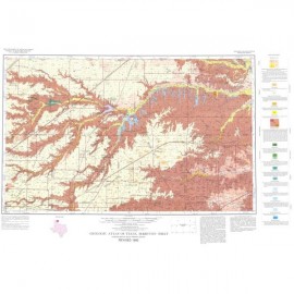
1. Late Paleozoic basins and uplifts of the southern Midcontinent region (Ancestral Rockies) showing location and tectonic setting of the Palo Duro Basin
2. Data base showing areas where the selectivity of data points (wells) varied
3. Location map of cross sections used in this report
4. Plot of sediment accumulation rates versus time for the Palo Duro, western Anadarko, and Dalhart Basins
5. Rate of accumulation of granite wash, Palo Duro and western Anadarko Basins
6. Structure contour map of crystalline basement in western Oklahoma, Texas Panhandle, and northeastern New Mexico
7. Typical pre-Pennsylvanian sequence in eastern part of the Palo Duro Basin
8. Structure contour map of top of Ordovician Ellenburger Group, Palo Duro Basin
9. Isopach map of Ellenburger Group, Palo Duro Basin
10. Structure contour map of top of Mississippian System, Palo Duro Basin
11. Isopach map of Mississippian System, Palo Duro Basin
12. East-west cross section G-G´ showing stratigraphic framework and depositional systems composing Pennsylvanian - lower Permian strata
13. East-west cross section J-J´
14. Isopach map of Pennsylvanian System
15. Structure contour map of top of Pennsylvanian System
16. Isopach map of Wolfcampian Series
17. Typical electric log patterns of fan-delta, shelf and shelf-margin, delta, and basin facies
18. Hydrocarbon shows from drill-stem tests and cuttings of Pennsylvanian carbonate, granite wash, and sandstone
19. Distribution of oil stains and shows, as reported on sample logs, in relation to Wolfcamp structure, porous carbonate fairways, and lithology of host rock
20. Location of oil and gas fields in the Palo Duro Basin and surrounding areas
21. Isolith map of Pennsylvanian and Wolfcampian granite wash in the Texas Panhandle
22. North-south cross section E-E´ of Pennsylvanian strata, Donley to Floyd Counties
23. Block diagrams of paleogeographic evolution of Palo Duro Basin during Pennsylvanian and Wolfcampian time
24. Schematic diagram of fan-delta system
25. East-west cross section l-l´ of Pennsylvanian strata, Parmer to Childress Counties
26. Net-carbonate map of lower part of Pennsylvanian System
27. Net-carbonate map of upper part of Pennsylvanian System
28. Percent-carbonate map of lower Permian strata in the Palo Duro Basin
29. Isopach map, based on sample log information, of upper Pennsylvanian dolomite
30. Isopach map of porous carbonate strata in upper part of the Pennsylvanian System
31. Isopach map of porous carbonate strata in Wolfcampian Series
32. Net-sandstone map of upper part of the Pennsylvanian System, including both granite wash and nonarkosic sandstone
33. Isolith maps of Wolfcampian deltaic sandstones in southeastern Palo Duro Basin
34. North-south cross section F-F´ of lower Clear Fork Formation
35. North-south cross section C-C´ of San Andres Formation in areas of production, showing generalized lithic interpretations and inferred depositional systems
36. Diagrammatic cross section of San Andres rocks in hydrocarbon-producing areas, illustrating distribution of facies and depositional systems
37. Map of San Andres oil production, shelf margins, and surface lineaments
38. Cross section across Northern Shelf of the Midland Basin, lower San Andres Formation, showing porosity relationships
39. Summary of lineament length by 10° azimuth category within each named 1° × 2° National Map Series sheet
40. Joint orientations from localities in the Texas Panhandle and eastern New Mexico
41. Simple Bouguer gravity anomaly map, Texas Panhandle and vicinity
42. Basement lithologic provinces in the Texas Panhandle
43. Gravity model A-A´
44. Gravity model B-B´
45. Plot of TOC with depth for 20 wells in the Palo Duro and Dalhart Basins
46. Distribution of percent TOC in Pennsylvanian rocks of the Palo Duro Basin
47. Distribution of percent TOC in Wolfcampian rocks of the Palo Duro Basin
48. Paleotemperature, vitrinite reflectance, and kerogen color related to hydrocarbon facies
49. Thermal maturity of Midland and Palo Duro Basin samples based on kerogen color and kerogen type.
50. Distribution of kerogen type in Pennsylvanian strata, Palo Duro Basin
51. Distribution of kerogen type in Wolfcampian strata, Palo Duro Basin
52. Pennsylvanian potential reservoir fairways
53. Wolfcampian (lower Permian) potential reservoir fairways
Tables
1. Stratigraphic chart and general lithology of the Palo Duro Basin
2. Potential reservoir facies in the Palo Duro Basin
3. Stratigraphic chart of Permian System in Palo Duro and Dalhart Basins
4. Wells sampled for geochemical source-rock analyses
5. Organic Matter Index values of different kerogen types
Plates (in pocket of book)
I. Base map of well control
II. Structural cross sections B-B´ and D-D´ across the Palo Duro Basin, basement to surface
III. Stratigraphic cross section H-H´ of basement to mid-Permian
IV. Stratigraphic cross section A-A´ through upper Permian salt-bearing strata
V. Structure contour map on top of crystalline basement, Texas Panhandle
VI. Bouguer gravity map, Texas Panhandle
Citation
Dutton, S. P., Goldstein, A. G., and Ruppel, S. C., 1982, Petroleum Potential of the Palo Duro Basin, Texas Panhandle: The University of Texas at Austin, Bureau of Economic Geology, Report of Investigation No. 123, 87 p.