Reports of Investigations
-
Books & Reports
- Reports of Investigations
- Guidebooks
- Udden Series
- Geological Circulars
- Down To Earth
- Atlases of Major Oil and Gas Reservoirs
- Texas Memorial Museum Publications
- Environmental Geologic Atlas of the Texas Coastal Zone
- Mineral Resource Circulars
- Other Reports
- Seminars and Workshops
- Handbooks
- Submerged Lands of Texas
- Symposia
- Annual Reports
- Open File Reports
-
Maps & Cross Sections
- Thematic Maps
- Miscellaneous Maps, Charts & Sections
- Geologic Atlas of Texas
- STATEMAP Project Maps
- Geologic Quadrangle Maps
- Cross Sections
- Highway Geology Map
- Energy and Mineral Resource Maps
- Shoreline Change and Other Posters
- Wilcox Group, East Texas, Geological / Hydrological Folios
- Bouguer Gravity Atlas of Texas
- River Basin Regional Studies
- Featured Maps
- Posters
- Teachers & the Public
-
Geological Society Publications
- Gulf Coast Association of Geological Societies
- Alabama Geological Society
- Austin Geological Society
- Corpus Christi Geological Society
- Houston Geological Society
- Lafayette Geological Society
- Mississippi Geological Society
- New Orleans Geological Society
- South Texas Geological Society
- GCS SEPM Publications
- Historic BEG & UT Series
Genetic Stratigraphy and Oil Recovery in an Upper Cretaceous ...Deltaic Reservoir, Big Wells (San Miguel) Field
RI0153
For a downloadable, digital version: RI0153D.
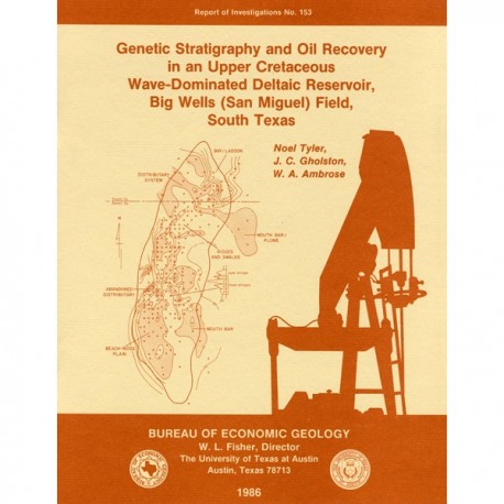
RI0153. Genetic Stratigraphy and Oil Recovery in an Upper Cretace ous Wave-Dominated Deltaic Reservoir, Big Wells (San Miguel) Field, South Texas, by Noel Tyler, J. C. Gholston, and W. A. Ambrose. 38 p., 33 figs., 1 table, 1986. ISSN: 0082335X: Print.
To purchase this publication as a downloadable PDF, please order RI0153D.
ABSTRACT
The Big Wells (San Miguel) reservoir in Dimmit and Zavala Counties, South Texas, produces from a broadly lenticular, wave-dominated deltaic sandstone encased in prodelta and shelf mudstones. An updip porosity pinch-out coincides with a gentle undulation on a uniformly gulfward-dipping monocline and forms a structurally modified stratigraphic trap. The reservoir is relatively tight and has average porosity of 21 percent and average permeability of 6 md; wells require fracturing to stimulate production. Ultimate recovery is projected to be 57 million barrels, or 29 percent of the 198-million-barrel field.
The reservoir is subdivided into an upper nonproductive, transgressive shelf sandstone and a lower productive, intensely bioturbated, deltaic sandstone. The tight upper sandstone seals the reservoir, which consists of four major internal facies elements. A dip-oriented distributary system carried sediment into the basin, where it was transported along strike (dominantly to the southwest) by longshore drift. Here wave action reworked the sands into a beach-ridge plain. The resultant distributary/beach-ridge plain complex exhibits an asymmetric cuspate geometry elongated to the southwest. Landward of the delta system lay a muddy coastal plain. Prodelta and lower shoreface silts and shelf muds were deposited seaward of the deltaic/shorezone system.
Biogenic activity destroyed most of the primary bedding structures. However, three associations of trace fossils together with subtle variation in lithology allow inference of depositional setting. The Zoophycos ichnofacies, a homogenized sandy and silty mudstone, grades upward into churned sandy siltstone of the Cruziana ichnofacies. Distinctive vertical Skolithos burrows in fine-grained sandstone characterize the Skolithos ichnofacies, which rests on the Cruziana ichnofacies and is transitional upward with the sole lithofacies, the weakly bioturbated, bedded sandstone facies. This vertical progression in ichnofacies represents a shoaling cycle from shelf through lower shoreface, upper shoreface, to foreshore environments. More important is the lateral distribution of ichnofacies, particularly in the oil column. Sand-rich foreshore deposits (composed of sparsely bioturbated, bedded sandstone) and the Skolithos ichnofacies are dominant in the southern half of the field; finer grained, less mature sediment of the Cruziana and Zoophycos ichnofacies characterize the northern half of the field.
The northward transition from thicker and cleaner beach-ridge plain sandstones to argillaceous sandstones within and adjacent to the distributary system strongly affects oil recovery from the field. Critical parameters, reservoir permeability and induced-fracture half-lengths (calculated from pressure transient analysis), decrease dramatically to the north. Consequently, well performance peaks in the beach-plain sediments and decreases northward and updip and downdip into adjacent muddier sediments. Recovery efficiencies of the original oil in place average 50 percent in the southern half of the pool and drop to 20 to 30 percent in the north. However, recovery of movable oil is highly efficient. About 88 percent of the nonresidual oil in the pool will be produced. Wave dominated deltaic reservoirs are characterized by minimal well-to-well variability, excellent internal continuity, and consequently, maximum efficiency of mobile-oil recovery.
Keywords: Big Wells (San Miguel) reservoir, Dimmit County, oil and gas production, South Texas, Upper Cretaceous, wave-dominated deltaic sandstone, Zavala County
CONTENTS
ABSTRACT
INTRODUCTION
GEOLOGIC SETTING OF THE SAN MIGUEL FORMATION
Structural framework
WAVE-DOMINATED DELTA SYSTEMS
BIG WELLS (SAN MIGUEL) FIELD
Well-stimulation practice
Development and production history
Petrophysical characteristics
BIG WELLS RESERVOIR GEOLOGY
Structure
Genetic reservoir stratigraphy
Transgressive upper unit
Thickness trends
Sedimentary facies
Interpretation
Big Wells deltaic sandstone
Thickness trends
Sedimentary facies
Zoophycos ichnofacies
Cruziana ichnofacies
Skolithos ichnofacies
Weakly bioturbated, bedded sandstone facies
Interpretation
Facies architecture
Depositional model
BIG WELLS ENGINEERING AND PRODUCTION CHARACTERISTICS
Oil distribution
Reservoir continuity
Critical reservoir parameters
Reservoir permeability
Fracture half-lengths
Oil production
CONCLUSIONS
ACKNOWLEDGMENTS
REFERENCES
FIGURES
1. Structural setting of the Maverick Basin
2. Simplified Upper Cretaceous stratigraphy in the Maverick Basin
3. Distribution of deltaic sandstones in the San Miguel Formation
4. Structure map of the northern Maverick Basin and location of the Big Wells field
5. Process classification of San Miguel delta systems
6. The spectrum of wave-dominated to wave-modified delta types in the San Miguel Formation
7. Oil field discovery history of South Texas
8. Map showing the Big Wells (San Miguel) unit area, discovery wells, and well utilization histories
9. Development and production history of the Big Wells (San Miguel) reservoir
10. Spontaneous potential structure section showing the updip and downdip pinch-out of reservoir-quality sandstones
11. Spontaneous potential structure section and calculated water saturations across the reservoir
12. Calculated water saturations
13. Structure map of the Big Wells field area contoured on the top of the San Miguel reservoir sandstone
14. Genetic subdivisions in the Big Wells reservoir
15. lsopach map showing total thickness (sandstone and mudstone) of the Big Wells (San Miguel) transgressive upper unit
16. Net-sandstone map of the Big Wells transgressive upper unit
17. lsopach map (sandstone and mudstone) of the Big Wells (San Miguel) deltaic system
18. Net-sandstone distribution in Big Wells (San Miguel) deltaic system
19. Percent-sandstone map of the uppermost lower sandstone stringer
20. Description and interpretation of a typical Big Wells core
21. Intensely bioturbated mudstone, siltstone, and sandstone of the Zoophycos ichnofacies
22. Cruziana ichnofacies
23. Skolithos ichnofacies "pipe rock"
24. Weakly bioturbated, bedded sandstone lithofacies
25. Core cross section showing the vertical and lateral extent of ichnofacies and sandstone stringers
26. Depositional model of the Big Wells sandstone based largely on the architecture of lower progradational stringer
27. Oil volumetrics of Big Wells (San Miguel) reservoir
28. lsoresistivity maps of lower stringers 1 and 2 of the Big Wells (San Miguel) reservoir
29. Spontaneous potential and resistivity dip section of the southern half of the Big Wells (San Miguel) reservoir
30. Spontaneous potential and resistivity dip section in the center of the Big Wells (San Miguel) reservoir
31. Resistivity strike section of Big Wells (San Miguel) reservoir
32. Big Wells (San Miguel) reservoir-wide variation in permeability to oil and induced-fracture half-lengths
33. Oil production from the Big Wells (San Miguel) reservoir
TABLE
1. Physical and chemical characteristics of the Big Wells (San Miguel) reservoir
Citation
Tyler, Noel, Gholston, J. C., and Ambrose, W. A., 1986, Genetic Stratigraphy and Oil Recovery in an Upper Cretaceous Wave-Dominated Deltaic Reservoir, Big Wells (San Miguel) Field, South Texas: The University of Texas at Austin, Bureau of Economic Geology, Report of Investigations No. 153, 38 p.


