Geological Circulars
-
Books & Reports
- Reports of Investigations
- Guidebooks
- Udden Series
- Geological Circulars
- Down To Earth
- Atlases of Major Oil and Gas Reservoirs
- Texas Memorial Museum Publications
- Environmental Geologic Atlas of the Texas Coastal Zone
- Mineral Resource Circulars
- Other Reports
- Seminars and Workshops
- Handbooks
- Submerged Lands of Texas
- Symposia
- Annual Reports
- Open File Reports
-
Maps & Cross Sections
- Thematic Maps
- Miscellaneous Maps, Charts & Sections
- Geologic Atlas of Texas
- STATEMAP Project Maps
- Geologic Quadrangle Maps
- Cross Sections
- Highway Geology Map
- Energy and Mineral Resource Maps
- Shoreline Change and Other Posters
- Wilcox Group, East Texas, Geological / Hydrological Folios
- Bouguer Gravity Atlas of Texas
- River Basin Regional Studies
- Featured Maps
- Posters
- Teachers & the Public
-
Geological Society Publications
- Gulf Coast Association of Geological Societies
- Alabama Geological Society
- Austin Geological Society
- Corpus Christi Geological Society
- Houston Geological Society
- Lafayette Geological Society
- Mississippi Geological Society
- New Orleans Geological Society
- South Texas Geological Society
- GCS SEPM Publications
- Historic BEG & UT Series
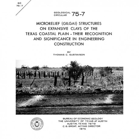
Microrelief ...Structures on Expansive Clays of the Texas Coastal Plain: Their Recognition and Significance
GC7507
A free, digital version of this publication can be found on: Texas ScholarWorks
GC7507. Microrelief (Gilgai) Structures on Expansive Clays of the Texas Coastal Plain: Their Recognition and Significance in Engineering Construction, by T. C. Gustavson. 18 p., 14 figs., 1 table, 1975. ISSN: 0082-3309. Print.
To purchase this publication as a PDF download, please order GC7507D.
ABSTRACT
Cracked pavements, undulating road surfaces, broken curbs, stairstep fractures of brick and stone building walls, and tilted power poles are common occurrences in areas underlain by cracking, expansive clay soils of the Vertisol order. These soils, which underlie 15 to 20 percent of the Coastal Plain of Texas, are composed predominately of montmorillonite and develop distinctive microtopographic features known as gilgaies. Relief between adjacent microknolls or ridges and microdepressions ranges up to 18 inches (45.7 cm). Cracks develop in these soils to depths of 60 inches (152.4 cm) and to widths of 4 inches (10.2 cm).
Gilgai microtopography forms as montmorillonitic clay soils expand with the adsorption of water introduced via deep cracks, root holes, animal burrows, and normal gravity infiltration. Subsoil clay and dry clay soil which has fallen into cracks from the surface expand, causing subsoil material to move both laterally and upward. Areas of marked vertical movement produce diapirlike ridges of light-colored clay subsoil extending upward into dark surface soils. The subsoil diapirs underlie surface microknolls and microridges.
Areas of gilgai microrelief are easily recognized from aerial photographs on which the scale is greater than 1:80,000. On slopes of less than 1 percent, the pattern is an irregular network of microridges. As slope increases, microridges and microdepressions become elongated downslope, resulting in a pattern of alternating linear ridges and troughs that are approximately parallel to slope direction. Towards the bases of slopes, gilgai microtopography becomes obscured by colluvium. As a consequence of large hydration pressures, vertical soil movements in areas of gilgai microrelief may place severe limitations on the construction of roads, buildings, power lines, buried transmission lines, and pipelines. Current engineering techniques for the mitigation of damage to highways and buildings include lime stabilization, ponding, and subgrading of highways .and use of steel reinforcing bars or post-tension cables in concrete-foundation slabs of buildings.
Keywords: clays, engineering geology, gilgaies, gilgai, soils, Texas Coastal Plain
Citation
Gustavson, T. C., 1975, Microrelief (Gilgai) Structures on Expansive Clays of the Texas Coastal Plain: Their Recognition and Significance in Engineering Construction: The University of Texas at Austin, Bureau of Economic Geology, Geological Circular GC 75-7, 18 p.
