Geological Circulars
-
Books & Reports
- Reports of Investigations
- Guidebooks
- Udden Series
- Geological Circulars
- Down To Earth
- Atlases of Major Oil and Gas Reservoirs
- Texas Memorial Museum Publications
- Environmental Geologic Atlas of the Texas Coastal Zone
- Mineral Resource Circulars
- Other Reports
- Seminars and Workshops
- Handbooks
- Submerged Lands of Texas
- Symposia
- Annual Reports
- Open File Reports
-
Maps & Cross Sections
- Thematic Maps
- Miscellaneous Maps, Charts & Sections
- Geologic Atlas of Texas
- STATEMAP Project Maps
- Geologic Quadrangle Maps
- Cross Sections
- Highway Geology Map
- Energy and Mineral Resource Maps
- Shoreline Change and Other Posters
- Wilcox Group, East Texas, Geological / Hydrological Folios
- Bouguer Gravity Atlas of Texas
- River Basin Regional Studies
- Featured Maps
- Posters
- Teachers & the Public
-
Geological Society Publications
- Gulf Coast Association of Geological Societies
- Alabama Geological Society
- Austin Geological Society
- Corpus Christi Geological Society
- Houston Geological Society
- Lafayette Geological Society
- Mississippi Geological Society
- New Orleans Geological Society
- South Texas Geological Society
- GCS SEPM Publications
- Historic BEG & UT Series
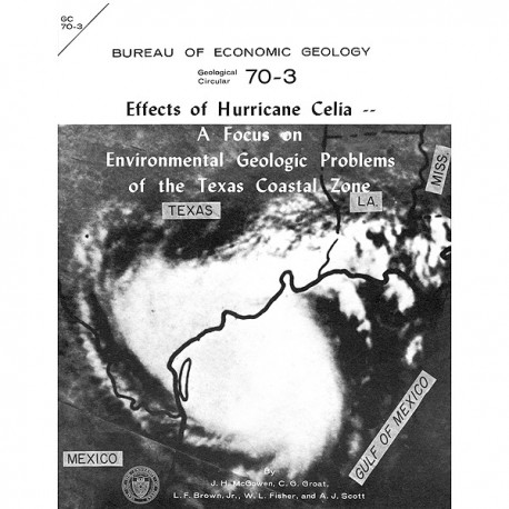
Effects of Hurricane Celia: A Focus on Environmental Geologic Problems of the Texas Coastal Zone
GC7003
For a downloadable, digital version: GC7003D.
This product is no longer in stock
GC7003. Effects of Hurricane Celia: A Focus on Environmental Geologic Problems of the Texas Coastal Zone, by J. H. McGowen, C. G. Groat, L. F. Brown, Jr., W. L. Fisher, and A. J. Scott. 35 p., 9 figs., 1970. ISSN: 0082-3309. Print.
To purchase this publication as a PDF download, please order GC7003D.
From the Introduction
At 10 p.m. (CDT) on Friday, July 31, 1970, a tropical squall struck the western tip of Cuba, causing property damage and the loss of 5 lives. Twelve hours later at 10 a.m. (CDT), Saturday, August 1, the tropical depression had moved 150 miles northwest and had intensified into Tropical Storm Celia. At 5 p.m. (CDT) the same day, Celia was located about 225 miles northwest of Cuba with 75-mile-per-hour cyclonic winds, classifying her as a full-fledged hurricane. Twenty hours later at 1 p.m. (CDT) on Sunday, August 2, Hurricane Celia was 290 miles directly south of New Orleans, Louisiana, moving northwest toward Galveston, Texas, at less than 20 miles per hour. During the next several hours Celia changed direction and forward speed several times. In the early hours on Monday, August 3, as Celia lined up on a course toward the relatively uninhabited coastline near Baffin Bay, her destructive core approximately doubled in size in less than three hours. Then between 8 and 10 a.m. (CDT) on the 3rd, Celia suddenly veered to the northwest toward Port Aransas. At the same time her turbulent core shrank by approximately 40 percent, coincident with a rapid increase in the velocity of her 90-mile-per-hour counterclockwise winds. Moving coastward at 10 to 15 miles per hour, Celia struck the Texas coastal bend at Port Aransas by midafternoon, and shortly after 4 p.m. (CDT) southwest winds on the back side of Celia reached 30-second gusts of 160 to 180 miles per hour, with sustained winds of 130 miles per hour. The most intense winds moved through Port Aransas, Aransas Pass, Ingleside, Portland, and the north part of Corpus Christi.
Keywords: hurricanes, Texas Coastal Zone, Port Aransas, Aransas Pass, Ingleside, Portland, Corpus Christi, environmental geology, Texas, coastal studies
CONTENTS
Introduction
Hurricanes and their effects on the Texas coast: A model
Hurricane Celia: Geological effects
Effects on barrier islands
Storm passes and washovers
Beaches and dunes
Back-island areas
Effects on bays and adjacent areas
Modification of storm effects by normal processes
Effects on man-made features and structures
Summary
Hurricanes and land-use planning: Areview
Conclusions and recommendations
References
Figures
1. Track of Hurricane Celia
2. Hurricane activity on the Texas coast, 1900-1963
A. Tropical cyclone activity by decades
B. Points of entry of tropical cyclones
3. Schematic model of hurricane effects on the Texas coastline
A. Physical features characterizing Texas coasts
B. Effect of approaching hurricanes
C. Effect of hurricanes upon impact with coast
D. Aftermath effects of hurricanes
4. Idealized profile of Mustang Island
5. Photographs of hurricane damage and geologic effects
A. Damage to Portland, Texas
B. Destruction of property in Port Aransas
C. Hurricane beach on Mustang Island
D. Hurricane beach near north end of Mustang Island
6. Geologic and index map of Texas coast struck by Celia
7. Beach profiles of Mustang Island showing effects of Celia's erosion
8. Photographs of hurricane effects
A. Washover effects at Vinson Slough and Cedar Bayou on St. Joseph Island
B. Washover effects at Corpus Christi Pass
C. Barrier flats protected from erosion by vegetation
D. Erosion along unvegetated barrier flat adjacent to south edge of Corpus Christi Pass.
9. Comparison of Hurricanes Carla and Beulah with Celia
A. Carla and Beulah's effects on the coastal bend.
B. Celia's effects on the coastal bend
Citation
McGowen, J. H., Groat, C. G., Brown, L. F., Jr., Fisher, W. L., and Scott, A. J., 1970, Effects of Hurricane Celia: A Focus on Environmental Geologic Problems of the Texas Coastal Zone: The University of Texas at Austin, Bureau of Economic Geology, Geological Circular 70-3, 35 p.
