Geological Circulars
-
Books & Reports
- Reports of Investigations
- Guidebooks
- Udden Series
- Geological Circulars
- Down To Earth
- Atlases of Major Oil and Gas Reservoirs
- Texas Memorial Museum Publications
- Environmental Geologic Atlas of the Texas Coastal Zone
- Mineral Resource Circulars
- Other Reports
- Seminars and Workshops
- Handbooks
- Submerged Lands of Texas
- Symposia
- Annual Reports
- Open File Reports
-
Maps & Cross Sections
- Thematic Maps
- Miscellaneous Maps, Charts & Sections
- Geologic Atlas of Texas
- STATEMAP Project Maps
- Geologic Quadrangle Maps
- Cross Sections
- Highway Geology Map
- Energy and Mineral Resource Maps
- Shoreline Change and Other Posters
- Wilcox Group, East Texas, Geological / Hydrological Folios
- Bouguer Gravity Atlas of Texas
- River Basin Regional Studies
- Featured Maps
- Posters
- Teachers & the Public
-
Geological Society Publications
- Gulf Coast Association of Geological Societies
- Alabama Geological Society
- Austin Geological Society
- Corpus Christi Geological Society
- Houston Geological Society
- Lafayette Geological Society
- Mississippi Geological Society
- New Orleans Geological Society
- South Texas Geological Society
- GCS SEPM Publications
- Historic BEG & UT Series
Seismic Analysis of the Duval County Ranch Area, South Texas:...Exploration Potential of the Wilcox, Queen City
GC9504
For a downloadable, digital version: GC9504D.
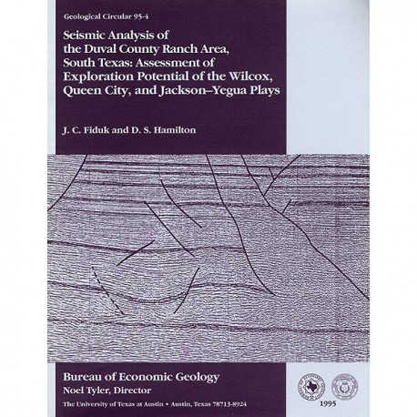
GC9504. Seismic Analysis of the Duval County Ranch Area, South Texas: Assessment of Exploration Potential of the Wilcox, Queen City, and Jackson-Yegua Plays, by J. C. Fiduk and D. S. Hamilton. 42 p., 29 figs., 1995. ISSN: 0082-3309: Print.
To purchase this publication as a downloadable PDF, please order GC9504D.
ABSTRACT
Potential for commercial hydrocarbon accumulations in Eocene and older strata of the Duval County Ranch in South Texas was assessed using seismic data. Three seismic facies are recognized and tied to well control. Seismic facies 1 has low- amplitude, continuous seismic reflections; seismic facies 2 has short, discontinuous, high-amplitude reflections; and seismic facies 3 has long, continuous, intermediate to high-amplitude reflections. In the upper Wilcox Group (lower Eocene) and Queen City Formation (middle Eocene), seismic facies 1 and 2 are thought to be sandstone-rich coastal/delta-plain and delta-front/distributary-mouth-bard deposits, respectively, and they both rank high in exploration potential. Seismic facies 3 is thought to be a mudstone-rich, deeper water shelfal deposit having lower exploration potential. The Duval County Ranch area was a locus of clastic deposition during the early Eocene because of subsidence and growth faulting along the underlying Wilcox Fault Zone. Sandstone-rich seismic facies 1 and 2 of the upper Wilcox Group are thus widespread in the Duval County Ranch area. Shelf-margin progradation followed upper Wilcox deposition, and by Queen City time, coastal/delta-plain deposits of seismic facies 1 dominated the Duval County Ranch area. Seismic facies 2 and 3 of the Queen City Formation are restricted to the southeasternmost part of the study area.
Seismic character of the Yegua (upper middle Eocene) and Jackson (upper Eocene) stratigraphic intervals resembles that of the underlying upper Wilcox Group and Queen City Formation. Seismic facies 1, 2, and 3 are recognized within the Yegua and Jackson over the Duval County Ranch area, but only seismic facies 1 is widespread within the boundaries of the Duval County Ranch. Although seismic facies 1 is associated with sandstone-rich barrier-island and strandplain deposits in the Jackson-Yegua interval, prospectivity of this seismic facies is more difficult to assess than that of the underlying units because, within this interval, hydrocarbon accumulation depends heavily on trapping mechanisms provided by stratigraphic pinch-out and facies variability. Unlike the upper Wilcox, effects of the Wilcox Fault Zone on Jackson-Yegua strata were minor, now represented only as small-scale faults and gentle flexures.
In all stratigraphic units, seismic facies 1 and 2 are more prospective when they contain specific horizons having very high amplitude "bright spot" reflections. A bright spot anomaly in Queen City sandstones produces oil and gas in Lundell field, and untested bright spot anomalies detected in this study appear elsewhere in the Queen City Formation and Jackson Group. High-amplitude seismic reflections of Jackson sandstones to the southeast of Seventy-Six West field suggest potential for a field extension or new field discovery. Upper Wilcox seismic facies 2 exhibits numerous untested zones in the Duval County Ranch area that are expressed as discontinuous, very high amplitude reflections. These random bright spot anomalies are associated with a zone of expanded upper Wilcox section in which sand deposition was focused on the downthrown side of the growth faults where rollover structures provide closure. A trend of greatly expanded upper Wilcox section, known as the Deep Wilcox Trend, occurs principally downdip of the Duval County Ranch, and potential for discovery of fields such as Seven Sisters East or Rosita Northwest is restricted to the southeasternmost corner. We also discovered that the lower Wilcox appears to be sandstone poor in the Duval County Ranch area, and we therefore assigned it a low exploration potential. Below the lower Wilcox, a high-risk deep gas exploration play, comprising large structures associated with salt withdrawal, lies in the Lower Cretaceous.
Keywords: Duval County Ranch, Jackson-Yegua, Queen City Formation, seismic analysis, South Texas, Texas, Wilcox Group
CONTENTS
Abstract
Introduction
Regional Stratigraphic and Structural Setting
Data and Methods
Seismic Interpretation of Cenozoic, Cretaceous, and Paleozoic Stratigraphy
Paleozoic Ouachita Facies
Cretaceous Strata
Seismic Analysis
Lower Wilcox Group
Seismic Analysis
Upper Wilcox Group
Seismic Analysis
Seismic Facies
Well Tests of Seismic Facies
Queen City Formation
Seismic Analysis
Seismic Facies
Yegua Formation and Jackson Group
Seismic Analysis
Seismic Facies
Well Tests of Seismic Facies
Assessment of Exploration Potential
Cretaceous Strata
Lower Wilcox Group
Upper Wilcox Group
Queen City Formation
Yegua Formation and Jackson Group
Conclusions
Acknowledgments
References
Figures
1. Location of Duval County Ranch, Wilcox expansion zone, and nearby Deep Wilcox Trend production
2. Texas Gulf Coast Cenozoic stratigraphy and depositional episodes
3. Structural setting of the Duval County Ranch, which overlies the Wilcox Fault Zone in northwest part of the Rio Grande Salt Basin
4. Seismic and well data of the Duval County Ranch area
5. Stratigraphic and synthetic tie to seismic data, Duval County Ranch
6. Dip-oriented seismic line, illustrating the interpreted top-of-Paleozoic surface, an overlying salt-withdrawal syncline, and the adjacent fault-bounded Lower Cretaceous structure
7. SP and resistivity logs for the Mobil 306 No . 3 well and its corresponding synthetic seismogram
8. Map view of interpreted upper Wilcox fault pattern showing major down-to-the-basin growth faults and seismic two-way traveltime structure contours on top of the upper Wilcox
9. Dip-oriented seismic line showing representative examples of interpreted stratigraphic horizons, Wilcox growth-fault zone, and expansion of upper Wilcox section
10. Seismic facies of the upper Wilcox from seismic line
11. Map showing spatial distribution of seismic facies of the upper Wilcox, Duval County Ranch
12. SP and resistivity logs for the Tana Hahl No. 1 well
13. Projection of SP and resistivity logs of the Tana Hahl No. 1 well onto seismic line, showing the relationship of log character to seismic facies
14. Map of fault pattern and seismic two-way traveltime structure contours on top of the Queen City Formation
15. Structure map contoured on top of the Queen City Formation, constructed from well data, showing details of Lundell field and adjacent areas
16. Seismic facies of the Queen City Formation from seismic lines
17. Map of the distribution of Queen City seismic facies, Duval County Ranch
18. Map of SP log patterns of the first Queen City sandstone, Lundell field
19. Net-sandstone map of the first Queen City sandstone, Lundell field
20. Seismic line and well logs, showing relationship of seismic bright spot anomaly and long-normal resistivity log character
21. Map of Duval County Ranch, showing Lundell field and an untested fault block where a bright spot anomaly exists
22. Map of fault pattern and seismic two-way trayeltime structure contours on top of the Yegua Formation
23. Map of fault pattern and seismic two-way traveltime structure contours on top of the Jackson Group 24. Seismic facies map on top of the Yegua Formation
25. Seismic facies map on top of the Jackson Group
26. Principal depositional systems and strike profile, Jackson Group, South Texas
27. Example of seismic facies 3 of the Yegua Formation and Jackson Group from seismic line
28. Example of seismic facies 1 of the Yegua Formation and Jackson Group from seismic line
29. Seismic line MI-66-79 through Seventy-Six West field
Citation
Fiduk, J. C., and Hamilton, D. S., 1995, Seismic Analysis of the Duval County Ranch Area, South Texas: Assessment of Exploration Potential of the Wilcox, Queen City, and Jackson-Yegua Plays: The University of Texas at Austin, Bureau of Economic Geology, Geological Circular 95-4, 42 p.


