Geological Circulars
-
Books & Reports
- Reports of Investigations
- Guidebooks
- Udden Series
- Geological Circulars
- Down To Earth
- Atlases of Major Oil and Gas Reservoirs
- Texas Memorial Museum Publications
- Environmental Geologic Atlas of the Texas Coastal Zone
- Mineral Resource Circulars
- Other Reports
- Seminars and Workshops
- Handbooks
- Submerged Lands of Texas
- Symposia
- Annual Reports
- Open File Reports
-
Maps & Cross Sections
- Thematic Maps
- Miscellaneous Maps, Charts & Sections
- Geologic Atlas of Texas
- STATEMAP Project Maps
- Geologic Quadrangle Maps
- Cross Sections
- Highway Geology Map
- Energy and Mineral Resource Maps
- Shoreline Change and Other Posters
- Wilcox Group, East Texas, Geological / Hydrological Folios
- Bouguer Gravity Atlas of Texas
- River Basin Regional Studies
- Featured Maps
- Posters
- Teachers & the Public
-
Geological Society Publications
- Gulf Coast Association of Geological Societies
- Alabama Geological Society
- Austin Geological Society
- Corpus Christi Geological Society
- Houston Geological Society
- Lafayette Geological Society
- Mississippi Geological Society
- New Orleans Geological Society
- South Texas Geological Society
- GCS SEPM Publications
- Historic BEG & UT Series
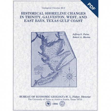
GC8603D. Historical Shoreline Changes in Trinity, Galveston, West, and East Bays, Texas Gulf Coast, by J. G. Paine and R. A. Morton. 58 p., 30 figs., 2 tables, 3 appendices, 1986. doi.org/10.2387/gc8603D. Downloadable PDF.
To purchase this publication in book format, please order GC8603.
ABSTRACT
Changes in shoreline position occurring for more than a century provide estimates of the relative stability of shorelines and, along the Texas coast, allow comparisons of shoreline changes before and after human modifications became significant. Documenting long-term shoreline movement in the Galveston Bay system (Trinity, Galveston, West, and East Bays), Texas Gulf Coast, included comparing topographic charts (dated 1850 to 1852) with aerial photographs (taken in 1930, 1956, 1974, and 1982), measuring shoreline movement, calculating the rates of change for particular time periods (1850-52 to 1930, 1930 to 1982, and 1850-52 to 1982), and summarizing in tables and on maps the magnitude and rate of shoreline changes.
Unprotected sediments forming the margins of the Galveston Bay system are modified by natural coastal processes and human activities, both of which can cause shoreline movement. These shorelines occur along steep clay bluffs, salt- and brackish-water marshes, and sand and shell beaches, at the base of moderate slopes composed mainly of sand, and in newly formed areas filled by dredged material. Despite the widespread use of shoreline protection measures, which began in some areas before 1930, approximately 78 percent of the shorelines within the Galveston Bay system retreated between the early 1850's and 1982. During this period, bay shorelines moved an average of 2.2 ft/yr landward, causing the loss of approximately 12.5 mi2 of land. Although the prevailing direction of shoreline movement remained the same through time, the rates of shoreline retreat increased from an average rate of 1.8 ft/yr before 1930 to 2.4 ft/yr after 1930.
Shoreline attributes (orientation, wave fetch, and sediment type) determine shoreline response and consequent movement after changes in coastal conditions. Contributing to shoreline changes are (1) regional and worldwide climate, (2) local changes in relative sea level, (3) local alterations in sediment supply, (4) frequent and intense storms, and (5) human activities. Historical data indicate that increasing temperatures, rising sea level, subsiding land surface, decreasing sediment supply, recurring severe storms, and ongoing human activities all promote continued erosion of most Galveston Bay shorelines.
Keywords: Texas Coastal Zone, Galveston Bay, shoreline changes, shoreline protection, coastal processes, geologic hazards, Texas
Citation
Paine, J. G., and Morton, R. A., 1986, Historical Shoreline Changes in Trinity, Galveston, West, and East Bays, Texas Gulf Coast: The University of Texas at Austin, Bureau of Economic Geology, Geological Circular 86-3D, 58 p. doi.org/10.23867/gc8603D.
