Geological Circulars
-
Books & Reports
- Reports of Investigations
- Guidebooks
- Udden Series
- Geological Circulars
- Down To Earth
- Atlases of Major Oil and Gas Reservoirs
- Texas Memorial Museum Publications
- Environmental Geologic Atlas of the Texas Coastal Zone
- Mineral Resource Circulars
- Other Reports
- Seminars and Workshops
- Handbooks
- Submerged Lands of Texas
- Symposia
- Annual Reports
- Open File Reports
-
Maps & Cross Sections
- Thematic Maps
- Miscellaneous Maps, Charts & Sections
- Geologic Atlas of Texas
- STATEMAP Project Maps
- Geologic Quadrangle Maps
- Cross Sections
- Highway Geology Map
- Energy and Mineral Resource Maps
- Shoreline Change and Other Posters
- Wilcox Group, East Texas, Geological / Hydrological Folios
- Bouguer Gravity Atlas of Texas
- River Basin Regional Studies
- Featured Maps
- Posters
- Teachers & the Public
-
Geological Society Publications
- Gulf Coast Association of Geological Societies
- Alabama Geological Society
- Austin Geological Society
- Corpus Christi Geological Society
- Houston Geological Society
- Lafayette Geological Society
- Mississippi Geological Society
- New Orleans Geological Society
- South Texas Geological Society
- GCS SEPM Publications
- Historic BEG & UT Series
Gulf Shoreline Movement between Sabine Pass and the Brazos River... Digital Download
GC9703D
For a print version: GC9703.
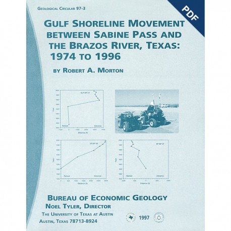
GC9703D. Gulf Shoreline Movement between Sabine Pass and the Brazos River Texas: 1974 to 1996, by R. A. Morton. Assisted by S. J. Clift, E. S. Angle, and E. M. Boghici. 46 p., 10 figs., 4 tables, 3 appendices, 1997. ISSN: 2475-3637. doi.org/10.23867/gc9703D. Downloadable PDF
To purchase this publication in book format, please order GC9703.
ABSTRACT
Changes in shoreline position along the southeastern Texas Gulf coast between 1974 and 1996 were documented by conducting a kinematic real-time differential global positioning system (DGPS) field survey in 1996 and comparing that shoreline with other shorelines archived in a geographic information system. Results show that (1) beach morphology, shoreline movement, and the regional geologic framework are closely interrelated, (2) Gulf beaches are generally retreating, and (3) the rates of retreat have accelerated locally. Between Sabine Pass and Rollover Pass, almost all of the Gulf beaches are retreating. Exceptions are the locally stable beach segments at Sea Rim State Park and southwest of High Island. On Bolivar Peninsula, beaches between Caplen and Rollover Pass are rapidly retreating, whereas those farther southwest are either slowly retreating or are relatively stable; beaches at the southern end of the peninsula are stable or advancing, and they benefit from the sand supplied by updrift erosion. The shoreline on East Beach of Galveston Island undergoes minor fluctuations, but the beach position is relatively stable. West Beach of Galveston lsland continues to retreat, but rates of retreat depend on location. The beach segment between the Jamaica Beach and Sea Isle subdivisions has the lowest long-term average retreat rate, whereas retreat rates generally increase to the northeast toward the seawall and to the southwest toward San Luis Pass. These three segments having different beach morphologies and retreat rates were also identified in prior studies. Beaches from San Luis Pass to the mouth of the Brazos River also are generally retreating, and rates of retreat near Surfside, Quintana, and Bryan Beach are influenced by the jetties at Freeport Harbor and the diversion of the mouth of the Brazos River. The study also demonstrated that the high-water line mapped on aerial photographs undergoes large seasonal fluctuations and therefore is a less reliable indicator of shoreline position than the vegetation line, berm crest, or backbeach erosional scarp. DGPS field surveys are a rapid, relatively low cost method of acquiring accurate shoreline positions and have many advantages over interpreting shoreline positions from aerial photographs.
Keywords: beach morphology, coastal geology, environmental geology, GPS, shoreline changes, Texas
Citation
Morton, R. A., 1997, Gulf Shoreline Movement between Sabine Pass and the Brazos River Texas: 1974 to 1996: The University of Texas at Ausitn, Bureau of Economic Geology, Geological Circular 97-3, 46 p. doi.org/10.23867/gc9703D.


