Reports of Investigations
-
Books & Reports
- Reports of Investigations
- Guidebooks
- Udden Series
- Geological Circulars
- Down To Earth
- Atlases of Major Oil and Gas Reservoirs
- Texas Memorial Museum Publications
- Environmental Geologic Atlas of the Texas Coastal Zone
- Mineral Resource Circulars
- Other Reports
- Seminars and Workshops
- Handbooks
- Submerged Lands of Texas
- Symposia
- Annual Reports
- Open File Reports
-
Maps & Cross Sections
- Thematic Maps
- Miscellaneous Maps, Charts & Sections
- Geologic Atlas of Texas
- STATEMAP Project Maps
- Geologic Quadrangle Maps
- Cross Sections
- Highway Geology Map
- Energy and Mineral Resource Maps
- Shoreline Change and Other Posters
- Wilcox Group, East Texas, Geological / Hydrological Folios
- Bouguer Gravity Atlas of Texas
- River Basin Regional Studies
- Featured Maps
- Posters
- Teachers & the Public
-
Geological Society Publications
- Gulf Coast Association of Geological Societies
- Alabama Geological Society
- Austin Geological Society
- Corpus Christi Geological Society
- Houston Geological Society
- Lafayette Geological Society
- Mississippi Geological Society
- New Orleans Geological Society
- South Texas Geological Society
- GCS SEPM Publications
- Historic BEG & UT Series
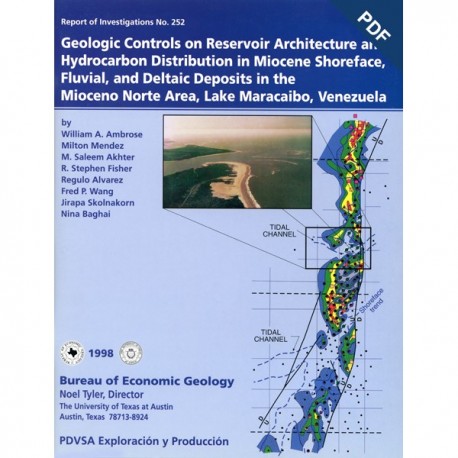
Geologic Controls on Reservoir Architecture and Hydrocarbon Distribution in ...Mioceno Norte... Digital Download
RI0252D
For a print version: RI0252.
RI0252D. Geologic Controls on Reservoir Architecture and Hydrocarbon Distribution in Miocene Shoreface Fluvial and Deltaic Deposits in the Mioceno Norte Area, Lake Maracaibo, Venezuela, by W. A. Ambrose, M. Mendez, M. Saleem Akhter, and others. 61 p., 42 figs., 1 table, 1 plate in back pocket, 1998. doi.org/10.23867/RI0252D. Downloadable PDF.
To purchase this publication in book format, please order RI0252.
ABSTRACT
Facies architecture, structure, and diagenesis control reservoir geometry and distribution of remaining oil in shoreface, fluvial, and deltaic reservoirs of Miocene age in the 18-mi2 (46.7-km2) Mioceno Norte Area in northern Lake Maracaibo. This mature field is undergoing depletion and nearing the final stages of primary recovery. Although the area has produced oil since the 1940's, appreciable volumes of oil (commonly 400 to 1,200 MSTB [thousand stock tank barrels]/20-acre drainage area) remain in multiple, poorly contacted reservoir sandstones at the current 984-ft (300-m) well spacing. Detailed lithofacies maps, documenting the control of sandstone architecture on hydrocarbon distribution, demonstrate that the current well spacing on a grid pattern is too large to recover the remaining oil efficiently. Moreover, the facies architecture influences water-cut patterns and theirregular advancement of inferred oil-water contacts on the west margin of the field.
A joint study by the Bureau of Economic Geology and Lagoven, S.A., proposes a variety of infill wells, recompletions, redrilled wells, horizontalwells, and water-injection wells. Approximately 80 MMSTB (million stock tank barrels) of remaining oil will be produced by maintaining the current 984-ft (300-m) well spacing. An additional 46.5 MMSTB, however, can be produced with geologically targeted infill wells, recompletions, and horizontal wells. In addition, new water-injection wells can appreciably increase oil recovery by enhancing sweep efficiency and providing pressure support.
Keywords: facies analysis, fluvial and deltaic, Maracaibo Basin, Miocene, oil reservoirs, petrophysical evaluation, reservoir characterization, Venezuela
CONTENTS
ABSTRACT
INTRODUCTION
STUDY AREA AND OBJECTIVES
METHODS AND DATA BASE
SEDIMENT-DISPERSAL DIRECTIONS
GENETIC STRATIGRAPHIC UNITS
Marker Beds
Marine Flooding Surfaces
Paleosols
Other Marker Beds
PETROGRAPHIC ANALYSIS
Primary Results
Framework-Grain Mineralogy
Texture
Intergranular Material
Porosity
Composition-Porosity Relations
PETROPHYSICAL ANALYSIS
Models for Calculating Volume of Shale (Vsh)
Porosity Determination
Permeability-Porosity Transforms
Modified Simandoux Model
RESERVOIR-PERFORMANCE ANALYSIS
Objectives
Production-Data Analysis
Fluid Distribution
Calculation of Remaining-Oil Volumes
OPPORTUNITIES AND STRATEGIES FOR OPTIMAL OIL RECOVERY
Introduction
Shoreface Reservoirs
LR 60-LR 90 (Upper La Rosa Formation)
Lithofacies
Sandstone-Body Geometry
Reservoir Development
Fluvial and Deltaic Reservoirs
Fluvial Reservoirs
LaS 60-LaS 90 (Upper Laguna Member
Lithofacies
Sandstone-Body Geometry
So$IH and Reservoir Development
BACHl 40-BACHI 50 (Lower Bachaquero Member)
Lithofacies
Sandstone-Body Geometry
Net Pay, Remaining Oil, and Reservoir Development
BACHl 50-BACHI 60 (Lower Bachaquero Member)
Lithofacies and Sandstone-Body Geometry
Reservoir Development
Deltaic Reservoirs
Lal 10-La1 20 (Lower Laguna Member)
Lithofacies
Sandstone-Body Geometry
Remaining Oil
Reservoir Development
LaS 30-LaS 60 (Upper Laguna Member)
Lithofacies
Sandstone-Body Geometry
Net Pay and Reservoir Development
CONCLUSIONS
ACKNOWLEDGMENTS
REFERENCES
APPENDIX A: PALYNOLOGICAL RESULTS
Notes about Samples
Figures
1. Location map of Mioceno Norte Area field structure, distribution of Mioceno Norte reservoirs, and distribution of cored wells
2. Distribution of wells having porosity and open- and cased-hole gamma logs
3. Type log in the Mioceno Norte Area, showing producing intervals in the BACH-24, A-22, LL-02, and LL-08 reservoirs, genetic stratigraphic units, and major sequences in this study
4. Regional Miocene sediment-dispersal directions in the Maracaibo Basin
5. First in a series of three maps documenting sediment-dispersal directions in the Mioceno Norte Area
6. Second in a series of three maps documenting sediment-dispersal directions in the Mioceno Norte Area
7. Third in a series of three maps documenting sediment-dispersal directions in the Mioceno Norte Area
8. Northwest-southeast stratigraphic cross section B-B'
9. Log of LR-203 well, approximately 4 mi west of Mioceno Norte Area
10. Core description of the LR 90 shale marker bed above maximum flooding surface at top of calcareous, upward-coarsening sandstones in the upper part of the La Rosa Formation
11. Core photograph of paleosol representing the BACHl 70 marker bed in TJ-1094 well
12. Q:F:R plot of Mioceno Norte sandstones analyzed in this study
13. Q:F:R plot of mean Mioceno Norte sandstones grouped by facies and stratigraphic unit
14. Plot of total intergranular fill and total porosity of Mioceno Norte samples grouped by facies
15. Q:F:R fractions plot of framework grains versus total porosity in Mioceno Norte samples
16. Plot of total porosity versus carbonate and matrix intergranular-fill material in Mioceno Norte samples
17. Porosity-permeability cross plot of core data from TJ-1094 well
18. Water-cut map of the Lower Bachaquero Member
19. Net-sandstone map of the Lower Bachaquero Member
20. Reservoir volumetrics of Miocene reservoirs in the Mioceno Norte Area
21. Percent-sandstone map of LR 60-LR 90 genetic stratigraphic unit
22. Log-facies map of LR 60-LR 90 genetic stratigraphic unit
23. Aerial photograph of the mouth of the Santee River entering a wave-dominated coastline in South Carolina
24. Arithmetic-average permeability map of the undivided La Rosa Formation
25. SoI $H map of LR 60-LR 90 genetic stratigraphic unit
26. Water-cut map of the LL-02 reservoir
27. Remaining-oil and reservoir-development map of LR 60-LR 90 genetic stratigraphic unit
28. Core description of LaS 30-LaS 60 and LaS 60-LaS 90 genetic stratigraphic units in TJ-1094 well
29. Percent-sandstone map of LaS 60-LaS 90 genetic stratigraphic unit
30. So$H map of LaS 60-LaS 90 genetic stratigraphic unit
31. Core description of upper part of BACHI 30-BACHI 40 to lower part of BACHl 50-BACHI 60 genetic stratigraphic units in TJ-1094 well
32. Net-sandstone map of BACHl 40-BACHI 50 genetic stratigraphic unit
33. Log-facies map of BACHl 40-BACHI 50 genetic stratigraphic unit
34. Net-pay map of BACHl 40-BACHI 50 genetic stratigraphic unit
35. Remaining-oil and reservoir-development map of BACHl 40-BACHI 50 genetic stratigraphic unit
36. Log-facies map of BACHl 50-BACHI 60 genetic stratigraphic unit
37. Remaining-oil and reservoir-development map of BACHI 50-BACHI 60 genetic stratigraphic unit
38. Log-facies map of Lal 10-Lal 20 genetic stratigraphic unit
39. Remaining-oil and reservoir-development map of Lal 10-Lal 20 genetic stratigraphic unit
40. Net-sandstone map of LaS 30-LaS 60 genetic stratigraphic unit
41. Log-facies map of LaS 30-LaS 60 genetic stratigraphic unit
42. Net-pay map of LaS 30-LaS 60 genetic stratigraphic unit
Table 1 (in text). Summary of proposed infield development wells in the BACH-24, A-22, LL-02, and LL-08 reservoirs. Mioceno Norte Area
Plate 1 (in folder/book pocket). North-south core-log cross section A-A' of LR 90-LL 30 genetic stratigraphic unit
Citation
Ambrose, W. A., Mendez, M., Ahkter, M. S., and others, 1998, Geologic Controls on Reservoir Architecture and Hydrocarbon Distribution in Miocene Shoreface Fluvial and Deltaic Deposits in the Mioceno Norte Area, Lake Maracaibo, Venezuela: The University of Texas at Austin, Bureau of Economic Geology, Report of Investigations No. 252, 61 p. doi.org/10.23867/RI0252D.
