Geological Circulars
-
Books & Reports
- Reports of Investigations
- Guidebooks
- Udden Series
- Geological Circulars
- Down To Earth
- Atlases of Major Oil and Gas Reservoirs
- Texas Memorial Museum Publications
- Environmental Geologic Atlas of the Texas Coastal Zone
- Mineral Resource Circulars
- Other Reports
- Seminars and Workshops
- Handbooks
- Submerged Lands of Texas
- Symposia
- Annual Reports
- Open File Reports
-
Maps & Cross Sections
- Thematic Maps
- Miscellaneous Maps, Charts & Sections
- Geologic Atlas of Texas
- STATEMAP Project Maps
- Geologic Quadrangle Maps
- Cross Sections
- Highway Geology Map
- Energy and Mineral Resource Maps
- Shoreline Change and Other Posters
- Wilcox Group, East Texas, Geological / Hydrological Folios
- Bouguer Gravity Atlas of Texas
- River Basin Regional Studies
- Featured Maps
- Posters
- Teachers & the Public
-
Geological Society Publications
- Gulf Coast Association of Geological Societies
- Alabama Geological Society
- Austin Geological Society
- Corpus Christi Geological Society
- Houston Geological Society
- Lafayette Geological Society
- Mississippi Geological Society
- New Orleans Geological Society
- South Texas Geological Society
- GCS SEPM Publications
- Historic BEG & UT Series
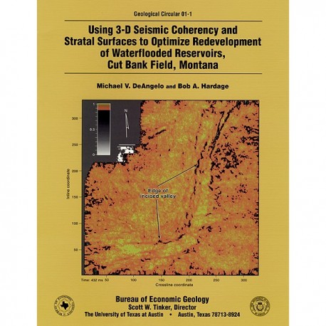
Using 3-D Seismic Coherency...Cut Bank Field, Montana
GC0101
For a downloadable, digital version: GC0101D.
GC0101. Using 3-D Seismic Coherency and Stratal Surfaces to Optimize Redevelopment of Waterflooded Reservoirs, Cut Bank Field, Montana, by M. V. DeAngelo and B. A. Hardage. 24 p., 17 figs., 2001. Print.
To purchase this publication as a PDF download, please order GC0101D.
About This Publication
The goal of this study was to improve results of an ongoing waterflood program in Glacier County, Montana, using 3-D seismic data collected over an 8-square-mile section of Cut Bank field. The 3-D data clearly delineated the presence of a major incised-valley system associated with the reservoir interval and revealed further information about reservoir compartmentalization that was not readily obtainable by conventional offset drilling. As a result of this study, five new proof-of-concept wells were drilled, four of which encountered reservoir-quality sand. Research was funded by MSR Exploration, a member of the Bureau's Exploration Geophysics Laboratory Industrial Associates.
ABSTRACT
In a 3-D seismic survey, we acquired data over an 8-mi2 section of Cut Bank field, located on the west flank of Sweetgrass Arch in Glacier County, Montana. The main objective of the study was to improve the results of an ongoing waterflood program. The targeted reservoirs were an alluvial braided-stream system having a gross sand thickness of 20 to 25 ft. These reservoirs were deposited as incised-valley systems that are now at a depth of approximately 3,000 ft. Because clay plugging of abandoned channels is a major impediment to reservoir sweep, we thought that seismic-attribute analysis would help determine the aerial distributions of important facies within the reservoirs.
Traditional horizon-slice imaging of seismic reflection amplitudes suggested the presence of two possible incised-valley systems at two different depth intervals. Coherence analysis of reflection waveshapes more clearly defined these two incised-valley systems, and possibly three more, each at different depths.
We used an integrated interpretation approach to define these thinbedded fluvial channels laterally and vertically. We used coherence technology to identify the lateral extents of incised-valley systems, followed by stratal-surface interpretation techniques to determine the facies distributions within thin-bedded sequences deposited in these incised valleys.
Keywords: coherency, Cut Bank, incised valley, seismic amplitude, strata! surface, thin bed, waterflood, Montana
CONTENTS
Abstract
Introduction
Data Acquisition
3-D Coherency Imaging of Channel Systems
Wells and Facilities
VSP Calibration of 3-D Seismic Data
Stratal Surface Imaging of Channel Systems
Validation
Conclusions
Acknowledgments
References
Figures
1. Regional and depositional settings of Cut Bank field
2. Type log from UNOCAL well SCCBSU No. 51-6
3. Structure-contour map of base of Cut Bank Sandstone
4. 3-D seismic survey design, Cut Bank field
5. Calculation of continuity attributes
6. Time slice across amplitude volume at 432 ms
7. Time slice across amplitude volume at 482 ms
8. Time slice across coherence volume at 360 ms
9. Time slice across coherence volume at 432 ms
10. Time slice across coherence volume at 482 ms
11. Time slice across coherence volume at 570 ms
12. Time slice across coherence volume at 600 ms
13. Well distribution within the 3-D seismic study area
14. Correlation between 3-D seismic reflection character and VSP reflection character
15. Vertical seismic section along inline 200, displaying upper, mid-, and lower bounding stratal surfaces
16. Average absolute amplitude of upper Cut Bank sand unit
17. Average absolute amplitude of lower Cut Bank sand unit
Citation
DeAngelo, M. V., and Hardage, B. A., 2001, Using 3-D Seismic Coherency and Stratal Surfaces to Optimize Redevelopment of Waterflooded Reservoirs, Cut Bank Field, Montana: The University of Texas at Austin, Bureau of Economic Geology, Geological Circular 01-1, 24 p.
