Austin Geological Society
-
Books & Reports
- Reports of Investigations
- Guidebooks
- Udden Series
- Geological Circulars
- Down To Earth
- Atlases of Major Oil and Gas Reservoirs
- Texas Memorial Museum Publications
- Environmental Geologic Atlas of the Texas Coastal Zone
- Mineral Resource Circulars
- Other Reports
- Seminars and Workshops
- Handbooks
- Submerged Lands of Texas
- Symposia
- Annual Reports
- Open File Reports
-
Maps & Cross Sections
- Thematic Maps
- Miscellaneous Maps, Charts & Sections
- Geologic Atlas of Texas
- STATEMAP Project Maps
- Geologic Quadrangle Maps
- Cross Sections
- Highway Geology Map
- Energy and Mineral Resource Maps
- Shoreline Change and Other Posters
- Wilcox Group, East Texas, Geological / Hydrological Folios
- Bouguer Gravity Atlas of Texas
- River Basin Regional Studies
- Featured Maps
- Posters
- Teachers & the Public
-
Geological Society Publications
- Gulf Coast Association of Geological Societies
- Alabama Geological Society
- Austin Geological Society
- Corpus Christi Geological Society
- Houston Geological Society
- Lafayette Geological Society
- Mississippi Geological Society
- New Orleans Geological Society
- South Texas Geological Society
- GCS SEPM Publications
- Historic BEG & UT Series
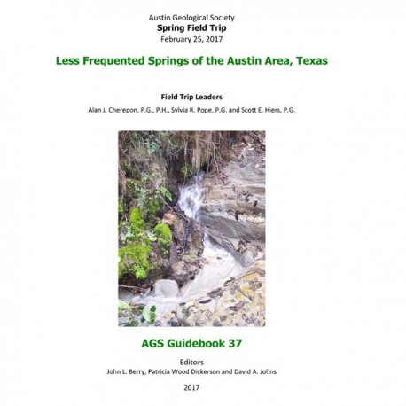
Less Frequented Springs of the Austin Area, Texas
AGS GB 37
For a downloadable, digital version: AGS GB 37D.
AGS GB 37. Less Frequented Springs of the Austin Area, Texas. J. L. Berry, P. W. Dickerson, and D. A. Johns, eds. A. J. Cherepon, S. R. Pope, and S. E. Hiers, Field Trip Leaders. Austin Geological Society Guidebook 37, 82 p., 2017. Print.
To purchase this publication as a downloadable PDF, please order AGS GB 37D.
CONTENTS
Dedication: Charles M. “Chock” Woodruff
Dennis R. Trombatore
Introduction
Texas Springs
Helen C. Besse
Spring Occurrences in the Austin Area
Stratigraphy
Spring Geochemistry
Spring Classification
Previous Work Regarding Austin Area Springs
Road Log
Stop 1: Hearth/Great Hills Spring
Stop 2: Bull Creek District Park Spring
Stop 3: Little Stillhouse Hollow & Stillhouse Hollow Springs
Stop 4: Big Boulder Spring, Shoal Creek
Stop 5: US Hwy 183/Little Walnut Creek Spring
Stop 6: Costley Spring, near Terry Lane, Del Valle
Detailed Stop Descriptions
Commentary on Field Stratigraphic Identifications
Summary and Conclusions
Research Bibliography on Springs in Travis County, Texas
Dennis R. Trombatore
Authors
Tables
Table 1. Number of springs/seeps in Austin area strata
Table 2. Composite stratigraphic section for the Austin area
Table 3. Major ion concentrations of Austin area aquifers and four springs
Table 4. Stop description summary
Text figures
Figure 1. Spring locations and geologic map of the Austin area
Figure 2. Distribution (%) of springs/seeps in geologic units of Austin area
Figure 3. Cross-section of the Georgetown, Edwards and Walnut Formations across Travis County, showing stratigraphic changes and relationships
Figure 4. Location map of cross-section X-X’ through Travis County shown in Figure 3
Figure 5. Ternary diagram (Piper plot) of the hydrochemical facies of minor aquifers and select spring samples in the Austin area
Figure 6. Spring types observed at field trip stops
Figure 7. Route map and stops
Figure 8. Hearth/Great Hills Spring location
Figure 9. Bull Creek District Park Springs location
Figure 10. Little Stillhouse Hollow Spring location
Figure 11. Big Boulder Spring on Shoal Creek near 29th Street
Figure 12. US Hwy. 183/Little Walnut Creek Spring location
Figure 13. Costley Spring location near Terry Lane, Del Valle
Figure 14. Segments of the Edwards Aquifer
Stop description figures
Figure 1-1. Geologic map in the vicinity of Hearth/Great Hills Spring
Figure 1-2. General stratigraphic section at Hearth/Great Hills Spring on Laurel Oaks Creek
Figures 1-3 through 1-6. Hearth/Great Hills Spring
Figures 1-7 and 1-8. Features of Walnut Fm. near Hearth/Great Hills Spring
Figure 2-1. Measured section at Bull Creek Park Dam Spring, Bull Creek District Park
Figures 2-2 and 2-3. Bull Creek Park Dam Spring orifice, near the dam, Stop 2A and Bull Creek Park Cliff Spring, Stop 2B
Figure 2-4. Old brochure (1960’s?) for Lakewood Park
Figure 2-5. Wagon wheel tracks in Bull Creek District Park, near Bull Creek Park Cliff Spring
Figure 3-1. Measured section at Little Stillhouse Hollow Spring Rock Shelter, Stillhouse Hollow Nature Preserve
Figure 3-2. Stillhouse Hollow Spring in Edwards Fm
Figure 3-3. Little Stillhouse Hollow Spring in Edwards Fm
Figures 3-4 and 3-5. Photos in the vicinity of Little Stillhouse Hollow Spring
Figures 3-6 through 3-9. Fossils in the Edwards Fm
Figure 4-1. Big Boulder Spring orifice, Buda Fm., on Shoal Creek downstream of 29th Street
Figure 4-2. Measured section at Big Boulder Spring on Shoal Creek downstream
Figures 4-3 and 4-4. Tufa and Buda strata near Big Boulder Spring
Figures 4-5 through 4-7. Fossils in the Buda Fm
Figures 4-8 and 4-9. Buda Fm
Figure 4-10. Fossils in the Del Rio Fm
Figure 5-1. Geologic map in the area of US Hwy 183/Little Walnut Creek Spring
Figure 5-2. US Hwy 183/Little Walnut Creek Spring and seeps
Figure 5-3. Measured section at US Hwy 183 and Walnut Creek Bridge
Figure 5-4. Measured section on Little Walnut Creek east of Avesta Agave Apartments on US Hwy 183
Figure 5-5. Dessau Chalk, Austin Group, beneath US Hwy 183 bridge on Little Walnut Creek
Figure 5-6. Burditt Marl, Austin Group, on Little Walnut Creek
Figures 5-7 and 5-8. Faulted Dessau Chalk, Austin Group, on Little Walnut Creek
Figures 5-9 through 5-14. Fossils in Dessau Chalk and Burditt Marl, Austin Group, on Little Walnut Creek
Figures 5-15 and 5-16. Faulted Dessau Chalk, Austin Group, at Centre Creek bridge
Figure 6-1. Quaternary terrace deposits overlying the Taylor Group, with associated springs
Figure 6-2. Measured section at Costley Spring
Figure 6-3. Costley Spring tufa terraces on eastern bank of Terry Creek
Figures 6-4a and 6-4b. Upper Costley Spring and terrace deposits
Figure 6-5. Main or Lower Costley Spring showing main orifice
Figures 6-6 through 11. Fossils in Taylor Clay on Terry Creek
Figure 6-12. McKinney Mill foundation near Costley Spring
Figure 6-13. Main or upper mill dam on Terry Creek
Figure 6-14. Tri-City Star newspaper article (1976), photo of mill dam
Keywords: guidebooks, fieldtrip guidebooks, springs, Austin, Texas
Citation
Berry, J. L., Dickerson, P. W., and Johns, D. A., eds., 2017, Less Frequented Springs of the Austin Area, Texas: Austin Geological Society, Guidebook 37, 82 p.
