Publication Year
2009
Publisher
Series
Open-File Map
Publication Year
2009
Publisher
Series
Open-File Map
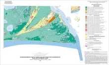
Publication Year
2009
Publisher
Series
Open-File Map
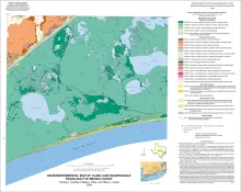
Publication Year
2009
Publisher
Series
Open-File Map
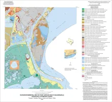
Publication Year
2009
Publisher
Series
Open-File Map