Publication Year
2010
Publisher
Series
Open-File Map
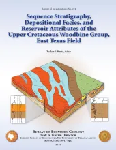
Publication Year
2010
Publisher
Series
Report of Investigations
Abstract
Although the mature, supergiant East Texas field on the west flank of the Sabine Uplift has been producing from the Upper Cretaceous (Cenomanian) siliciclastic Woodbine Group for more than 75 years, no modern comprehensive geologic study of it has been completed. This report presents results of an integrated geologic and reservoir-engineering analysis of the Woodbine interval in the field and adjacent East Texas Basin.
Publication Year
2010
Publisher
Series
Miscellaneous Map
Publication Year
2009
Series
Gulf Coast Association of Geological Societies
Publication Year
2009
Series
Annual Reports
Abstract
Annual report for the Bureau of Economic Geology 2009