Wolfberry (Wolfcampian-Leonardian) Deep-Water Depositional Systems in the Midland Basin: Stratigraphy, Lithofacies, Reservoirs, and Source Rocks Author Hamlin, H.S., Baumgardner, R.W., Jr. Keywords Deep-Water Depositional Systems, Lithofacies, Midland Basin, Reservoirs, Source Rocks, Stratigraphy, Wolfberry, Wolfcampian-Leonardian Sequence Stratigraphy, Depositional Systems, and Hydrocarbon Play Analysis of the Pennsylvanian Cleveland Formation and Marmaton Group, Anadarko Basin, North Texas and Western Oklahoma Author Ambrose, W.A. Keywords Anadarko Basin, Depositional Systems, Hydrocarbons, Marmaton Group, Oklahoma, Pennsylvanian, Stratigraphy The Salt Mine: A Digital Atlas of Salt Tectonics Author Hudec, M.R., Jackson, M.P.A. Keywords Atlases, Salt Geologic Maps of the Upper Cretaceous and Tertiary Strata, Big Bend National Park, Texas Author Cooper, R.W. Keywords Big Bend National Park, Cretaceous, Geologic Maps Geologic map of the east part of Cleburne, Texas, 30 x 60 minute quadrangle: South Fort Worth-Interstate 35W corridor Author Collins, E.W., Baumgardner, R.W., Jr. Keywords Cleburne, Fort Worth, Geologic Maps Pagination First page « First Previous page ‹‹ … Page 20 Page 21 Page 22 Page 23 Page 24 Page 25 Page 26 Page 27 Page 28 … Next page ›› Last page Last »
Sequence Stratigraphy, Depositional Systems, and Hydrocarbon Play Analysis of the Pennsylvanian Cleveland Formation and Marmaton Group, Anadarko Basin, North Texas and Western Oklahoma Author Ambrose, W.A. Keywords Anadarko Basin, Depositional Systems, Hydrocarbons, Marmaton Group, Oklahoma, Pennsylvanian, Stratigraphy The Salt Mine: A Digital Atlas of Salt Tectonics Author Hudec, M.R., Jackson, M.P.A. Keywords Atlases, Salt Geologic Maps of the Upper Cretaceous and Tertiary Strata, Big Bend National Park, Texas Author Cooper, R.W. Keywords Big Bend National Park, Cretaceous, Geologic Maps Geologic map of the east part of Cleburne, Texas, 30 x 60 minute quadrangle: South Fort Worth-Interstate 35W corridor Author Collins, E.W., Baumgardner, R.W., Jr. Keywords Cleburne, Fort Worth, Geologic Maps Pagination First page « First Previous page ‹‹ … Page 20 Page 21 Page 22 Page 23 Page 24 Page 25 Page 26 Page 27 Page 28 … Next page ›› Last page Last »
The Salt Mine: A Digital Atlas of Salt Tectonics Author Hudec, M.R., Jackson, M.P.A. Keywords Atlases, Salt Geologic Maps of the Upper Cretaceous and Tertiary Strata, Big Bend National Park, Texas Author Cooper, R.W. Keywords Big Bend National Park, Cretaceous, Geologic Maps Geologic map of the east part of Cleburne, Texas, 30 x 60 minute quadrangle: South Fort Worth-Interstate 35W corridor Author Collins, E.W., Baumgardner, R.W., Jr. Keywords Cleburne, Fort Worth, Geologic Maps Pagination First page « First Previous page ‹‹ … Page 20 Page 21 Page 22 Page 23 Page 24 Page 25 Page 26 Page 27 Page 28 … Next page ›› Last page Last »
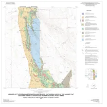
Geologic Maps of the Upper Cretaceous and Tertiary Strata, Big Bend National Park, Texas Author Cooper, R.W. Keywords Big Bend National Park, Cretaceous, Geologic Maps Geologic map of the east part of Cleburne, Texas, 30 x 60 minute quadrangle: South Fort Worth-Interstate 35W corridor Author Collins, E.W., Baumgardner, R.W., Jr. Keywords Cleburne, Fort Worth, Geologic Maps Pagination First page « First Previous page ‹‹ … Page 20 Page 21 Page 22 Page 23 Page 24 Page 25 Page 26 Page 27 Page 28 … Next page ›› Last page Last »
Geologic map of the east part of Cleburne, Texas, 30 x 60 minute quadrangle: South Fort Worth-Interstate 35W corridor Author Collins, E.W., Baumgardner, R.W., Jr. Keywords Cleburne, Fort Worth, Geologic Maps