
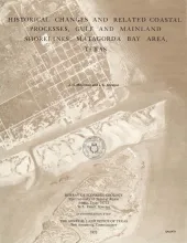
Change, both natural and man-induced, is a significant and defining element of the Coastal Zone. Man-induced change, by definition, can be controlled if desired. The work of nature, however, is altered and modified with much more difficulty, if at all, and attempts to do so commonly lead to unintended results. Prudent use and adequate management of the Coastal Zone must consider natural changes.
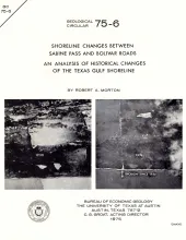
Historical monitoring between Sabine Pass and Bolivar Roads records the nature and magnitude of changes in position of the shoreline and vegetation line and provides insight into the factors affecting those changes.
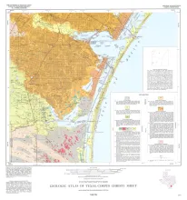
Geologic map that depicts the surface geology of Nueces County and parts of Jim Wells, San Patricio, Aransas, Kleberg, and Kenedy Counties.
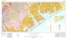
Geologic map that depicts the surface geology of Goliad, Refugio, and Calhoun Counties and parts of Karnes, De Witt, Victoria, Jackson, Matagorda, Aransas, San Patricio, Bee, and Live Oak Counties. The 4-page booklet indicates geologic formations, abbreviations, and ages.
The Houston-Galveston Area Council of Governments (HGAC) encompasses over 12,000 square miles of southeast Texas (fig. 1). It is an area undergoing rapid development and population growth due to the presence of vast agricultural, mineral, and energy resources, expanding industrial activity, and diverse recreational areas. Planning is particularly critical in the HGAC to ensure orderly development.