Corpus Christi Publications
| Title | Publication Year Sort ascending | Abstract | Author | Series | Publisher | |
|---|---|---|---|---|---|---|
|
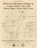
Historical shoreline changes in Corpus Christi, Oso, and Nueces Bays, Texas Gulf coast | 1984 | Changes in the position and stability of shorelines around Corpus Christi, Oso, and Nueces Bays, Texas Gulf Coast, were documented using historical-monitoring techniques. |
Morton, R.A., Paine, J.G., Robinson, D.E. | Geological Circular | Bureau of Economic Geology |
|
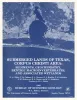
Submerged lands of Texas, Corpus Christi area: sediments, geochemistry, benthic macroinvertebrates, and associated wetlands | 1983 | The State-owned submerged lands of Texas encompass almost 6,000 mi2 (15,540 km2). They lie below waters of the bay-estuary-lagoon system and the Gulf of Mexico and extend 10.3 mi (16.6 km) seaward from the Gulf shoreline (fig. 1). |
White, W.A., Calnan, T.R., Morton, R.A., Kimble, R.S., Littleton, T.G., McGowen, J.H., Nance, H.S., Schmedes, K.E. | Submerged Lands of Texas | Bureau of Economic Geology |
|
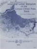
Land and water resources of the Corpus Christi area, Texas | 1978 | Land and water resources have been analyzed in the Corpus Christi area--Aransas, Nueces, Refugio, and San Patricio Counties along the central Texas coast. The city and port of Corpus Christi compose the largest metropolitan center in the area. |
Kier, R.S., White, W.A. | Report of Investigations | Bureau of Economic Geology |
|
Engineering Properties of Land Resource Units in the Corpus Christi Area | 1978 | Land resource units that are defined by their physical properties can be characterized quantitatively using engineering test data. Information about substrate properties in quantitative terms confirms and augments qualitative statements about the physical characteristics of land resource units. |
Kier, R.S., Bell, D.L., Patton, P.C. | Research Note | |
|
Hydrology of the Corpus Christi Area, Texas | 1978 | Ground-water resources in the Corpus Christi area-Nueces, San Patricio, Refugio, and Aransas Counties (fig. 1)-were investigated as part of a broader study of land and water resources of the four-county area (Kier and others, 1974a and 1974b; Kier and White, in preparation). |
Woodman, J.T., Kier, R.S., Bell, D.L. | Research Note | |
|
Environmental geologic Atlas of the Texas coastal zone -- Corpus Christi area | 1976 | The Texas Coastal Zone is marked by diversity in geography, resources, climate, and industry. |
Brown, L.F., Jr., Brewton, J.L., McGowen, J.H., Evans, T.J., Fisher, W.L., Groat, C.G. | Environmental Geologic Atlas of the Texas Coastal Zone | Bureau of Economic Geology |
|
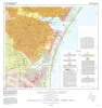
Geologic Atlas of Texas, Corpus Christi sheet | 1975 | Geologic map that depicts the surface geology of Nueces County and parts of Jim Wells, San Patricio, Aransas, Kleberg, and Kenedy Counties. |
Barnes, V.E., Aronow, Saul, Humble Oil and Refining Co., Martin, R.G., Maxson, M.J., Wyeth, J.C., Knupke, J.A., Buck, C.E. | Geologic Atlas of Texas | Bureau of Economic Geology |
|
Mineral resources of south Texas: region served through the port of Corpus Christi | 1962 | This report is a compilation of all available data on mineral resources (exclusive of oil and gas) in 39 south Texas counties. Information from published and unpublished sources was checked and supplemented by field investigations. |
Maxwell, R.A. | Report of Investigations | Bureau of Economic Geology |