Annual report for the Bureau of Economic Geology 1994
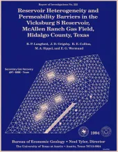
This report documents research done on the mature and prolific McAllen Ranch gas field in South Texas, as part of the Secondary Gas Recovery (SGR) project funded by the Gas Research Institute, U.S. Department of Energy, and State of Texas.ABSTRACTA Secondary Gas Recovery project study in South Texas demonstrated that reservoir compartmentalization can result in reserve growth in a mature gas field. McAllen Ranch is an important field in that it typifies South Texas gas fields that produce from the deep, overpressured sandstone reservoirs of the Oligocene Vicksburg Formation.
Lake Meredith, which supplies water for domestic use to all major Texas cities on the Southern High Plains, exceeds State of Texas limits for chloride and sulfate content.