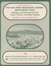
The Van Horn Mountains caldera is a small (~10-km2) igneous center in the Trans-Pecos volcanic province. The caldera formed 37 to 38 mya during eruption of the first of two ash-flow tuffs related to the caldera. Part of the first tuff ponded within the caldera; the lower marker horizon of the Chambers Tuff in the Sierra Vieja south of the Van Horn Mountains is probably the correlative outflow tuff. Following collapse, the caldera was partly filled by a heterogeneous assemblage of air-fall tuff, tuffaceous sediment, and possible ash-flow tuff.
This folded transparent map is at the same scale as its corresponding Geologic Atlas of Texas (GAT) sheet and can be superimposed on it to compare gravity information with surface geology.
This folded transparent map is at the same scale as its corresponding Geologic Atlas of Texas (GAT) sheet and can be superimposed on it to compare gravity information with surface geology.
Fractures and veins in strata of the Palo Duro Basin area, Texas Panhandle and eastern New Mexico, are characterized using data from outcrop and core studies and from fracture identification log analysis. Fractures are associated with faults and folds that occur along the margins of the Palo Duro Basin and in relatively undeformed strata within the central basin area. Along the Amarillo Uplift, strikes of fractures in Permian and Triassic rocks differ from fracture orientations in overlying Tertiary strata.

