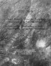
The public tends to dismiss floods as somewhat unreal catastrophes or occasional inconveniences that usually affect others. When a flood disaster strikes at the local level, the magnitude of the event is appraised in terms of the damage to human works on the river-valley floor or, in some cases, in terms of the loss of life. Resources are mobilized to combat the disaster, and discussions ensue concerning flood control plans and projects.
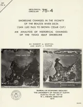
Historical monitoring in the vicinity of the Brazos River delta (San Luis Pass to Brown Cedar Cut) records the nature and magnitude of changes in position of the shoreline 'and vegetation line and provides insight into the factors affecting those changes.
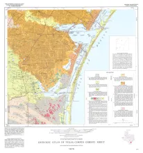
Geologic map that depicts the surface geology of Nueces County and parts of Jim Wells, San Patricio, Aransas, Kleberg, and Kenedy Counties.
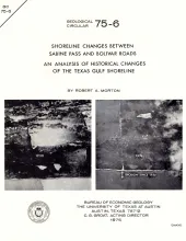
Historical monitoring between Sabine Pass and Bolivar Roads records the nature and magnitude of changes in position of the shoreline and vegetation line and provides insight into the factors affecting those changes.
Knowledge of the regional sand distribution and its relationship to formation temperature and pressure is a preliminary step in evaluating the geothermal resources of the Frio Formation. At depths generally greater than 7,000 feet, the sands and shales of the Frio Formation are overpressured and undercompacted. The insulating effect of these overpressured and undercompacted sediments results in the accumulation of subsurface heat and, thus, high temperature water.