|
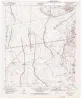
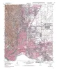
Geologic map of the Nations South Well quadrangle, Texas |
1995 |
|
Collins, E.W. |
Open-File Map |
Bureau of Economic Geology |
|
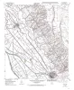
Geologic map of the Clint quadrangle, Texas |
1995 |
|
Collins, E.W., Raney, J.A. |
Open-File Map |
Bureau of Economic Geology |
|
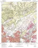
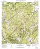
Geologic map of the Longhorn quadrangle, Texas |
1994 |
|
Collins, E.W. |
Open-File Map |
Bureau of Economic Geology |
|
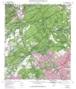
Geologic map of the Castle Hills quadrangle, Texas |
1994 |
|
Collins, E.W. |
Open-File Map |
Bureau of Economic Geology |
|
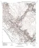
Geologic map of the El Paso Quadrangle, Texas |
1994 |
|
Collins, E.W., Raney, J.A. |
Open-File Map |
Bureau of Economic Geology |
|
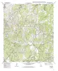
Geologic map of the Camp Bullis quadrangle, Texas |
1994 |
|
Collins, E.W. |
Open-File Map |
Bureau of Economic Geology |
|
Geologic map of the Fort Hancock quadrangle, Texas |
1994 |
|
Collins, E.W., Raney, J.A. |
Open-File Map |
Bureau of Economic Geology |
|
Geologic map of the Bergheim quadrangle, Texas |
1994 |
|
Collins, E.W. |
Open-File Map |
Bureau of Economic Geology |
|
Geologic map of the Boerne quadrangle, Texas |
1994 |
|
Collins, E.W. |
Open-File Map |
Bureau of Economic Geology |
|
Geologic map of the Campo Grande Mountain quadrangle, Texas |
1994 |
|
Collins, E.W., Raney, J.A. |
Open-File Map |
Bureau of Economic Geology |