Geologic Maps Publications
|
Title |
Publication Year
Sort ascending
|
Abstract |
Author |
Series |
Publisher |
|
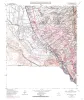
Geologic map of the Isla Quadrangle, Texas |
1996 |
|
Collins, E.W. |
Open-File Map |
Bureau of Economic Geology |
|
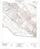
Geologic map of the McNary quadrangle, Texas |
1996 |
|
Collins, E.W. |
Open-File Map |
Bureau of Economic Geology |
|
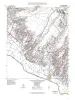
Geologic map of the Canutillo quadrangle, Texas |
1996 |
|
Collins, E.W. |
Open-File Map |
Bureau of Economic Geology |
|
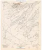
Geologic map of the Padre Canyon quadrangle, Texas |
1996 |
|
Collins, E.W. |
Open-File Map |
Bureau of Economic Geology |
|
Geologic map of the Smeltertown quadrangle, Texas |
1996 |
|
Collins, E.W. |
Open-File Map |
Bureau of Economic Geology |
|
Geologic map of the Tornillo quadrangle, Texas |
1996 |
|
Collins, E.W. |
Open-File Map |
Bureau of Economic Geology |
|
Geologic map of the Esperanza quadrangle, Texas |
1996 |
|
Collins, E.W. |
Open-File Map |
Bureau of Economic Geology |
|
Geologic map of the T P Well quadrangle, Texas |
1996 |
|
Collins, E.W. |
Open-File Map |
Bureau of Economic Geology |
|
Geologic map of the Whiterock Hills Quadrangle, Texas |
1996 |
|
Collins, E.W. |
Open-File Map |
Bureau of Economic Geology |
|
Geologic map of the Fort Hancock NW quadrangle, Texas |
1996 |
|
Collins, E.W. |
Open-File Map |
Bureau of Economic Geology |