Skip to main content
Main navigation
Maps
Geologic Maps and Cross Sections
Thematic Maps
Other Maps
Reports
Reports of Investigation
Geological Circulars
Oil and Gas Atlases
Coastal Studies
Historic BEG Reports
Open-File Reports
Mineral Resources
Other Reports
Education and General Interest
Down to Earth
Udden Series
Guidebooks
K-12 Resources
Thematic Maps
Geological Society Publications
Austin Geological Society
Corpus Christi Geological Society
Gulf Coast Association of Geological Societies
Gulf Coast Section SEPM
Houston Geological Society
Lafayette Geological Society
Mississippi Geological Society
New Orleans Geological Society
South Texas Geological Society
Texas Memorial Museum
User account menu
Log in
0 items
Breadcrumb
Home
Keywords
Publication Search
Advanced Search
Browse By Author
Browse By County
Browse By Keyword
Signup for news and announcements
You must have JavaScript enabled to use this form.
Email Address
Geologic Maps Publications
Title
Publication Year
Sort ascending
Abstract
Author
Series
Publisher
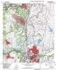
Geologic map of the Round Rock quadrangle, Texas
1997
Collins, E.W.
Open-File Map
Bureau of Economic Geology
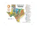
Geologic Map of Texas - Postcard
1997
A 4x6" postcard showing the geology of Texas
University of Texas at Austin, Bureau of Economic Geology
Miscellaneous Map
Bureau of Economic Geology
Geologic map of the Weir quadrangle, Texas
1997
Collins, E.W.
Open-File Map
Bureau of Economic Geology
Geologic map of the Bandera quadrangle, Texas
1997
Collins, E.W.
Open-File Map
Bureau of Economic Geology
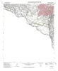
Geologic map of the Del Rio NW Quadrangle, Texas
1997
Collins, E.W.
Open-File Map
Bureau of Economic Geology
Geologic map of the Del Rio SW Quadrangle, Texas
1997
Collins, E.W.
Open-File Map
Bureau of Economic Geology
Geologic map of the Tarpley Pass Quadrangle, Texas
1997
Collins, E.W.
Open-File Map
Bureau of Economic Geology
Geologic map of the Tarpley Quadrangle, Texas
1997
Collins, E.W.
Open-File Map
Bureau of Economic Geology
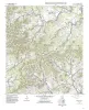
Geologic map of the Georgetown quadrangle, Texas
1997
Collins, E.W.
Open-File Map
Bureau of Economic Geology
Geologic map of the Fort Hancock NW quadrangle, Texas
1996
Collins, E.W.
Open-File Map
Bureau of Economic Geology
Pagination
First page
« First
Previous page
‹‹
…
Page
18
Page
19
Page
20
Page
21
Page
22
Page
23
Page
24
Page
25
Page
26
…
Next page
››
Last page
Last »