Gulf Of Mexico Publications
| Title | Publication Year Sort ascending | Abstract | Author | Series | Publisher | |
|---|---|---|---|---|---|---|
|
Modern depositional environments of the Texas coast | 1980 | The Texas Coastal Plain is ideal for studying physical processes and the late Quaternary sedimentological record. |
Morton, R.A., McGowen, J.H. | Guidebook | Bureau of Economic Geology |

|
Landsat analysis of the Texas coastal zone | 1979 | Mapping based on Landsat imagery was initiated along the Texas coast for four test sites selected for contrasting vegetation, environmental geology, and levels of economic development. |
Finley, R.J. | Report of Investigations | Bureau of Economic Geology |
|
Depositional patterns of Miocene facies, middle Texas coastal plain | 1979 | Doyle, J.D. | Report of Investigations | Bureau of Economic Geology | |

|
Sandstone distribution and potential for geopressured geothermal energy production in the Vicksburg Formation along the Texas Gulf coast | 1979 | Potential geopressured geothermal reservoirs in the Vicksburg Formation are limited to Hidalgo County along the Lower Texas Gulf Coast. |
Loucks, R.G. | Geological Circular | Bureau of Economic Geology |
|
Evaluating the Environmental Geology Map, Environmental Geologic Atlas of the Texas Coastal Zone | 1978 | Comparison of Environmental Geology maps, from the Environmental Geologic Atlas of the Texas Coastal Zone, with aerial photographs taken in February 1975 revealed changes related to economic development of the region and to ongoing natural processes. |
Finley, R.J. | Research Note | |
|
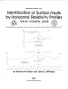
Identification of surface faults by horizontal resistivity profiles, Texas coastal zone | 1978 | The land surface in the Texas Coastal Zone is interlaced with active and potentially active surface faults. They are subtle features which are difficult to identify until they have caused damage to manmade structures. To date (1978), significant damage has resulted. |
Kreitler, C.W., McKalips, D.G. | Geological Circular | Bureau of Economic Geology |
|
Catahoula Formation of the Texas coastal plain: depositional systems, composition, structural development, ground-water flow history, and uranium distribution | 1977 | The Catahoula Formation of the Texas Gulf Coastal Plain consists of two depositional systems--the Gueydan bedload fluvial system of the Rio Grande embayment and the Chita-Corrigan mixed load fluvial system of the Houston embayment. |
Galloway, W.E., Murphy, T.D., Belcher, R.C., Johnson, B.D., Sutton, Stanley | Report of Investigations | Bureau of Economic Geology |
|
Shoreline changes on Mustang Island and North Padre Island (Aransas Pass to Yarborough Pass) -- an analysis of historical changes of the Texas Gulf shoreline | 1977 | Historical monitoring along Mustang and north Padre Islands records the nature and magnitude of changes in position of the shoreline and vegetation line and provides insight into the factors affecting those changes. |
Morton, R.A., Pieper, M.J. | Geological Circular | Bureau of Economic Geology |
|
Shoreline changes on central Padre Island (Yarborough Pass to Mansfield Channel) -- an analysis of historical changes of the Texas Gulf shoreline | 1977 | Historical monitoring along central Padre Island records the nature and magnitude of changes in position of the shoreline and vegetation line and provides insight into the factors affecting those changes. |
Morton, R.A., Pieper, M.J. | Geological Circular | Bureau of Economic Geology |
|
The Gulf shoreline of Texas: processes, characteristics, and factors in use | 1977 | The State of Texas has about 367 miles of open Gulf shoreline, most of it typified by rather broad, sandy beaches and a comparatively mild climate that permits almost year-round use of this recreational resource. All but about 87 miles of the Gulf beach is accessible to the general public. |
McGowen, J.H., Garner, L.E., Wilkinson, B.H. | Geological Circular | Bureau of Economic Geology |