Gulf Of Mexico Publications
| Title | Publication Year Sort ascending | Abstract | Author | Series | Publisher | |
|---|---|---|---|---|---|---|
|
Salt-Related Fault Families and Fault Welds in the Northern Gulf of Mexico | 2003 | We classify salt-related faults and fault welds in the northern Gulf of Mexico on the basis of the three-dimensional geometry of the faults, welds, deformed strata, and associated salt bodies. |
Jackson, M.P.A., Rowan, M.G. | Report of Investigations | Bureau of Economic Geology |
|
Geology and land use in the western part of the Gulf Coast coal-bearing region | 2002 | Warwick, P.D., Aubourg, C.E., Hook, R.W., SanFilipio, J.R., Barnes, V.E., Morrissey, E.A., Schultz, A.C., Karlsen, A.W. | Miscellaneous Map | Bureau of Economic Geology | |
|
Atlas of northern Gulf of Mexico gas and oil reservoirs: Volume 1. Miocene and older reservoirs | 1997 | Seni, S.J., Hentz, T.F., Kaiser, W.R. | Atlases of Major Oil and Gas Reservoirs | Bureau of Economic Geology | |
|
Atlas of northern Gulf of Mexico gas and oil reservoirs: Volume 2. Pliocene and Pleistocene reservoirs | 1997 | Hentz, T.F., Seni, S.J., Wermund, E.G. | Atlases of Major Oil and Gas Reservoirs | Bureau of Economic Geology | |
|
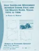
Gulf shoreline movement between Sabine Pass and the Brazos River, Texas: 1974 to 1996 | 1997 | Changes in shoreline position along the southeastern Texas Gulf coast between 1974 and 1996 were documented by conducting a kinematic real-time differential global positioning system (DGPS) field survey in 1996 and comparing that shoreline with other shorelines archived in a geographic informatio |
Morton, R.A. | Geological Circular | Bureau of Economic Geology |
|
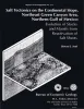
Salt Tectonics on the Continental Slope, Northeast Green Canyon Area, Northern Gulf of Mexico | 1994 | Data from conventional two- and three-dimensional seismic surveys and wells were used to analyze the morphology of salt structures and to determine the history of salt emplacement in a 1,500-mi2 (3,885-km2) region of the continental slope, northeast Green Canyon Area. |
Seni, S.J. | Report of Investigations | Bureau of Economic Geology |

|
Reference high-resolution correlation cross sections, Paleogene section, Texas coastal plain | 1994 | This cross section set traverses four Cenozoic depositional sub-provinces: the Rio Grande Embayment, San Marcos Arch, Houston Embayment, and Sabine Arch. |
Galloway, W.E., Liu, Xijin, Travis-Neuberger, Deborah, Xue, Liangquing | Cross Sections | Bureau of Economic Geology |
|
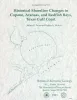
Historical shoreline changes in Copano, Aransas, and Redfish Bays, Texas Gulf coast | 1993 | Shorelines bordering the bays of Texas are generally not as dynamic as those along the Gulf of Mexico. Nevertheless, the predominantly erosional movement of these bay shorelines translates to large losses of wetlands, arable uplands, and recreational and residential property. |
Paine, J.G., Morton, R.A. | Geological Circular | Bureau of Economic Geology |
|
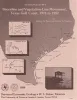
Shoreline and vegetation-line movement, Texas Gulf coast, 1974 to 1982 | 1989 | The purposes of this study were (1) to quantify recent (1974 to 1982) movement of Texas shorelines and vegetation lines by analysis of aerial photographs; (2) to place this movement in historical (pre-1974) context; and (3) to examine the influence of environmental variables such as storms, sea l |
Paine, J.G., Morton, R.A. | Geological Circular | Bureau of Economic Geology |
|
Hydrocarbon production and exploration potential of the distal Frio Formation, Texas Gulf coast and offshore | 1989 | Along the Texas Gulf shoreline and offshore, the distal margin of the Frio Formation is a deep hydrocarbon province that is underexplored relative to the onshore Frio. |
Hamlin, H.S. | Geological Circular | Bureau of Economic Geology |