Gulf Of Mexico Publications
| Title | Publication Year Sort ascending | Abstract | Author | Series | Publisher | |
|---|---|---|---|---|---|---|
|
Shoreline changes on Mustang Island and North Padre Island (Aransas Pass to Yarborough Pass) -- an analysis of historical changes of the Texas Gulf shoreline | 1977 | Historical monitoring along Mustang and north Padre Islands records the nature and magnitude of changes in position of the shoreline and vegetation line and provides insight into the factors affecting those changes. |
Morton, R.A., Pieper, M.J. | Geological Circular | Bureau of Economic Geology |
|
Shoreline changes on central Padre Island (Yarborough Pass to Mansfield Channel) -- an analysis of historical changes of the Texas Gulf shoreline | 1977 | Historical monitoring along central Padre Island records the nature and magnitude of changes in position of the shoreline and vegetation line and provides insight into the factors affecting those changes. |
Morton, R.A., Pieper, M.J. | Geological Circular | Bureau of Economic Geology |
|
The Gulf shoreline of Texas: processes, characteristics, and factors in use | 1977 | The State of Texas has about 367 miles of open Gulf shoreline, most of it typified by rather broad, sandy beaches and a comparatively mild climate that permits almost year-round use of this recreational resource. All but about 87 miles of the Gulf beach is accessible to the general public. |
McGowen, J.H., Garner, L.E., Wilkinson, B.H. | Geological Circular | Bureau of Economic Geology |
|
Hydrogeology of Gulf coast aquifers, Houston-Galveston area, Texas | 1977 | Aquifers in the Houston-Galveston area are composed principally of fluvial-deltaic sediments. The Alta Loma Sand is a complexly faulted, high-sand-percent unit that represents a seaward progression of fluvial, delta-plain, and delta-front facies. |
Kreitler, C.W., Guevara, E.H., Granata, G.E., McKalips, D.G. | Geological Circular | Bureau of Economic Geology |
|
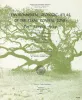
Environmental geologic Atlas of the Texas coastal zone -- Port Lavaca area | 1976 | The Texas Coastal Zone is marked by diversity in geography, resources, climate, and industry. |
McGowen, J.H., Proctor, C.V., Jr., Brown, L.F., Jr., Evans, T.J., Fisher, W.L., Groat, C.G. | Environmental Geologic Atlas of the Texas Coastal Zone | Bureau of Economic Geology |
|
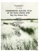
Environmental geologic Atlas of the Texas coastal zone -- Bay City-Freeport area | 1976 | The Texas Coastal Zone is marked by diversity in geography, resources, climate, and industry. |
McGowen, J.H., Brown, L.F., Jr., Evans, T.J., Fisher, W.L., Groat, C.G. | Environmental Geologic Atlas of the Texas Coastal Zone | |
|
Shoreline changes on Matagorda Island and San Jose Island (Pass Cavallo to Aransas Pass) -- an analysis of historical changes of the Texas Gulf shoreline | 1976 | Historical monitoring along Matagorda Island and San Jose Island records the nature and magnitude of changes in position of the shoreline and vegetation line and provides insight into the factors affecting those changes. |
Morton, R.A., Pieper, M.J. | Geological Circular | Bureau of Economic Geology |

|
Regional Tertiary cross sections -- Texas Gulf coast | 1976 | The Bureau of Economic Geology has been conducting regional studies of the Frio Formation along the Texas Gulf Coast to evaluate potential geothermal energy from deep, geopressured sandstone reservoirs (Bebout, Dorfman, and Agagu, 1975; Bebout, Agagu, and Dorfman, 1975). |
Bebout, D.G., Luttrell, P.E., Seo, J.H. | Geological Circular | Bureau of Economic Geology |
|
Lineations and faults in the Texas coastal zone | 1976 | Over 7,000 miles of lineations have been observed on aerial photographic mosaics of the Texas Coastal Zone. These lineations, in part, represent the surface traces of faults originating in the Tertiary sediments and propagating through the Quaternary sediments. |
Kreitler, C.W. | Report of Investigations | Bureau of Economic Geology |
|
Shoreline changes on Matagorda Peninsula (Brown Cedar Cut to Pass Cavallo) -- an analysis of historical changes of the Texas Gulf shoreline | 1976 | Historical monitoring along Matagorda Peninsula from Brown Cedar Cut to Pass Cavallo records the nature and magnitude of changes in position of the shoreline and vegetation line and provides insight into the factors affecting those changes. |
Morton, R.A., Pieper, M.J., McGowen, J.H. | Geological Circular | Bureau of Economic Geology |