Gulf Of Mexico Publications
| Title | Publication Year Sort ascending | Abstract | Author | Series | Publisher | |
|---|---|---|---|---|---|---|

|
Environmental geologic Atlas of the Texas coastal zone -- Corpus Christi area | 1976 | The Texas Coastal Zone is marked by diversity in geography, resources, climate, and industry. |
Brown, L.F., Jr., Brewton, J.L., McGowen, J.H., Evans, T.J., Fisher, W.L., Groat, C.G. | Environmental Geologic Atlas of the Texas Coastal Zone | Bureau of Economic Geology |
|
Historical changes and related coastal processes, Gulf and mainland shorelines, Matagorda Bay area, Texas | 1975 | Change, both natural and man-induced, is a significant and defining element of the Coastal Zone. Man-induced change, by definition, can be controlled if desired. |
McGowen, J.H., Brewton, J.L. | Selected Reports | Bureau of Economic Geology |
|
Shoreline changes on Brazos Island and south Padre Island (Mansfield Channel to north of the Rio Grande) -- an analysis of historical changes of the Texas Gulf shoreline | 1975 | Historical monitoring along Brazos and south Padre Islands records the nature and magnitude of changes in position of the shoreline and vegetation line and provides insight into the factors affecting those changes. |
Morton, R.A., Pieper, M.J. | Geological Circular | Bureau of Economic Geology |
|
Shoreline changes in the vicinity of Brazos River delta (San Luis Pass to Brown Cedar Cut) -- an analysis of historical changes of the Texas Gulf shoreline | 1975 | Historical monitoring in the vicinity of the Brazos River delta (San Luis Pass to Brown Cedar Cut) records the nature and magnitude of changes in position of the shoreline 'and vegetation line and provides insight into the factors affecting those changes. |
Morton, R.A., Pieper, M.J. | Geological Circular | Bureau of Economic Geology |
|
Shoreline changes between Sabine Pass and Bolivar Roads -- an analysis of historical changes of the Texas Gulf shoreline | 1975 | Historical monitoring between Sabine Pass and Bolivar Roads records the nature and magnitude of changes in position of the shoreline and vegetation line and provides insight into the factors affecting those changes. |
Morton, R.A. | Geological Circular | Bureau of Economic Geology |

|
Geothermal resources, Frio Formation, middle Texas Gulf coast | 1975 | Knowledge of the regional sand distribution and its relationship to formation temperature and pressure is a preliminary step in evaluating the geothermal resources of the Frio Formation. |
Bebout, D.G., Agagu, O.K., Dorfman, M.H. | Geological Circular | Bureau of Economic Geology |
|
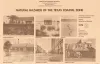
Natural hazards of the Texas coastal zone | 1974 | The Texas Coastal Zone is marked by diversity in geography, resources, climate, and industry. |
Brown, L.F., Jr., Morton, R.A., McGowen, J.H., Kreitler, C.W., Fisher, W.L. | Selected Reports | Bureau of Economic Geology |
|
Shoreline changes on Galveston Island (Bolivar Roads to San Luis Pass) -- an analysis of historical changes of the Texas Gulf shoreline | 1974 | Historical monitoring along Galveston Island records the type and magnitude of changes in position of the shoreline and vegetation line and provides insight into the factors affecting those changes. |
Morton, R.A. | Geological Circular | Bureau of Economic Geology |
|
Environmental geologic Atlas of the Texas coastal zone -- Beaumont-Port Arthur area | 1973 | The Texas Coastal Zone is marked by diversity in geography, resources, climate, and industry. |
Fisher, W.L., Brown, L.F., Jr., McGowen, J.H., Groat, C.G. | Environmental Geologic Atlas of the Texas Coastal Zone | Bureau of Economic Geology |
|
Environmental geologic Atlas of the Texas coastal zone -- Galveston-Houston area | 1972 | The Texas Coastal Zone is marked by diversity in geography, resources, climate, and industry. |
Fisher, W.L., McGowen, J.H., Brown, L.F., Jr., Groat, C.G. | Environmental Geologic Atlas of the Texas Coastal Zone | Bureau of Economic Geology |