STATEMAP Project Maps
-
Books & Reports
- Reports of Investigations
- Guidebooks
- Udden Series
- Geological Circulars
- Down To Earth
- Atlases of Major Oil and Gas Reservoirs
- Texas Memorial Museum Publications
- Environmental Geologic Atlas of the Texas Coastal Zone
- Mineral Resource Circulars
- Other Reports
- Seminars and Workshops
- Handbooks
- Submerged Lands of Texas
- Symposia
- Annual Reports
- Open File Reports
-
Maps & Cross Sections
- Thematic Maps
- Miscellaneous Maps, Charts & Sections
- Geologic Atlas of Texas
- STATEMAP Project Maps
- Geologic Quadrangle Maps
- Cross Sections
- Highway Geology Map
- Energy and Mineral Resource Maps
- Shoreline Change and Other Posters
- Wilcox Group, East Texas, Geological / Hydrological Folios
- Bouguer Gravity Atlas of Texas
- River Basin Regional Studies
- Featured Maps
- Posters
- Teachers & the Public
-
Geological Society Publications
- Gulf Coast Association of Geological Societies
- Alabama Geological Society
- Austin Geological Society
- Corpus Christi Geological Society
- Houston Geological Society
- Lafayette Geological Society
- Mississippi Geological Society
- New Orleans Geological Society
- South Texas Geological Society
- GCS SEPM Publications
- Historic BEG & UT Series
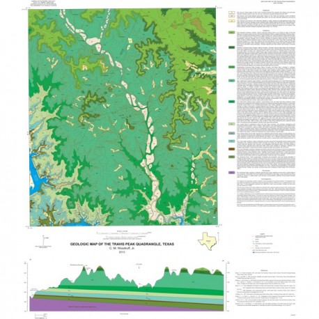
OFM0210. Geologic Map of the Travis Peak Quadrangle, Texas, by C. M. Woodruff, Jr. Oversize geologic map on color topographic base, map scale 1:24,000, 2013. Paper map. For PDF: OFM0210D.
About This Publication
The Travis Peak quadrangle comprises dissected terrain on the north side of the Colorado River (impounded in this area as Lake Travis), including Post Oak Ridge, Hickory Gap, Boultinghouse Mountain, the valley of Cow Creek, and the Balcones Canyonlands National Wildlife Refuge (NWR). The area is underlain by an almost complete section of Lower Cretaceous bedrock units and a small exposure of Pennsylvanian Smithwick Shale. In addition to local bulk-rock products (limestone, alluvial sand and gravel, and caliche), key potential ground-water resources are mapped.
Keywords: maps, geologic maps, quadrangle maps, Balcones Canyonlands National Wildlife Refuge, Travis Peak, Texas
Citation
Woodruff, C. M., Jr., 2013, Geologic Map of the Travis Peak Quadrangle, Texas: The University of Texas at Austin, Bureau of Economic Geology, Open-File Map No. OFM0210, scale 1:24,000.

