Reports of Investigations
-
Books & Reports
- Reports of Investigations
- Guidebooks
- Udden Series
- Geological Circulars
- Down To Earth
- Atlases of Major Oil and Gas Reservoirs
- Texas Memorial Museum Publications
- Environmental Geologic Atlas of the Texas Coastal Zone
- Mineral Resource Circulars
- Other Reports
- Seminars and Workshops
- Handbooks
- Submerged Lands of Texas
- Symposia
- Annual Reports
- Open File Reports
-
Maps & Cross Sections
- Thematic Maps
- Miscellaneous Maps, Charts & Sections
- Geologic Atlas of Texas
- STATEMAP Project Maps
- Geologic Quadrangle Maps
- Cross Sections
- Highway Geology Map
- Energy and Mineral Resource Maps
- Shoreline Change and Other Posters
- Wilcox Group, East Texas, Geological / Hydrological Folios
- Bouguer Gravity Atlas of Texas
- River Basin Regional Studies
- Featured Maps
- Posters
- Teachers & the Public
-
Geological Society Publications
- Gulf Coast Association of Geological Societies
- Alabama Geological Society
- Austin Geological Society
- Corpus Christi Geological Society
- Houston Geological Society
- Lafayette Geological Society
- Mississippi Geological Society
- New Orleans Geological Society
- South Texas Geological Society
- GCS SEPM Publications
- Historic BEG & UT Series
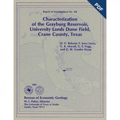
Characterization of the Grayburg Reservoir, University Lands Dune Field, Crane County, Texas. Digital Download
RI0168D
For a print version: RI0168.
RI0168D. Characterization of the Grayburg Reservoir, University Lands Dune Field, Crane County, Texas, by D. G. Bebout, F. J. Lucia, C. R. Hocott, G. E. Fogg, and G. W. Vander Stoep. 98 p., 85 figs., 9 tables, 4 pls., 1987. doi.org/10.23867/RI0168D. Downloadable PDF.
To purchase this publication in book format, please order RI0168.
ABSTRACT
San Andres and Grayburg reservoirs have yielded about 42 percent (9.8 billion barrels) of the total cumulative production of oil from the Permian Basin of West Texas. However, recovery efficiencies have been low, and significant quantities of mobile oil remain after primary and conventional secondary recovery. Major San Andres and Grayburg reservoirs, each of which has produced more than 10 million barrels, are estimated to contain 8.7 billion barrels of unrecovered mobile oil. About 900 million barrels of unrecovered mobile oil lies within a northwest-trending group of fields including McElroy, Dune, Waddell, Jordan, and Penwell on the eastern margin of the Central Basin Platform. This oil is trapped within reservoir heterogeneities inherited from original depositional systems and modified by diagenesis during subsequent burial. Current rates of production decline in these old fields can be moderated or reversed through selective recompletion and infill-drilling programs guided by a knowledge of the distribution of remaining mobile oil. This distribution can be defined only through integrated geological and engineering studies of the reservoirs.
Such a study of part of the Dune field has resulted in the delineation of more than 10 million barrels of unrecovered mobile oil in an area of only 1 square mile. Much of this oil occurs in a single reservoir interval (the middle unit) that includes a high-permeability grainstone bar facies. The low recovery of hydrocarbons from this zone is a result of limited reservoir contact during primary production and waterflooding because of pronounced permeability stratification. Detailed characterization of carbonate rock types and diagenetic history, calibration of well-log data to low-temperature core analysis, and mapping of remaining oil-saturated thickness and permeability trends are key aspects of this study. Successful application of these approaches at the Dune field suggests that wider use of integrated methods offers major economic potential in an otherwise mature hydrocarbon province.
Keywords: carbonate facies, dolomite, Grayburg Formation, gypsum, permeability, Permian Basin, Permian System, petroleum reserves, petrophysics, porosity, reservoir characterization, rock fabric, Texas
CONTENTS
Abstract
General Introduction
Historical background
Dune field development
Available materials
Geological Characterization, by D. G. Bebout, F. Jerry Lucia, and G. E. Fogg
Introduction
Regional setting
Local setting-Dune field
Field geology
Facies descriptions and distribution
Facies descriptions
Vertical facies distribution
Lateral facies distribution
Core permeability related to facies
Depositional environments
Diagenesis
General
Textural and geochemical data
Dolomite
Anhydrite and gypsum
Relationship of anhydrite and gypsum to porosity
Siliciclastics
Diagenesis and its control on porosity and pore geometry
Distribution of Remaining Mobile Oil, by F. Jerry Lucia, C. R. Hocott, and G. W. Vander Stoep
Introduction
Original oil in place
Gypsum effects
Correlation of acoustic-log and core porosity
Water saturation.
Calculation of original oil in place
Cumulative
Permeability from wireline
Rock-fabric types .
Relationships of porosity, rock fabric, and permeability
Relationships of rock type and saturation
Permeability calculations
Permeability distribution
Comparison of rock-fabric method with routine method
Distribution of remaining mobile oil
Conclusions
Acknowledgments
References
85 Figures
9 Tables
1. Development status. Mobil University Unit 15/16. Dune field
2. Log permeability statistics by stratigraphic interval
3. Porosity and thickness &erages by zone in Section 15
4. Comparison of water saturation values calculated from corrected and uncorrected resistivity values
5. Net-pay water saturations by zone in Section 15
6. Original oil in place in Section 15
7. Water saturation by pore family
8. Summary of zonal kh data in Section 15
9. Original oil in place, produced oil, and remaining mobile oil by zone in Section 15
4 Plates
1.
a. lntergranular porosity in a dolomitized pellet grainstone
b. lntergranular porosity in a dolornitized pellet packstone
c. lntercrystalline porosity in a coarsely crystalline doiomitized wackestone
d. lntercrystalline porosity in a dolomitized wackestone
2.
a. Intraparticle porosity within a dolomitized fusulinid surrounded by nonporous fine-grained dolomite
b. Vuggy porosity within a dolornitized wackestone
c. d. Dolomitized pellet grainstone from the CZ dolostone
3.
a. b. Twinned gypsum with dolomolds in a dolomite matrix
c. d. Bright anhydrite crystal surrounded by tan fibrous bassanitei?) in a matrix of dolomite
4.
a. b. Leached anhydrite showing pore space between anhydrite laths
c. d. Sample from which gypsum was plucked during thin-section preparation
Citation
Bebout, D. G., Lucia, F. J., Hocott, C. R., Fogg, G. E., and Vander Stoep, G. W., 1987, Characterization of the Grayburg Reservoir, University Lands Dune Field, Crane County, Texas: The University of Texas at Austin, Bureau of Economic Geology, Report of Investigations No. 168, 98 p.
