Reports of Investigations
-
Books & Reports
- Reports of Investigations
- Guidebooks
- Udden Series
- Geological Circulars
- Down To Earth
- Atlases of Major Oil and Gas Reservoirs
- Texas Memorial Museum Publications
- Environmental Geologic Atlas of the Texas Coastal Zone
- Mineral Resource Circulars
- Other Reports
- Seminars and Workshops
- Handbooks
- Submerged Lands of Texas
- Symposia
- Annual Reports
- Open File Reports
-
Maps & Cross Sections
- Thematic Maps
- Miscellaneous Maps, Charts & Sections
- Geologic Atlas of Texas
- STATEMAP Project Maps
- Geologic Quadrangle Maps
- Cross Sections
- Highway Geology Map
- Energy and Mineral Resource Maps
- Shoreline Change and Other Posters
- Wilcox Group, East Texas, Geological / Hydrological Folios
- Bouguer Gravity Atlas of Texas
- River Basin Regional Studies
- Featured Maps
- Posters
- Teachers & the Public
-
Geological Society Publications
- Gulf Coast Association of Geological Societies
- Alabama Geological Society
- Austin Geological Society
- Corpus Christi Geological Society
- Houston Geological Society
- Lafayette Geological Society
- Mississippi Geological Society
- New Orleans Geological Society
- South Texas Geological Society
- GCS SEPM Publications
- Historic BEG & UT Series


Facies Architecture and Production Characteristics of ... the Frio Formation, Texas. Digital Download
RI0146D
A free, digital version of this publication can be found on: Texas ScholarWorks
To purchase a print version (if available): RI0146
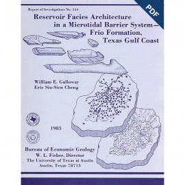
RI0146D. Facies Architecture and Production Characteristics of Strandplain Reservoirs in the Frio Formation, Texas, by Noel Tyler and W. A. Ambrose. 42 p., 29 figs., 1 table, 1985. doi.org/10.23867/RI0146D. Downloadable PDF.
To purchase this publication in book format, please order RI0146.
ABSTRACT
Many modern shore zones comprise a continuum of depositional environments that encompass both strandplain and barrier-island systems. Strandplains are further subdivided into two classes: sand-rich beach-ridge plains and mud-rich chenier plains. Tertiary shorezone systems of the Texas Gulf Coast Basin contain a significant proportion of the Texas oil resource in clastic reservoirs. These reservoirs display better-than-average oil recovery efficiencies. This report describes the production attributes of three Frio strandplain reservoirs--the Cayce, the Cornelius, and the Carlson--in the North Markham-North Bay City field, Matagorda County, Texas.
Hydrocarbons in the North Markham-North Bay City field were trapped in a simple rollover anticline. Oil is produced from stacked strandplain sandstones in this multiple reservoir field. Composite sandstones of beach-ridge plain/distributary/delta-front origin constitute the Cayce oil reservoir. Internal heterogeneity results in considerable fluid-flow anisotropy, as displayed by sequential water-cut maps and oil production maps. Water influx in the strandplain deposits follows broad fronts, whereas water invasion in channel deposits is more restricted and erratic. The Cornelius reservoir was deposited in a system intermediate between sand-rich beach plains and mud-rich chenier plains. Sandy beach ridges, separated by muddy swales, compose the productive framework of this class of strandplain reservoir and furthermore act as conduits for early water influx. Sandstones, possibly of washover origin, in the intervening swales produce oil but are more rapidly drained than are beach-ridge sandstones. The Carlson reservoir produces from transgressed strandplain deposits. Oil is contained in upward-fining transgressive sandstones that rest on thicker but oil-barren progradational facies. Facies analysis indicates that the Carlson had a complex and episodic depositional history, yet water-influx maps and oil production maps suggest isotropic fluid behavior. Modern sand-rich transgressive shore-zone deposits are characteristically sheetlike, as is the transgressive component of the Carlson reservoir. This distinctive morphology appears to have fostered reservoir productivity.
Oil recovery from the North Markham-North Bay City reservoirs follows a predictable trend. Recovery efficiency is highest from the transgressive sheet sands of the Carlson, which is the shallowest of the major oil reservoirs; intermediate from the composite Cayce; and lowest from the depositionally complex and mud-rich Cornelius, which overlies the Cayce. Reservoir efficiency of the strandplain sandstones in the North Markham-North Bay City field exceeds that of barrier and back-barrier deposits productive elsewhere in the Frio Formation of the central Texas Gulf Coast.
Keywords: Texas Gulf Coast, Matagorda County, Frio Formation, North Markham-North Bay City oil field, strandplain reservoirs, reservoir architecture, oil production
CONTENTS
ABSTRACT
INTRODUCTION
Strandplain depositional systems
Beach-ridge plains
Chenier plains
Oil-bearing strandplain systems of the Texas Gulf Coast Basin
NORTH MARKHAM-NORTH BAY CITY FIELD
Oil production from the North Markham- North Bay City field
Facies influence on reservoir continuity
CAYCE RESERVOIR: A COMPOSITE PROGRADATIONAL STRANDPLAIN/FLUVIODELTAIC COMPLEX
Depositional environment
Thickness trends and sandstone distribution
Areal distribution of component facies
Interpretation of depositional environments
Architecture and dimensions of component facies
Areal stratification trends
Reservoir continuity and hydrocarbon distribution
Reservoir drainage characteristics
Water-influx trends
Reservoir productivity
CORNELIUS RESERVOIR: A PROGRADED MUD-RICH STRANDPLAIN COMPLEX
Depositional environment
Sandstone distribution
Areal distribution of component facies
Interpretation of depositional environments
Reservoir continuity and hydrocarbon distribution
Reservoir drainage characteristics
Water-influx trends
Reservoir productivity
CARLSON RESERVOIR: A TRANSGRESSED BEACH-RIDGE PLAIN
Depositional environment
Sandstone distribution
Areal distribution of component facies
Interpretation of depositional environments
Reservoir continuity
Reservoir drainage trends
CONCLUSIONS
Reservoir models
Oil recovery and fluid injection
ACKNOWLEDGMENTS
REFERENCES
Figures
1. Schematic models illustrating the principal environments of deposition in (A) beach-ridge plain, (B) chenier plain, and (C} barrier-island systems
2. Physiography of a modem beach-ridge strandplain, Nayarit coastal plain, Mexico, and a cross section illustrating the tabularity of prograding beach-ridge deposits
3. Physiography of a modem chenier plain, western Louisiana, and a cross section illustrating the shallow-based and irregular distribution of chenier plain beach ridges
4. Frio depositional systems and location of the North Markham- North Bay City field
5. Upper Frio stratigraphic dip cross section
6. Structure map of the North Markham-North Bay City field contoured on top of the Cayce sandstone
7. Generalized west-east section across the North Markham- North Bay City field
8. Percent-sandstone map, Cayce reservoir
9. Log-character and net-sandstone map, Cayce reservoir
10. Facies anatomy of the Cayce sandstone, adapted from vertical SP profiles
11. Exploded reservoir facies of the Cayce sandstone
12. Stratigraphic complexity (number of strata} map of the Cayce sandstone
13. Resistivity cross sections, east Cayce reservoir
14. Resistivity cross section, west Cayce reservoir
15. Sequential water-cut maps, east and west Cayce reservoirs
16. Reservoir productivity maps of the Cayce reservoir for periods 1942 through 1965 and 1966 through 1982
17. Net-sandstone map, Cornelius sandstone
18. Detailed net-sandstone map of the third Cornelius sandstone
19. Interpretive facies anatomy of the third Cornelius sandstone
20. Resistivity dip sections, Cornelius sandstone
21. Resistivity section aligned obliquely to the strike of the Cornelius sandstone
22. Sequential water-cut maps of the west Cornelius reservoir
23. Reservoir production maps, west Cornelius reservoir
24. Log-facies map of the Carlson sandstone
25. Resistivity cross section, Carlson reservoir
26. Water-cut and production maps of the Carlson reservoir
27. Continuity of a composite progradational beach-ridge strandplain transected by a fluvial-deltaic system modeled on the Cayce reservoir
28. Reservoir continuity models of a mud-rich beach-ridge plain complex
29. Reservoir continuity model of transgressed strandplain sandstones
Table
1. Geologic, fluid property, engineering, and production characteristics of the principal oil reservoirs of the North Markham-North Bay City field
Citation
Tyler, Noel, and Ambrose, W. A., 1985, Facies Architecture and Production Characteristics of Strandplain Reservoirs in the Frio Formation, Texas: The University of Texas at Austin, Bureau of Economic Geology, Report of Investigations No. 146, 42 p.