Reports of Investigations
-
Books & Reports
- Reports of Investigations
- Guidebooks
- Udden Series
- Geological Circulars
- Down To Earth
- Atlases of Major Oil and Gas Reservoirs
- Texas Memorial Museum Publications
- Environmental Geologic Atlas of the Texas Coastal Zone
- Mineral Resource Circulars
- Other Reports
- Seminars and Workshops
- Handbooks
- Submerged Lands of Texas
- Symposia
- Annual Reports
- Open File Reports
-
Maps & Cross Sections
- Thematic Maps
- Miscellaneous Maps, Charts & Sections
- Geologic Atlas of Texas
- STATEMAP Project Maps
- Geologic Quadrangle Maps
- Cross Sections
- Highway Geology Map
- Energy and Mineral Resource Maps
- Shoreline Change and Other Posters
- Wilcox Group, East Texas, Geological / Hydrological Folios
- Bouguer Gravity Atlas of Texas
- River Basin Regional Studies
- Featured Maps
- Posters
- Teachers & the Public
-
Geological Society Publications
- Gulf Coast Association of Geological Societies
- Alabama Geological Society
- Austin Geological Society
- Corpus Christi Geological Society
- Houston Geological Society
- Lafayette Geological Society
- Mississippi Geological Society
- New Orleans Geological Society
- South Texas Geological Society
- GCS SEPM Publications
- Historic BEG & UT Series
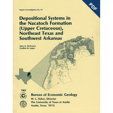
Depositional Systems in the Nacatoch Formation...Northeast Texas and Southwest Arkansas. Digital Download
RI0137D
A free, digital version of this publication can be found on: Texas ScholarWorks
To purchase a print version (if available): RI0137
RI0137D. Depositional Systems in the Nacatoch Formation (Upper Cretaceous), Northeast Texas and Southwest Arkansas, by M. K. McGowen and C. M. Lopez. 59 p., 44 figs., 5 tables, 1983. doi.org/10.23867/RI0137D. Downloadable PDF.
To purchase this publication in book format, please order RI0137.
ABSTRACT
The Nacatoch Formation of the East Texas Basin is the middle formation of the Navarro Group and consists of marine sandstones and mudstones derived largely from source areas to the northwest, north, and northeast of the East Texas Embayment. Terrigenous clastics were supplied to the Nacatoch Basin by a major northeastern dispersal system originating in southwest Arkansas. Three minor fluvial-delta systems contributed sediment in southern Red River, Delta, and Hunt Counties, Texas.
Five facies are recognized in Nacatoch outcrops in southwest Arkansas: tidal-flat, tidal-channel, tidal-inlet- associated, shoreface, and shelf facies. In northeast Texas, a delta sequence occurs in south-central Hunt County, and shelf sandstones and mudstones are present in Navarro and Kaufman Counties. The lateral association of deltaic deposits and tidal-flat sequences, together with the type, scale, and distribution pattern of inferred tide-produced structures, suggests that tides within the upper microtidal to lower mesotidal range (3 to 8 ft; 1 to 2.5 m) occurred in the East Texas and North Louisiana Embayments during deposition of the Nacatoch Formation.
The Nacatoch Formation in the East Texas Basin is restricted to the northern and western parts of the basin. The sandstone bodies trend mainly northeast to southwest in the northern part of the basin and north to south along the western margin. In the southern half of the basin, the Nacatoch Formation consists of mudstones.
In the subsurface of the East Texas Basin, the Nacatoch Formation can generally be subdivided into nearshore and shelf deposits. Nearshore sequences include deltaic deposits in the north and the northwest parts of the basin that are located downdip from surface exposures of the same facies. Two thick net-sand axes, oriented perpendicularly to the outcrop belt, extend southward into the basin. Orientation of these sand axes changes abruptly to become parallel within the dominant northeast-southwest trend, suggesting that the delta was dominated by tides and waves. It is inferred that interdeltaic areas were sites of short barrier islands, broad tidal inlets with associated tidal deltas, and tidal flats. Offshore deposits can be arbitrarily divided into a lower and an upper sandstone sequence separated by 50 to 100 ft (16.6 to 33.3 m) of marine mudstone. Sandstone bodies of the lower sequence are elongate, exhibit gradational lower boundaries and abrupt upper contacts, and grade laterally into muddy sandstones and mudstones. Sandstones composing these depositional sequences are well sorted, calcitic, glauconitic, fine to medium grained, and contain shell fragments. The sandstone bodies are interpreted to be offshore bars, which have a geometry derived primarily from tidal currents. Sandstones of the upper sequence compose a fairly continuous sheet sand; textures and composition are similar to sandstones of the lower sequence.
Tectonism, coincident with deposition, controlled local sandstone distribution patterns. Development of rim synclines concomitant with salt dome growth considerably affected the thickness and distribution of the Nacatoch Formation; for example, thick Nacatoch sections exist around Haynesville salt dome in Wood County, Texas. Other piercement domes associated with salt withdrawal basins that were active during Nacatoch deposition are Steen, Mt. Sylvan, East Tyler, Brooks, and Bethel.
Few sandstones occur in the Nacatoch Formation in the southern part of the East Texas Basin. These thin, laterally discontinuous sandstone bodies do not threaten the hydrologic integrity of salt domes now being investigated to determine their feasibility for nuclear waste storage.
Sandstones within the Nacatoch Formation in the East Texas Basin are important shallow oil and gas reservoirs. Hydrocarbon reservoirs from the Nacatoch Formation are restricted to the shelf-sand facies. However, hydrocarbon entrapment appears to be more a function of structural closure than of depositional facies. Hydrocarbons are produced from Nacatoch fields developed over the Van salt dome in Van Zandt County and along the Mexia-Talco fault system trend near the western margin of the basin.
Keywords: Nacatoch Formation, Navarro Group, Upper Cretaceous, northeast Texas, southwest Arkansas, East Texas Basin, sedimentation, deltaic environment, shelf environment, sedimentary structures
CONTENTS
ABSTRACT
INTRODUCTION
PREVIOUS WORK
STRATIGRAPHY
TECTONIC FRAMEWORK
TECTONIC PROVINCES
Mexia-Talco fault zone
Sabine Uplift
East Texas salt basin
SURFACE STUDIES
GENERAL FRAMEWORK
OUTCROP OBSERVATIONS IN SOUTHWEST ARKANSAS
Tidal deposits
Shoreface deposits
Shoreface and tidal-inlet-associated deposits
OUTCROP OBSERVATIONS IN NORTHEAST TEXAS
Shelf deposits
Deltaic deposits
SUBSURFACE STUDIES
FACIES DISTRIBUTION PATTERNS IN THE NACATOCH FORMATION
Nearshore deltaic facies
Shelf facies
Sand depocenter in Cass and Bowie Counties, Texas
Salt tectonism
FACIES DISTRIBUTION IN THE UPPER NAVARRO MARL
OIL AND GAS PRODUCTION
MEXIA-TALCO FAULT TREND
VAN SHALLOW FIELD
DEPOSITIONAL HISTORY
ACKNOWLEDGMENTS
REFERENCES
APPENDIX A. WELLS USED ON ISOPACH MAPS AND CROSS SECTIONS
APPENDIX B. ELECTRIC LOG PATIERNS AND DESCRIPTIONS OF SIDEWALL CORES AND WELL CUTTINGS
APPENDIX C. THIN SECTION DESCRIPTIONS
Figures
1. Major tectonic elements around the East Texas Basin
2. Stratigraphic section, Mesozoic and Cenozoic strata, East Texas Basin
3. Structure contour map of base of Upper Navarro Marl; Late Cretaceoussubbasins included
4. Salt domes and major fault systems, East Texas Basin.
5. Index map with sample locations, southwest Arkansas
6. Tidal-flat deposits with alternating sequences of current-rippled sands and foreset crossbedded sands, Location 5a
7. Tidal-flat deposit with concentration of Ophiomorpha in mud-rich zones,Location 5a
8. Tidal-flat deposits exhibiting small-scale channeling, Location 4
9. Tidal-channel fill overlain by tidal-flat sequence, Location 4
10. Tidal-flat deposits displaying flaser bedding, current-rippled sands, foreset cross-stratified sands, and channel-fill sequence, Location 5b
11. Upper shoreface deposits with thin channel-fill sequence overlain by horizontally bedded sands, Location 6
12. Lower shoreface deposits with alternating sequence of parallel-laminated to horizontally bedded sands, Location 6
13. Shoreface deposit showing detail of burrows radiating from central point, Location 6
14. Shoreface deposit (A) with structureless to parallel-laminated sands containing mud drapes and abundant Ophiomorpha, Location 14
15. Shoreface deposit (B), a line drawing of photo mosaic, Location 14
16. Tidal-inlet facies, generalized diagram of outcrop showing sequence and thickness of depositional units, Location 12
17. Tidal-Inlet facies, detail of Unit A within tensely burrowed parallel-laminated muds and sands, Location 12
18. Tidal-channel-fill deposit exhibiting bidirectional cross-stratified sands, Location 12
19. Index map of northeast Texas showing outcrop localities and wells that provideddrill cuttings and sidewall cores
20. Delta-associated units, Hunt County. Generalized vertical section of outcrop showing sequence and thickness of depositional unit
21. Delta-influenced unit, Hunt County. Massive sandstone with abundant Ophiomorpha
22. Delta-influenced unit, Hunt County. Massive sandstone with zones of intensive burrowing overlain by horizontally bedded sand
23. Delta-influenced unit, Hunt County. Massive to horizontally bedded sandsoverlain by trough crossbedded sand
24. Index map of East Texas Basin showing location of well control, cross sections, and wells thatprovided sidewall cores and drill cuttings
25. lsopach map of Upper Navarro Marl, East Texas Basin
26. Net-sand map, Nacatoch Formation, East Texas Basin, showing outcrop of NacatochFormation and surface sample locations
27. Regional stratigraphic section A-A' across the northwest and northern part of the East Texas Basin
28. Electric log patterns from delta-influenced units in northwest part of the East Texas Basin
29. North-south regional stratigraphic section B-B' across the eastern part of the East Texas Basin
30. Northwest-southeast regional stratigraphic section D-D' across part of the deltaicand shelf facies of the Nacatoch Formation
31. Northwest-southeast regional stratigraphic section E-E' across part of the deltaic and shelf facies of the Nacatoch Formation 38
32. North-south regional stratigraphic section C-C' showing influence of Hainesville Dome on sediment distribution in the NacatochFormation
33. Index map showing well control and line of cross section H-H' acrossHainesville Dome, East Texas Basin
34. Structure section H-H', Hainesville Dome
35. Typical electric log, Nacatoch Formation, Hainesville Dome, showing intervals mapped on figures 36, 37, and 38
36. Net-sand map of lower Nacatoch sandstone, Hainesville Dome
37. Net-sand map of upper Nacatoch sandstones, Hainesville Dome
38. lsopach map of Upper Navarro Marl, Hainesville Dome
39. Regional stratigraphic section F-F' across East Texas Basin showing relation of Upper Navarro Marl and Nacatoch Formation
40. Oil and gas fields producing from Nacatoch Formation and Upper Navarro Marl, East Texas Basin
41. Paleogeographic map of Cretaceous seaway during early Maestrichtian
42A and B. lsopach map, shelf-sand body, Nacatoch Formation, showing (A) lateral gradation into mudstone, and (B) updip and downdip gradation into mudstone
43. SP induction log, Frontier Formation (Upper Cretaceous), Wyoming, correlated with conventional core from same interval
44. Facies distribution map, Nacatoch Formation, East Texas Basin
Tables
1. Generalized relation among surface stratigraphic units composing the Navarro Group of Arkansas, Louisiana, and northeast Texas
2. Location of outcrops and inferred depositional environments, southwest Arkansas
3. Characteristics of tidal-flat and tidal-channel-fill sequences
4. Characteristics of shoreface sequence
5. Locations of outcrops and inferred depositional environments, northeast Texas
Citation
McGowen, M. K., and Lopez, C. M., 1983, Depositional Systems in the Nacatoch Formation (Upper Cretaceous), Northeast Texas and Southwest Arkansas: The University of Texas at Austin, Bureau of Economic Geology, Report of Investigations No. 137, 59 p.
