Reports of Investigations
-
Books & Reports
- Reports of Investigations
- Guidebooks
- Udden Series
- Geological Circulars
- Down To Earth
- Atlases of Major Oil and Gas Reservoirs
- Texas Memorial Museum Publications
- Environmental Geologic Atlas of the Texas Coastal Zone
- Mineral Resource Circulars
- Other Reports
- Seminars and Workshops
- Handbooks
- Submerged Lands of Texas
- Symposia
- Annual Reports
- Open File Reports
-
Maps & Cross Sections
- Thematic Maps
- Miscellaneous Maps, Charts & Sections
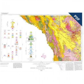
- Geologic Atlas of Texas
- STATEMAP Project Maps
- Geologic Quadrangle Maps
- Cross Sections
- Highway Geology Map
- Energy and Mineral Resource Maps
- Shoreline Change and Other Posters
- Wilcox Group, East Texas, Geological / Hydrological Folios
- Bouguer Gravity Atlas of Texas
- River Basin Regional Studies
- Featured Maps
- Posters
- Teachers & the Public
-
Geological Society Publications
- Gulf Coast Association of Geological Societies
- Alabama Geological Society
- Austin Geological Society
- Corpus Christi Geological Society
- Houston Geological Society
- Lafayette Geological Society
- Mississippi Geological Society
- New Orleans Geological Society
- South Texas Geological Society
- GCS SEPM Publications
- Historic BEG & UT Series


Oligocene Volcanism and ... Caldera Formation...Chinati Mountains, Presidio County, Texas. Digital Download
RI0135D
A free, digital version of this publication can be found on: Texas ScholarWorks
To purchase a print version (if available): RI0135
RI0135D. Oligocene Volcanism and Multiple Caldera Formation in the Chinati Mountains, Presidio County, Texas, by J. C. Cepeda and C. D. Henry. 32 p., 15 figs., 3 tables, 2 pls., 1983. doi.org/10.23867/RI0135D. Downloadable PDF.
To purchase this publication in book format, please order RI0135.
ABSTRACT
The Chinati Mountains caldera, which lies in Trans-Pecos Texas in the southern Basin and Range Province, was formed by eruption of the Mitchell Mesa Rhyolite. The caldera (30 km by 20 km) is part of a larger Oligocene volcanic province that includes Trans-Pecos Texas and extends to the Sierra Madre Occidental of western Mexico.
Volcanism in the Chinati Mountains area began several million years before formation of the Chinati Mountains caldera. Rocks of the Morita Ranch Formation, Infiernito caldera, and Shely Group ring the caldera on the south, east, and north. After its collapse, the caldera was filled by rhyolitic to trachytic lava flows and an ash-flow tuff of the Chinati Mountains Group. These include, from oldest to youngest, the lower trachyte, middle trachyte, lower rhyolite, upper trachyte, and upper rhyolite (ash-flow tuff). The Chinati Mountains Group was then intruded by the West Chinati Stock, the resurgent dome of the caldera.
Three cycles of rhyolitic to trachytic magmatism, all derived from a zoned magma chamber, are represented by (1) Mitchell Mesa Rhyolite to lower and middle trachytes, (2) lower rhyolite to upper trachyte, and (3) upper rhyolite to West Chinati Stock. Dominant caldera collapse followed eruption of the Mitchell Mesa Rhyolite, but collapse is also associated with rhyolitic eruptions in the second and third cycles. The entire sequence erupted between 32 and 33 mya.
The Chinati Mountains area is the site of one major, inactive silver mine and numerous prospects for silver, lead, zinc, copper, molybdenum, uranium, and fluorite. The Shafter silver district produced 31 million ounces of silver from Permian dolomitic limestones just south of the southern boundary of the caldera. Major prospects are associated with a quartz-monzonite porphyry intrusion (copper-molybdenum) just west of Shafter and with the West Chinati Stock (silver, lead, zinc, copper, and fluorite). All mineralization is probably genetically related to the caldera.
Keywords: ash-flow tuffs, calderas, igneous rocks, K/Ar, mineral deposits, Oligocene, Presidio County, Texas, Trans-Pecos, volcanism
CONTENTS
ABSTRACT
INTRODUCTION
REGIONAL SETTING
ACCESS
HISTORY
PREVIOUS WORK
FIELD METHODS
NOMENCLATURE
STRATIGRAPHY
PRE-TERTIARY ROCKS
TERTIARY VOLCANIC ROCKS
Morita Ranch Formation
Infiernito caldera sequence
Shely Group
Mitchell Mesa Rhyolite
Chinati Mountains Group
Collapse agglomerate
Lower trachyte
Middle trachyte
Lower rhyolite
Upper trachyte
Non-porphyritic domes and flows
Upper rhyolite
Gonzales rhyolite
Tascotal Formation
Perdiz Conglomerate Intrusive rocks of the Chinati Mountains caldera
Red Hill
West Chinati Stock
Plagioclase trachyte intrusions
Dikes and sills
Flow-banded dikes and plugs
GEOCHEMISTRY
STRUCTURAL GEOLOGY
LARAMIDE-TYPE FOLDING
CALDERA COLLAPSE
Chinati Mountains caldera
lntracaldera collapse zones
BASIN AND RANGE FAULTS
WEST-TRENDING STRUCTURES
ECONOMIC GEOLOGY
WATER GEOTHERMAL POTENTIAL
BASE AND PRECIOUS METALS
URANIUM
GEOLOGIC HISTORY
PRE-TERTIARY GEOLOGIC HISTORY
MID-TERTIARY VOLCANIC ACTIVITY
Morita Ranch Formation
Infiernito caldera sequence
Shely Group
Chinati Mountains caldera
LATE CENOZOIC EVENTS
SUMMARY
ACKNOWLEDGMENTS
REFERENCES
Figures
1. Approximate distribution of Tertiary volcanic rocks in Mexico and adjacent regions of West Texas, New Mexico, and Arizona
2. Known calderas and the Bofecillos volcano of Trans-Pecos Texas and adjacent Mexico
3. Generalized geologic map of the Chinati Mountains area
4. Index map showing selected previous study areas in Presidio County, Texas, and adjacent Chihuahua, Mexico
5. Known and suspected stratigraphic relations among Tertiary rocks near the Chinati Mountains caldera
6. Generalized stratigraphy of the Morita Ranch Formation near Shafter
7. Generalized stratigraphy of the Shely and Infiernito Groups in the Infiernito caldera area, northern Chinati Mountains
8. Distribution of the Mitchell Mesa Rhyolite, Texas and Mexico
9. Volcanic agglomerate (mud-flow deposit), consisting dominantly of lower rhyolite,in matrix of finer fragments
10. Massive cliffs of lower rhyolite, overlain by upper trachyte, along western front of Chinati Mountains
11. Numerous flows of upper trachyte composing main mass of Chinati Peak
12. a. Flow-banded, rhyolitic dome along Oso Creek south of Aguja Peak. b. Domes of non-porphyriticrhyolite along presumed secondary collapse zone
13. Distinctly layered cliffs of upper rhyolite within secondary collapse area in central Chinati Mountains
14. Distribution of the Perdiz Conglomerate and Tascotal Formation
15. Structural features of the central Chinati Mountains
Tables
1. Nomenclature of the Chinati Mountains Group
2. K-Ar ages of rocks of the Chinati Mountains caldera
3. Comparison of Smith and Bailey caldera model with events in the Chinati Mountains caldera
Plates (in pocket of book)
1. Geologic map of the Chinati Mountains caldera
2. Geologic cross sections of the Chinati Mountains caldera
Citation
Cepeda, J. C., and Henry, C. D., 1983, Oligocene Volcanism and Multiple Caldera Formation in the Chinati Mountains, Presidio County, Texas: The University of Texas at Austin, Bureau of Economic Geology, Report of Investigations No. 135, 32 p.