Reports of Investigations
-
Books & Reports
- Reports of Investigations
- Guidebooks
- Udden Series
- Geological Circulars
- Down To Earth
- Atlases of Major Oil and Gas Reservoirs
- Texas Memorial Museum Publications
- Environmental Geologic Atlas of the Texas Coastal Zone
- Mineral Resource Circulars
- Other Reports
- Seminars and Workshops
- Handbooks
- Submerged Lands of Texas
- Symposia
- Annual Reports
- Open File Reports
-
Maps & Cross Sections
- Thematic Maps
- Miscellaneous Maps, Charts & Sections
- Geologic Atlas of Texas
- STATEMAP Project Maps
- Geologic Quadrangle Maps
- Cross Sections
- Highway Geology Map
- Energy and Mineral Resource Maps
- Shoreline Change and Other Posters
- Wilcox Group, East Texas, Geological / Hydrological Folios
- Bouguer Gravity Atlas of Texas
- River Basin Regional Studies
- Featured Maps
- Posters
- Teachers & the Public
-
Geological Society Publications
- Gulf Coast Association of Geological Societies
- Alabama Geological Society
- Austin Geological Society
- Corpus Christi Geological Society
- Houston Geological Society
- Lafayette Geological Society
- Mississippi Geological Society
- New Orleans Geological Society
- South Texas Geological Society
- GCS SEPM Publications
- Historic BEG & UT Series
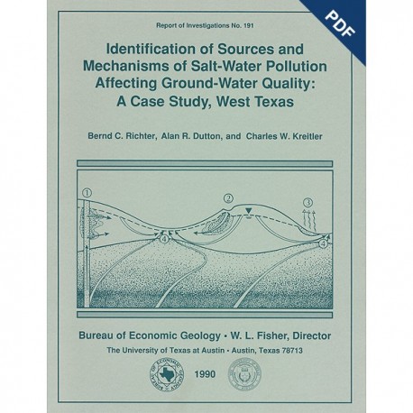
Identification of Sources and Mechanisms of Salt-Water Pollution Affecting Ground-Water Quality. Digital Download
RI0191D
For a print version: RI0191.
RI0191D. Identification of Sources and Mechanisms of Salt-Water Pollution Affecting Ground-Water Quality; A Case Study, West Texas, by B. C. Richter, A. R. Dutton, and C. W. Kreitler. 43 p., 32 figs., 3 tables, 2 appendices, 1990. doi.org/10.23867/RI0191D. Downloadable PDF.
To purchase this publication in book format, please order RI0191.
ABSTRACT
Occurrences of ground-water and soil salinization are numerous in the Concho River watershed and its confluence with the Colorado River in West Texas and in other semiarid regions of Texas and the United States. Salinization results from both natural and anthropogenic processes, which can occur together or separately. To recognize regional salt-water sources and understand salinization mechanisms in the Concho River valley, we investigated chemical and physical characteristics associated with saline ground water. Using more than 1,200 chemical analyses of water samples from previous studies and 76 analyses of samples from this investigation, we differentiated salinization mechanisms by mapping hydrogeologically controlled salinity patterns and hydrochemical facies and by graphically analyzing isotopic compositions and ionic ratios.
In the eastern part of the study area, located in Runnels County, evaporation of irrigation water and ground water from a shallow aquifer accounts for most salinization. In the western part of the study area, located in lrion and Tom Green Counties, much of the saline to brackish ground water is interpreted as being a naturally occurring mixture of subsurface brine flowing eastward from the Midland Basin and shallowly circulating meteoric water recharged in the Concho River watershed. Test drilling to depths below the base of fresh water confirmed the presence of subsurface brine in shallow Permian formations. Aquifers that contain relatively fresh water in outcropping Permian rocks also contain brine and hydrocarbons at depths as shallow as 60 to 275 m (200 to 900 ft), tens of kilometers to the west.
Test drilling also helped document two anthropogenic mechanisms for local mixing of subsurface brine and shallow ground water: (1) upward flowing of brine allowed by abandoned oil and gas exploration holes, where surface casing and borehole plugs are above the base of fresh water, and (2) leaching of accumulated salt from soil beneath former brine-disposal pits, an ongoing process even 20 years after this brine-disposal method was discontinued. A third mechanism, mixing of brine and shallow ground water via abandoned water wells, could not be tested. No records exist on deep water wells that reportedly were drilled into saline portions of aquifers and were abandoned without being plugged.
Chemical compositions of subsurface brines make up a continuous array between two endmember groups in Permian and Pennsylvanian formations. The end-member groups are distinguishable by graphical analysis of the (1) calcium, magnesium, sodium, and sulfate concentrations, (2) Br/CI ratio plotted against chloride concentration, and (3) Cl/SO, ratio plotted against sulfate concentration and Na/Ca ratio. Most saline samples of shallow ground water in the Concho River watershed are chemically similar to the Permian formation brine end member. Coleman Junction Formation brines cannot be chemically distinguished from other Permian formation brines. Information about organic-acid anions, minor and trace constituents other than bromide, and isotopes of hydrogen, oxygen, carbon, and sulfur also can be used to differentiate between Permian and Pennsylvanian brines but may not always be useful measurements to determine sources of salinization in shallow ground waters.
Keywords: Concho River, contamination, hydrogeochemistry, hydrogeology, Permian formations, salinization sources, West Texas
CONTENTS
Abstract
Introduction
Hydrogeologic Setting
Shallow Ground Water
Subsurface Brine
Methods
Previously Identified Geochemical Indicators
Data and Techniques
Shallow Ground Water
Hydrochemical Facies
Salinity Distribution and Ionic Ratios
Subsurface Brine
Salinization Sources
Evaporative Concentration
Mixing Mechanisms Natural Discharge from Permian Formations
Abandoned Deep Water Wells
Abandoned Oil and Gas Wells
Brine-Disposal Pits
Production and Injection System Leaks
Conclusions
Acknowledgments
References
Appendix A. Chemical analyses of shallow ground water collected for this study
Appendix B. Chemical and isotopic composition of subsurface brines
Figures
1. Generalized geologic map of the Concho River watershed and its confluence with the Colorado River
2. Surface-casing depths in oil and gas exploration holes required by Texas Water Commission
3. Potentiometric surface of the Guadalupian Series
4. Total dissolved solids in subsurface brine from the Guadalupian Series
5. Oil and gas fields, depths of oil shows during the early 1900's, and depths of saline water in the study area
6. Location of sample sites
7. Piper diagrams of hydrochemical facies in shallow ground water
8. Hydrochemical facies in shallow ground water
9. Chemical composition of shallow ground waters, relative to stability fields of calcite and dolomite at 25°C
10. Piper diagrams of shallow ground water with chloride concentrations less than and greater than 250 mg/L in Tom Green and Runnels Counties
11. Total dissolved solids in shallow ground water collected before 1942 in eastern Irion and Tom Green Counties
12. Total dissolved solids in ground water collected from 1942 through 1954 in eastern Irion and Tom Green Counties
13. Total dissolved solids in ground water collected after 1954 in eastern Irion, Runnels, and Tom Green Counties
14. Variations in calcium, magnesium, and sulfate concentrations with chloride concentration in shallow ground water and in subsurface brine
15. Nitrate concentrations in shallow ground water
16. Variation in δD and δ18O in shallow ground water and in subsurface brine
17. Variation in Br/Cl ratios with chloride concentration in shallow ground water and in subsurface brine
18. Variation in calcium, magnesium, sodium, and sulfate concentrations with chloride concentration in subsurface brine
19. Variation in acetate concentration with δ18O in subsurface brine
20. Variation in δ13C with δ18O in subsurface brine
21. Variation in delta34S with sulfate concentration in subsurface brine
22. Conceptual model of salinity sources in the Concho River watershed
23. Variation in sodium and chloride ionic concentrations in shallow ground water and in subsurface brine
24. Variation in Cl/SO4 ratio with SO4 concentration in shallow ground water and in subsurface brine
25. Variation in Cl/SO4 with Na/Ca ratios in shallow ground water and in subsurface brine
26. Location of abandoned oil and gas exploration boreholes, Tom Green County
27. Schematic diagram of abandoned borehole 47 and test well 48, Washington County School Land lease
28. Active brine-disposal areas identified in 1964 aerial photographs, Tom Green County
29. Relationship between chloride concentration and depth in soil at site of abandoned brine-disposal pit near Tankersley
30. Relationship between chloride concentration and depth in soil underlying abandoned brine-disposal pits 46a and 46b in the Susan Peak field
31. Variation in calcium, magnesium, sodium, and sulfate concentrations with chloride concentration in shallow ground water in the Tankersley area
32. Estimates of water/oil ratios produced from oil and gas wells in Tom Green and Irion Counties, 1950-1969
Tables
1. Generalized stratigraphic chart for the Concho River watershed
2. Data used to estimate amount of salt water produced from oil and gas fields in Tom Green and Irion Counties, 1950-1969
3. Injection pressures for salt-water disposal in Tom Green County
Citation
Richter, B.C., Dutton, A. R., and Kreitler, C. W., 1990, Identification of Sources and Mechanisms of Salt-Water Pollution Affecting Ground-Water Quality; A Case Study, West Texas: The University of Texas at Austin, Bureau of Economic Geology, Report of Investigations No. 191, 43 p.

