Geological Circulars
-
Books & Reports
- Reports of Investigations
- Guidebooks
- Udden Series
- Geological Circulars
- Down To Earth
- Atlases of Major Oil and Gas Reservoirs
- Texas Memorial Museum Publications
- Environmental Geologic Atlas of the Texas Coastal Zone
- Mineral Resource Circulars
- Other Reports
- Seminars and Workshops
- Handbooks
- Submerged Lands of Texas
- Symposia
- Annual Reports
- Open File Reports
-
Maps & Cross Sections
- Thematic Maps
- Miscellaneous Maps, Charts & Sections
- Geologic Atlas of Texas
- STATEMAP Project Maps
- Geologic Quadrangle Maps
- Cross Sections
- Highway Geology Map
- Energy and Mineral Resource Maps
- Shoreline Change and Other Posters
- Wilcox Group, East Texas, Geological / Hydrological Folios
- Bouguer Gravity Atlas of Texas
- River Basin Regional Studies
- Featured Maps
- Posters
- Teachers & the Public
-
Geological Society Publications
- Gulf Coast Association of Geological Societies
- Alabama Geological Society
- Austin Geological Society
- Corpus Christi Geological Society
- Houston Geological Society
- Lafayette Geological Society
- Mississippi Geological Society
- New Orleans Geological Society
- South Texas Geological Society
- GCS SEPM Publications
- Historic BEG & UT Series
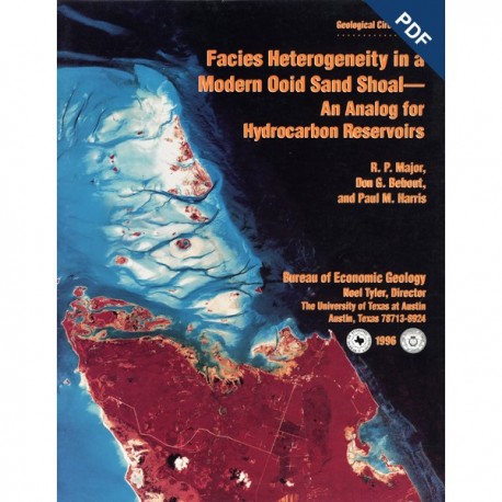
Facies Heterogeneity in a Modern Ooid Sand Shoal - Digital Download
GC9601D
Facies Heterogeneity in a Modern Ooid Sand Shoal--An Analog for Hydrocarbon Reservoirs, by R. P. Major, D. G. Bebout, and P. M. Harris. 30 p., 19 figs., 1996. ISSN: 2475-3637. doi.org/10.23867/gc9601D. Digital Version.
For a print version: GC9601.
GC9601D. Facies Heterogeneity in a Modern Ooid Sand Shoal--An Analog for Hydrocarbon Reservoirs, by R. P. Major, D. G. Bebout, and P. M. Harris. 30 p., 19 figs., 1996. ISSN: 2475-3637. Downloadable PDF. doi.org/10.23867/gc9601D.
To purchase this publication in book format, please order GC9601.
ABSTRACT
The ooid-sand shoals of the Joulters Cays area of Great Bahama Bank were chosen for detailed sedimentologic study to investigate patterns of internal heterogeneity within a modern carbonate sand deposit and to develop criteria for predicting the lateral extent of porous and permeable carbonate grainstone facies in hydrocarbon reservoirs. Using aerial photographs, surface observations, and shallow coring, we documented three sedimentary facies in a 2.7-km2 (1-mi2) study area dominated by mobile ooid sands. Cores were collected at the spacing characteristic of wells in mature hydrocarbon reservoirs.
The shoal crest at this locality had aggrading and northward-prograding (parallel to depositional strike) washover bars composed of crossbedded, well-sorted ooid sands. Burrowed, poorly sorted ooid sands were present seaward of the washover bars, and poorly sorted ooid sand and mud occupied a stabilized area bankward of the actively migrating shoal and local areas between washover bars on the crest of the shoal. Intraclast-rich zones and mud layers were also present. The shoal was crosscut by tidal channels, and older washover bars were in the process of being dissected by tidal currents. We anticipate that, upon burial and compaction, the poorly sorted ooid sand and mud facies will most likely retain negligible porosity and permeability, whereas both the well-sorted ooid sand and poorly sorted ooid sand facies will maintain their high initial porosity and permeability. However, in many ancient subsurface reservoirs, rocks with depositional textures similar to the well-sorted ooid sand facies have undergone considerable cementation and have resultant low porosity and permeability. Thus, in many settings, the poorly sorted ooid sand facies could retain the highest porosity and permeability. Additional cementation of intraclast-rich zones will most likely result in thin, low-porosity barriers within a reservoir. Hurricane Andrew, a category 4 hurricane with wind velocities of approximately 240 km/h (150 mi/h), passed over Joulters Cays in a westerly direction in August 1992, subsequent to our coring program. The hurricane profoundly changed surface features in the study area by eroding washover bars on the crest of the shoal and by transporting ooid sand seaward, leaving a nearly flat shoal crest overlain by a laterally continuous, decimeters-thick (foot-thick) lens of well-sorted ooids that thins seaward and bankward. Posthurricane tidal currents deposited a centimeters-thick (inches-thick) discontinuous layer of carbonate mud over this lens of well-sorted ooids. This mud, although more likely to be preserved in tidal channels than on the shoal crest, has the potential to form low-permeability layers that will define reservoir compartment boundaries. Modern sediment analog studies are an important addition to subsurface reservoir and outcrop analog characterization. Knowledge of the internal geometry of a sand shoal is critical for geologically targeted deployment of production technology and for predicting the efficiency of waterflood and other enhanced-oil recovery operations.
Keywords: Bahama Islands, hurricane, modern carbonate sediment, ooid shoal, reservoir analog
CONTENTS
Abstract
Introduction
Geologic Setting
Regional Facies Relationships
Exploration-Scale Heterogeneity
Methods
Sampling Grid
Coring Procedures
Core Description
Aerial Photographs
Facies Architecture
Depositional Facies
Well-Sorted Ooid Sand
Poorly Sorted Ooid Sand
Poorly Sorted Ooid Sand and Mud
Sedimentary Features
lntraclast-Rich Zones
Mud Layers
Development-Scale Heterogeneity
Recent Depositional History
Effects of Hurricane Andrew
Ancient Analogs
Alabama Ferry Field
San Andres Formation Outcrop
Conclusions
Acknowledgments
References
Figures
1. Location map and regional. exploration-scale facies map of Joulters Cays
2. Regional. exploration-scale facies cross section of Joulters Cays
3. Regional, exploration-scale isopach maps of Joulters Cays
4. Low-altitude aerial photograph and cross-section traces of development-scale study area
5. Vibracore rig
6. Facies cross sections of development-scale study area
7. Photographs of well-sorted ooid sand facies
8. Photographs of poorly sorted ooid sand facies
9. Photographs of poorly sorted ooid sand and mud facies
10. Photograph of cemented intraclasts in core B3
11. Photograph of mud layers in core D3
12. Aerial photographs of development-scale study area taken in 1947, 1967, and 1989
13. Surface facies-distribution maps of reservoir-scale study area in 1947, 1967, and 1989
14. Radar image of track of Hurricane Andrew
15. Aerial photograph and surface facies-distribution map of reservoir-scale study area after Hurricane Andrew
16. Posthurricane mud layer on the crest of Joulters Cays
17. lsopach map of Alabama Ferry field
18. Well log cross section in Alabama Ferry field
19. Outcrop exposure of San Andres Formation, Guadalupe Mountains, West Texas and New Mexico
Citation
Major, R. P., Bebout, D. G., and Harris, P. M., 1996, Facies Heterogeneity in a Modern Ooid Sand Shoal--An Analog for Hydrocarbon Reservoirs: THe University of Texas at Austin, Bureau of Economic Geology, Geological Circular 9601D, 30 p. doi.org/10.23867/gc9601D.
