Reports of Investigations
-
Books & Reports
- Reports of Investigations
- Guidebooks
- Udden Series
- Geological Circulars
- Down To Earth
- Atlases of Major Oil and Gas Reservoirs
- Texas Memorial Museum Publications
- Environmental Geologic Atlas of the Texas Coastal Zone
- Mineral Resource Circulars
- Other Reports
- Seminars and Workshops
- Handbooks
- Submerged Lands of Texas
- Symposia
- Annual Reports
- Open File Reports
-
Maps & Cross Sections
- Thematic Maps
- Miscellaneous Maps, Charts & Sections
- Geologic Atlas of Texas
- STATEMAP Project Maps
- Geologic Quadrangle Maps
- Cross Sections
- Highway Geology Map
- Energy and Mineral Resource Maps
- Shoreline Change and Other Posters
- Wilcox Group, East Texas, Geological / Hydrological Folios
- Bouguer Gravity Atlas of Texas
- River Basin Regional Studies
- Featured Maps
- Posters
- Teachers & the Public
-
Geological Society Publications
- Gulf Coast Association of Geological Societies
- Alabama Geological Society
- Austin Geological Society
- Corpus Christi Geological Society
- Houston Geological Society
- Lafayette Geological Society
- Mississippi Geological Society
- New Orleans Geological Society
- South Texas Geological Society
- GCS SEPM Publications
- Historic BEG & UT Series


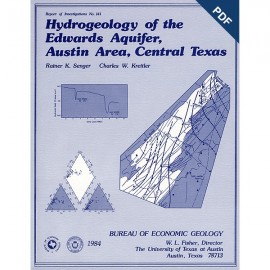
Hydrogeology of the Northern Segment of the Edwards Aquifer, Austin... Digital Download
RI0192D
For a print version: RI0192.
RI0192D. Hydrogeology of the Northern Segment of the Edwards Aquifer, Austin Region, by R. K. Senger, E. W. Collins, and C. W. Kreitler. 58 p., 34 figs., 2 tables, 1990. doi.org/10.23867/RI0192D. Downloadable PDF.
To purchase this publication in book format, please order RI0192.
ABSTRACT
Geologic mapping and fracture analysis of the Lower Cretaceous Edwards aquifer strata near Georgetown and Round Rock, Texas, were performed to provide a better understanding of the geologic framework of the Balcones Fault Zone and to provide information for assessing ground-water flow characteristics. Cretaceous strata dip gently eastward and are locally overlain by terrace deposits and alluvium. Several major normal faults, downthrown to the east, strike northward across the area. Gentle flexures, possibly related to faulting, parallel the faults. Minor normal faults and joints are most abundant in areas adjacent to major faults and flexures. These fractured-strata zones probably parallel the length of the faults or flexure axes and may be as wide as 1 mi (1.6 km).
Water-level, precipitation, and hydrochemical data were studied to characterize the hydrogeology of the northern Edwards aquifer. The potentiometric surfaces for conditions of high flow and low flow indicate a regional flow system that is noticeably affected by Balcones faults along the north and south edges of the northern segment of the Edwards aquifer. In the Georgetown area where faults are less abundant, regional ground water generally flows eastward, following approximately the dip of the stratigraphic units. Ground-water flow circulation is faster in the western part of the aquifer than in the eastern part. Main discharge for the western, fast-flowing system occurs along fractures through springs and seeps at the major creeks and rivers in the Georgetown area. Some recharge water moves farther downdip past these springs, where water levels show large seasonal variations due to reduced transmissivity and storativity of the aquifer.
The hydrochemistry of Edwards ground water indicates an evolution of ground water from a Ca-HCO, and Ca-Mg-HCO, to a mixed-cation-HCO, farther downdip to a Na-HCO, and finally to a Na-mixed-anion-type water. The hydrochemical evolution of ground water along the flow path indicates congruent and incongruent reaction of recharge water with limestone, resulting in a decrease in Ca/Mg ratios. Tritium concentrations are relatively high in the unconfined part, indicating that ground water was recently recharged. In the confined part, Ca decreases owing to cation exchange, causing an increase in Na. Gypsum dissolution in addition to influx of Glen Rose ground water causes SO, concentration to increase, and mixing with Na-Cl-type water results in both Na and Cl increase. The Na-Cl component in the Na-mixed-anion-type water in Williamson County, where faults are less abundant, may represent connate, interstitial water, as suggested by Sr data. However, Na increases disproportionately to Cl because of cation exchange. Ca ions, derived from gypsum dissolution, are probably exchanged for Na on clay minerals, although shale occurs only as relatively thin layers within the Edwards Limestone. In the confined part of the aquifer, large fluctuations in the potentiometric surface cause seasonal reversals in the vertical flow component. These thin shale layers within the Edwards aquifer strata represent large surface areas for vertical flow; thus, the high Na concentrations can be attributed to cation exchange.
Keywords: Balcones Fault Zone, Edwards aquifer, hydrochemical processes, hydrodynamics
CONTENTS
Abstract
Introduction
Previous studies
Methods
Hydrogeologic, physiographic, and climatic settings
Geologic framework
Physiography
Hydrologic framework
Climate
Geology
Stratigraphy
Glen Rose Formation
Walnut Formation
Comanche Peak Formation
Edwards Limestone
Georgetown Formation
Del Rio Formation
Buda Formation
Eagle Ford Formation
Austin Group
Quaternary deposits
Structure
Fractures in aquifer limestones
Aquifer hydrodynamics
Ground-water flow patterns, Edwards aquifer
Characterization of water-level variations
Long-term water-level variations, Edwards aquifer
Long-term water-level variations, lower Trinity aquifer
Short-term water-level fluctuations, Edwards aquifer
Water-level patterns
Water-level responses to recharge
Water-level responses to discrete rainfall events
Recharge and discharge mechanisms
Hydrochemistry
Edwards aquifer
Trinity aquifer
Discussion
Hydrochemical patterns
Sulfur isotopic composition
Hydrochemical evolution of ground water
Comparison with the southern aquifer segments
Leakage from deeper formations
"Bad-water" line
Hydrochemical implications of flow through the Georgetown Formation
Recommendations for future studies
Conclusions
Acknowledgments
References
Figures
1. Regional structural setting of the Balcones Fault Zone
2. Map of the Edwards aquifer outcrop belt and location of monitoring wells and rain gauges
3. Physiographic provinces of the Central Texas area
4. Stratigraphic column of Cretaceous rocks of the northern segment of the Edwards aquifer, Austin region
5. Dip-oriented cross section A-A' of the Balcones Fault Zone
6. Geologic map and cross section B-B' of study area
7. Distribution and geometries of major faults and flexures, minor faults, and joints exposed along the North Fork of the San Gabriel River
8. Potentiometric surface map representing high-flow conditions of the northern segment of the Edwards aquifer, Austin region
9. Potentiometric surface map representing low-flow conditions of the northern segment of the Edwards aquifer, Austin region
10. Water-level hydrographs of several wells in the study area
11. Water-level hydrograph of well 58-27-305 based on daily measurements and graph of monthly rainfall amounts in the area
12. Monthly pumpage volumes by the cities of Round Rock and Georgetown
13. Pattern of continuous water-level records from wells 58-35-110, 58-19-507, 58-19-205, and 58-19-623
14. Pattern of continuous water-level records from wells 58-27-210, 58-27-305, and 58-20-409
15. Water-level hydrographs based on weekly measurements for wells 58-27-103, 58-27-217, and 58-19-703
16. Daily water-level hydrographs based on continuous recordings for well 58-35-110
17. Daily water-level hydrographs based on weekly measurements for well 58-19-622 and on continuous recordings for well 58-19-623
18. Daily water-level hydrographs based on continuous recordings for wells 58-19-507 and 58-19-205
19. Daily water-level hydrographs based on continuous recordings for wells 58-19-910 and 58-20-409
20. Daily water-level hydrographs based on continuous recordings for wells 58-27-833 and 58-27-305
21. Continuous water-level recordings showing water-level responses in wells 58-19-623, 58-27-210, 58-35-110, and 58-19-507 to a discrete rainfall event
22. Piper diagram of ground water from the Edwards aquifer
23. Geographic distribution of water types and total dissolved solids in the Edwards aquifer
24. Geographic distribution of fluoride concentrations and water types in the Edwards aquifer
25. Geographic distribution of nitrate concentrations and water types in the Edwards aquifer
26. Piper diagram of ground water from the Glen Rose Formation (upper and middle Trinity aquifer)
27. Piper diagram of ground water from the Hosston Formation (lower Trinity aquifer)
28. (a) Molal SO4/Cl ratios versus SO4 concentrations and (b) concentrations of SO4 versus δ34S isotopic concentrations for four samples collected during this study compared with samples collected from the Edwards aquifer, San Antonio region
29. Plot of Ca-SO4 (molal) versus molal HC03 concentrations of water samples from the northern segment of the Edwards aquifer
30. Plot of molal concentrations of Na versus Ca
31. Plot of molal concentrations of Na versus Cl
32. Plot of Na-Cl (molal) versus molal concentration of SO4
33. Log of molal concentrations of Sr versus Cl for the confined part of the central segment in the San Antonio region, the Barton Springs segment, and the northern segment
34. Log of molal Sr concentrations versus Ca/Mg ratios for all sections of the Edwards aquifer
Tables
1. Fracture-spacing data measured in Georgetown Formation, Edwards Limestone, and Comanche Peak Formation
2. Results of chemical analyses of water samples collected during this study
Citation
Senger, R. K., Collins, E. W., and Kreitler, C. W., 1990, Hydrogeology of the Northern Segment of the Edwards Aquifer, Austin Region: The University of Texas at Austin, Bureau of Economic Geology, Report of Investigations No. 192, 58 p.