Reports of Investigations
-
Books & Reports
- Reports of Investigations
- Guidebooks
- Udden Series
- Geological Circulars
- Down To Earth
- Atlases of Major Oil and Gas Reservoirs
- Texas Memorial Museum Publications
- Environmental Geologic Atlas of the Texas Coastal Zone
- Mineral Resource Circulars
- Other Reports
- Seminars and Workshops
- Handbooks
- Submerged Lands of Texas
- Symposia
- Annual Reports
- Open File Reports
-
Maps & Cross Sections
- Thematic Maps
- Miscellaneous Maps, Charts & Sections
- Geologic Atlas of Texas
- STATEMAP Project Maps
- Geologic Quadrangle Maps
- Cross Sections
- Highway Geology Map
- Energy and Mineral Resource Maps
- Shoreline Change and Other Posters
- Wilcox Group, East Texas, Geological / Hydrological Folios
- Bouguer Gravity Atlas of Texas
- River Basin Regional Studies
- Featured Maps
- Posters
- Teachers & the Public
-
Geological Society Publications
- Gulf Coast Association of Geological Societies
- Alabama Geological Society
- Austin Geological Society
- Corpus Christi Geological Society
- Houston Geological Society
- Lafayette Geological Society
- Mississippi Geological Society
- New Orleans Geological Society
- South Texas Geological Society
- GCS SEPM Publications
- Historic BEG & UT Series
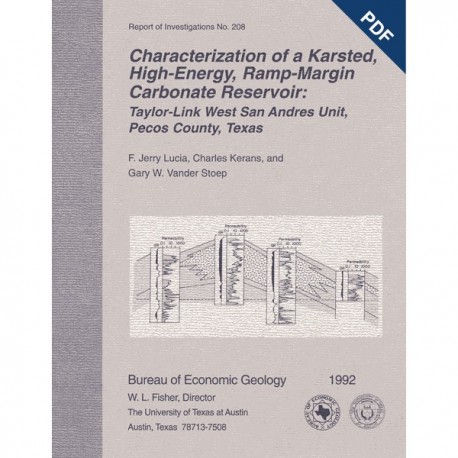
Characterization of a Karsted...Carbonate Reservoir: Taylor-Link West San Andres Unit, Pecos County. Digital Download
RI0208D
For a print version: RI0208.
RI0208D. Characterization of a Karsted, High-Energy, Ramp-Margin Carbonate Reservoir: Taylor-Link West San Andres Unit, Pecos County, Texas, by F. J. Lucia, Charles Kerans, and G. W. Vander Stoep. 46 p., 37 figs., 3 tables, 1992. doi.org/10.23867/RI0208D. Downloadable PDF.
To purchase this publication in book format, please order RI0208.
ABSTRACT
A waterflood was begun in 1985 in Taylor-Link West San Andres unit (10 million barrels cumulative production) on the south margin of the Central Basin Platform to capture a remaining mobile oil target estimated at 20 million barrels. From the onset of injection, oil-water ratios of 0.01 or less were recorded, which indicated that a simple, layered reservoir model was inadequate to describe observed performance. An integrated geologic-engineering model that used 12 continuous cores, petrography, gamma-ray-neutron wireline logs, and capillary pressure data from the upper San Andres Formation instead revealed a complex karst-modified ramp-crest grainstone reservoir. The bimodal fracture-interparticle pore system of this reservoir promoted extensive water cycling and poor sweep efficiency.
The Taylor-Link West San Andres reservoir contains, in ascending order, five intervals: (1) basal bryozoan-brachiopod-crinoid packstone-grainstone, (2) crinoid-brachiopod wackestone, (3) mudstone, (4) fusulinid wackestone, and (5) capping grainstone. The grainstone interval makes up more than 80 percent of the San Andres reservoir. Critical diagenetic events influencing reservoir development were (1) early reflux dolomitization and evaporite emplacement and (2) post-San Andres subaerial exposure and karst development.
Core and thin-section descriptions showed that porosity could be divided into two groups of pore types: (1) a matrix group composed of intergranular, intercrystalline, and separate-vug pore types related to depositional and early diagenetic events and (2) a touching-vug group composed of fracture, microbreccia, and large-vug porosity related to karstification. Unique relationships between interparticle porosity and water saturation for intergranular and intercrystalline pore types were used to calculate original water saturation because no reliable resistivity logs exist.
Volumetric calculations showed that the reservoir originally contained 48.2 million barrels of stock-tank oil. The reservoir has produced 10 million barrels of oil and has estimated reserves of 1.5 million barrels. This leaves 36 million barrels remaining in the reservoir, of which 20 million barrels is mobile oil. The richest area is in the ooid-peloid grainstone facies of the grainstone interval, which has 7.1 million barrels of stock-tank remaining mobile oil in place.
Fluid flow was characterized by two basic flow units. Flow unit A has interparticle flow in the ooid-peloid grainstone facies of the grainstone interval and contains most of the remaining oil saturation. Flow unit B contains little oil saturation and has flow through the fracture, microbreccia, and large-vug pore system in the fusulinid-wackestone interval and the fusulinid-peloid packstone facies of the grainstone interval.
Engineering analysis of the waterflood performance indicated that injection water is cycling through flow unit B, Because that unit has little oil saturation, oil cut is about 0.01. A recently acquired sponge core in the ooid-peloid grainstone facies shows that the mobile oil has migrated into the upper part of the grainstone facies.
Keywords: calcification, dolomite, flow model, fractures, karst, mobile oil, permeability, San Andres, vugs, Pecos County, Texas
CONTENTS
ABSTRACT
INTRODUCTION
FIELD HISTORY
REGIONAL GEOLOGlC SETTING
RESERVOIR GEOLOGY
Depositional History
San Andres Vertical Sequence
Bryozoan-Brachiopod-CrinoidPackstone-Grainstone Interval
Crinoid-Brachiopod-Wackestone lnterval Mudstone interval
Fusulinid-Wackestone Interval
Grainstone Interval
Depositional Facies-Grainstone Interval
Distribution of Facies-Grainstone Interval
Grayburg Formation Facies
Depositional Model
Outer Ramp
Ramp Crest
Diagenetic History
Dolomitization and Evaporite Emplacement
Subaerial Exposure and Karstification
Classification and Occurrence of Fracture-Breccia-Large-Vug Systems
Early Diagenetic History
DEVELOPMENT OF AN ENGINEERING RESERVOIR MODEL
Reconstruction of Original Oil Saturation from Core Data
Calculation of Original Oil in Place
Remaining Mobile Oil
Flow Model
Permeability Distribution
Reservoir Model
CONCLUSIONS
ACKNOWLEDGMENTS
REFERENCES
Figures
1. SoPhiH values of cored wells
2. Taylor-Link West stock tank original oil in place
3. Taylor-Link West volumetrics
4. Regional dip-oriented north-south cross section A-A' from the south end of Central Basin Platform across Sheffield Channel to Southern Shelf
5. Type gamma-ray/neutron log and characteristic lithologies and depositional environments of the stratigraphic intervals of the upper San Andres and Grayburg Formations at Taylor-Link West field
6. Photographs of core slabs of the bryozoan-brachiopod-crinoid packstone-grainstone interval
7. Photographs of the fusulinid-wackestone interval
8. Photographs of the grainstone interval
9. lsopach map of gamma-ray response of units having <50 API in the grainstone interval
10. Photographs of core slabs of basal Grayburg deposits
11. Summary of diagenetic events and relative timing of diagenesis in the San Andres Formation at Taylor-Link West reservoir
12. Photographs of indicators of relict anhydrite from the San Andres Formation at Taylor-Link West reservoir
13. Photographs of karst-related features displayed in Taylor-Link West core
14. Simplified classification scheme used for characterizing fracture and microbreccia fabrics
15. Photographs of fracture and microbreccia fabrics from core slabs
16. Vertical distribution of fracture-microbreccia fabrics from the Mid-America University No. 59 well, northwest part of the reservoir
17. Vertical distribution of fracture-microbreccia fabrics from the Mid-America University No. 67 well, core area of grainstone bar complex
18. Pore-space classification used in this report
19. Capillary pressure curves of samples having varying porosity values that show relation between saturation and height for brine capillary pressure curves and mercury capillary pressure curves
20. Capillary pressure curves for three porosity values from the fusulinid-wackestone interval showing the estimated elevation of the FWL, assuming that 50-percent water saturation equals the producing water level
21. Porosity-water-saturation cross plot and best-fit equation constructed from brine and mercury capillary pressure data
22. Capillary pressure curves for 200-ym grainstone fabric and for 15-µm wackestone fabric
23. Porosity-water-saturation-rock fabric cross plot and best-fit equations constructed from capillary pressure data
24. Effect of patchy porosity distribution on oil saturation calculations for the grainstone fabric
25. Depth plot showing matrix porosity types, particle size, and results of matrix saturation calculations for Mid-America University No. 66 well
26. Schematic structural cross section illustrating terminology used in volumetric calculations
27. Structure map contoured on top of wackestone interval showing location of producing water level
28. Producing water levels from grainstone and fusulinid-wackestone intervals superimposed on isopach map of grainstone interval
29. Iso-cumulative-production map of Taylor-Link West San Andres field, showing cumulative production through December 1984 for each 40-acre tract in the field
30. lsopach map of remaining mobile oil at Taylor-Link West
31. Porosity-permeability-particle-size cross plot for interparticle porosity showing best-fit equations for intergranular pores between 200-pm grains and for intercrystalline pores between 15 -pm dolomite crystals
32. Depth plot showing matrix and total permeability and relationship to matrix saturation calculations for well 66
33. Depth plot showing matrix and total permeability and relationship to matrix saturation calculation for well 59
34. Northwest-southwest cross section C-C'of the reservoir model of the Taylor-Link West San Andres reservoir showing distribution of flow units A and B
35. Production history of Taylor-Link West San Andres waterflood project
36. Injection profile of well 70, showing that increasing water-injection rates causes more water to flow into the touching-vug system of the fusulinid-wackestone interval
37. Vertical distribution of oil saturation in ooid-peloid grainstone facies from sponge core taken in December 1990 from well 84-P
Tables
1. SoPhiH values of cored wells
2. Taylor-Link West stock tank original oil in place
3. Taylor-Link West volumetrics
Citation
Lucia, F. J., Kerans, Charles, and Vander Stoep, G. W., 1992, Characterization of a Karsted, High-Energy, Ramp-Margin Carbonate Reservoir: Taylor-Link West San Andres Unit, Pecos County, Texas: The University of Texas at Austin, Bureau of Economic Geology, Report of Investigations No. 208, 46 p.
