Reports of Investigations
-
Books & Reports
- Reports of Investigations
- Guidebooks
- Udden Series
- Geological Circulars
- Down To Earth
- Atlases of Major Oil and Gas Reservoirs
- Texas Memorial Museum Publications
- Environmental Geologic Atlas of the Texas Coastal Zone
- Mineral Resource Circulars
- Other Reports
- Seminars and Workshops
- Handbooks
- Submerged Lands of Texas
- Symposia
- Annual Reports
- Open File Reports
-
Maps & Cross Sections
- Thematic Maps
- Miscellaneous Maps, Charts & Sections
- Geologic Atlas of Texas
- STATEMAP Project Maps
- Geologic Quadrangle Maps
- Cross Sections
- Highway Geology Map
- Energy and Mineral Resource Maps
- Shoreline Change and Other Posters
- Wilcox Group, East Texas, Geological / Hydrological Folios
- Bouguer Gravity Atlas of Texas
- River Basin Regional Studies
- Featured Maps
- Posters
- Teachers & the Public
-
Geological Society Publications
- Gulf Coast Association of Geological Societies
- Alabama Geological Society
- Austin Geological Society
- Corpus Christi Geological Society
- Houston Geological Society
- Lafayette Geological Society
- Mississippi Geological Society
- New Orleans Geological Society
- South Texas Geological Society
- GCS SEPM Publications
- Historic BEG & UT Series


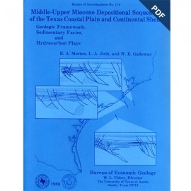
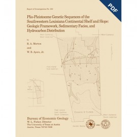
Plio-Pleistocene Depositional Sequences of SE Texas Continental Shelf and Slope:...Digital Download
RI0200D
For a print version: RI0200.
RI0200D. Plio-Pleistocene Depositional Sequences of the Southeastern Texas Continental Shelf and Slope: Geologic Framework, Sedimentary Facies, and Hydrocarbon Distribution, by R. A. Morton, R. H. Sams, and L. A. Jirik. 80 p., 40 figs., 1 table, 1 appendix, 3 pls., 1991. doi.org/10.23867/RI0200D. Downloadable PDF.
To purchase this publication in book format, please order RI0200.
ABSTRACT
Plio-Pleistocene strata of offshore Texas having hydrocarbon exploration potential are restricted to the southeastern continental shelf and upper continental slope. This thick wedge of nearshore and deep-marine sediments firms the west margin of a late Neogene and Quaternary depocenter. The wedge is divided into eight genetic sequences on the basis of well logs, paleontological reports, and seismic profiles. These same data are also used to establish the structural framework, determine the timing of deformation, and map the principal depositional systems of the western Gulf Coast Basin during the past 3 m.y. Contemporaneous sea-level fluctuations, salt migration, and shifting sites of sedimentation caused substantial lateral variations in sedimentary facies as well as structural styles. The resulting complex geologic history of this part of the basin directly controlled the migration and entrapment of hydrocarbons.
Early Pliocene inundation of the continental platform and attendant deposition of marine mudstones was interrupted by a fall in sea level and development of a broad entrenched system landward of the shelf margin. Repeated excavation of the entrenched system during the middle and late Pliocene promoted the deposition of successive sand-rich submarine channels and fans. These lowstand deposits extended more than 100 mi (160 km) basinward of the paleomargin. Overlying Pleistocene sediments were deposited mainly by mud-rich fluvial-deltaic systems of moderate size. These rivers and shelf-edge deltas constructed a broad continental platform that buried the submarine fans and prograded the shelf margin tens of miles basinward. Sand-rich delta-front deposits were faulted and slumped along unstable shelf margins and were resedimented on the continental slope. As a result, the Pleistocene sandstones were trapped by growth faults and in withdrawal synclines and therefore are not present very far downslope of the extant shelf margin.
Plio-Pleistocene reservoirs contain an estimated 1.5 billion barrels of oil equivalent in at least 75 different fields. The fields are located near diapirs or faults associated with late salt movement. Structural style, reservoir facies, and hydrocarbon composition are used to group the fields into six exploration plays. The most prolific play encompasses stacked sandstone reservoirs and broad rollover anticlines located between the Trimosina regional and counterregional fault systems. Each play produces gas and some oil; however, most of the oil comes from the oldest lowstand submarine fans (Globoquadrina altispira and Lenticulina 1). All six plays offer some potential for either new field discoveries or reserve growth.
Keywords: depositional system, genetic sequence, Gulf Coast, hydrocarbons, Plio-Pleistocene, Texas
CONTENTS
Abstract
Introduction
Exploration history and regional setting
Sources of data
Electric logs Paleontological reports
Seismic profiles
Climate and eustatic fluctuations
Pliocene-Pleistocene boundary
Structural framework
Principal structural features
Extensional faults
Shale ridges and salt diapirs
Unconformities
Formation temperatures
Structural styles
Timing of structural movement
Depositional system s, systems tracts, an d genetic sequences
Depositional systems
Shelf-edge delta systems
Slope systems
Depositional systems tracts
Sequence boundaries and offshore sequences
Onshore formations
Plio-Pleistocene depositional framework
Mapping depositional systems and shelf margins
Characteristics of Plio-Pleistocene genetic sequences
Pre-Buliminella 1 (not mapped)
Buliminella 1 to Globoquadrina altispira (unit 1)
Globoquadrina altispira to Lenticulina. 1 (unit 2)
Lenticulina 1 to Angulogerina B (unit 3)
Angulogerina B to Hyalinea balthica (unit 4)
Hyalinea balthica to Trimosina A (unit 5)
Trimosina A to Globorotalia flexuosa (unit 6)
Post-Globorotalia flexuosa (unit 7
Summary of depositional and structural history
Late Miocene and early Pliocene
Middle Pliocene
Late Pliocene
Early Pleistocene
Middle Pleistocene
Late Pleistocene
Hydrocarbon generation and distribution
Source rock potential, thermal maturation, and petroleum migration
Spatial distribution of hydrocarbons
Delineation of hydrocarbon plays
Play characteristics and exploration potential
Play 1
Play 2
Play 3
Play 4
Summary and conclusions
Acknowledgments
References
Appendix: Cumulative production and recoverable reserves in Plio-Pleistocene fields, by play
Figures
1. Chronostratigraphic and biostratigraphic subdivision of Plio-Pleistocene strata in the western Gulf Coast Basin
2. Schematic cross section of Plio-Pleistocene strata in the western Gulf Coast Basin showing the lithologic and biostratigraphic criteria used to correlate genetic sequences
3. Regional depositional framework of Plio-Pleistocene strata
4. Structural features of the southeastern Texas continental shelf and slope, Plio-Pleistocene productive trend
5. Subsea depths to the 150°F isotherm
6. Subsea depths to the 200°F isotherm
7. Structural cross section derived from seismic profile illustrating lithofacies, stratigraphic subdivisions, and structural style in the northern sector of the study area
8. Structural cross section derived from seismic profile illustrating Iithofacies, stratigraphic subdivisions, and structural style near the east margin of the study area
9. Structural cross section derived from seismic profile illustrating Iithofacies, stratigraphic subdivisions, and structural style near the center of the study area
10. Structural cross section derived from seismic profile illustrating lithofacies, stratigraphic subdivisions, and structural style near the west margin of the study area
11. Structural cross section derived from seismic profile illustrating lithofacies, stratigraphic subdivisions, and structural style of the upper continental slope
12. Areas affected by the periods of principal structural deformation in the northern East Breaks and western Garden Banks Areas
13. Typical electric log responses
14. Net-sandstone map of unit 1(Buliminella1 to Globoquadrina altispira)
15. Percent-sandstone map of unit 1 (Buliminella 1 to Globoquadrina altispira)
16. Seismic facies map of unit 1 (Buliminella 1 to Globoquadrina altispira)
17. Depositional systems map of unit 1 (Buliminella 1 to Globoquadrina altispira)
18. Net-sandstone map of unit 2 (Globoquadrina altispira to Lenticulina 1)
19. Percent-sandstone map of unit 2 (Globoquadrina altispira to Lenticulina 1)
20. Seismic facies map of unit 2 (Globoquadrina altispira to Lenticulina 1)
21. Depositional systems map of unit 2 (Globoquadrina altispira to Lenticulina 1)
22. Net-sandstone map of unit 3 (Lenticulina 1 to Angulogerina B)
23. Percent-sandstone map of unit 3 (Lenticulina 1 to Angulogerina B)
24. Seismic facies map of unit 3 (Lenticulina 1 to Angulogerina B)
25. Depositional systems map of unit 3 (Lenticulina 1 to Angulogerina B)
26. Net-sandstone map of unit 4 (Angulogerina B to Hyalinea balthica)
27. Percent-sandstone map of unit 4 (Angulogerina B to Hyalinea balthica)
28. Seismic facies map of unit 4 (Angulogerina B to Hyalinea balthica)
29. Depositional systems map of unit 4 (Angulogerina B to Hyalinea balthica)
30. Net-sandstone map of unit 5 (Hyalinea balthica to Trimosina A)
31. Percent-sandstone map of unit 5 (Hyalinea balthica to Trimosina A)
32. Seismic facies map of unit 5 (Hyalinea balthica to Trimosina A)
33. Depositional systems map of unit 5 (Hyalinea balthica to Trimosina A)
34. Net-sandstone map of unit 6 (Trimosina A to Globorotalia flexuosa
35. Percent-sandstone map of unit 6 (Trimosina A to Globorotalia flexuosa)
36. Seismic facies map of unit 6 (Trimosina A to Globorotalia flexuosa)
37. Depositional systems map of unit 6 (Trimosina A to Globorotalia flexuosa)
38. Distribution of Texas Plio-Pleistocene oil and gas fields and their subdivision into principal exploration plays
39. Sizes of known Texas Plio-Pleistocene oil and gas fields determined on the basis of recoverable reserves
40. Aggregated volume of cumulative production (1985) and recoverable reserves for each Plio-Pleistocene play
Table
Table 1. Summary of geologic characteristics and remaining exploration potential of Plio-Pleistocene hydrocarbon plays, offshore Texas
Plates
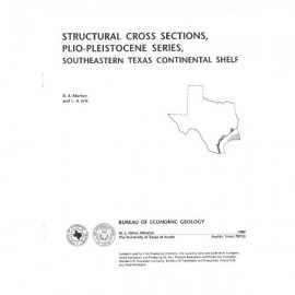
1. Structural cross section 3'-3"
2. Structural cross section 5'-5"
3. Structural cross section 8'-8"
Citation
Morton, R. A., Sams, R. H., and Jirik, L. A., Plio-Pleistocene Depositional Sequences of the Southeastern Texas Continental Shelf and Slope: Geologic Framework, Sedimentary Facies, and Hydrocarbon Distribution: The University of Texas at Austin, Bureau of Economic Geology, Report of Investigations No. 200, 80 p.