Reports of Investigations
-
Books & Reports
- Reports of Investigations
- Guidebooks
- Udden Series
- Geological Circulars
- Down To Earth
- Atlases of Major Oil and Gas Reservoirs
- Texas Memorial Museum Publications
- Environmental Geologic Atlas of the Texas Coastal Zone
- Mineral Resource Circulars
- Other Reports
- Seminars and Workshops
- Handbooks
- Submerged Lands of Texas
- Symposia
- Annual Reports
- Open File Reports
-
Maps & Cross Sections
- Thematic Maps
- Miscellaneous Maps, Charts & Sections
- Geologic Atlas of Texas
- STATEMAP Project Maps
- Geologic Quadrangle Maps
- Cross Sections
- Highway Geology Map
- Energy and Mineral Resource Maps
- Shoreline Change and Other Posters
- Wilcox Group, East Texas, Geological / Hydrological Folios
- Bouguer Gravity Atlas of Texas
- River Basin Regional Studies
- Featured Maps
- Posters
- Teachers & the Public
-
Geological Society Publications
- Gulf Coast Association of Geological Societies
- Alabama Geological Society
- Austin Geological Society
- Corpus Christi Geological Society
- Houston Geological Society
- Lafayette Geological Society
- Mississippi Geological Society
- New Orleans Geological Society
- South Texas Geological Society
- GCS SEPM Publications
- Historic BEG & UT Series
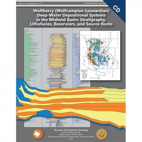
Wolfberry (Wolfcampian-Leonardian) Deep-Water Depositional Systems...Midland Basin. CD-ROM
RI0277CD
RI0277CD. Wolfberry (Wolfcampian-Leonardian) Deep-Water Depositional Systems in the Midland Basin: Stratigraphy, Lithofacies, Reservoirs, and Source Rocks, by H. S. Hamlin and R. W. Baumgardner. 61 p., 38 figs., 4 plates, 1 appendix, 2012. CD.
To purchase this publication in book format, please order RI0277.
To purchase this publication as a downloadable PDF, please order RI0277D.
ABSTRACT
The Wolfberry play combines favorable geology with innovative completion practices to form one of the largest unconventional oil plays in the United States. Wolfberry wells produced almost 55 million barrels of oil in 2011, and potential exists for that figure to double in a few years. Abundant organic carbon, brittle calcareous mudrock, and thin permeable beds form the geologic basis for the play. The Wolfberry concept grew out of preexisting plays in low-permeability sandstones (Spraberry Formation) and detrital carbonates (Wolfcamp interval) and developed in the early 2000’s through the application of modern hydraulic-fracture stimulation technology and refinement of geologic understanding of the reservoir-source-rock system. This report describes Wolfberry geology at regional and local scales and is intended to provide a context and reference for exploration and development.
Lower Permian (Wolfcampian and Leonardian Series) stratigraphy in the Midland Basin records deposition in an intracratonic, deep-water basin surrounded by shallow-water carbonate platforms. On the basin floor, siliciclastic, turbidite depositional systems alternate with calcareous, hemipelagic depositional systems in horizontal, laterally persistent layers. Turbidite sandstones form important reservoirs in basin-floor settings. Along the platform margins, slope depositional systems comprise carbonate-dominated clinoforms. Nearslope (periplatform) detrital carbonates (primarily debris flows and turbidites) form important Wolfberry reservoirs. By flooding or exposing the wide platforms, sea-level fluctuation controlled sediment input into the basin. During sea-level lowstands, platforms were exposed, and siliciclastic sediment was transported directly into the basin. During sea-level highstands, flooded platforms became carbonate factories, and sediment input to the basin comprised platform-derived carbonate and hemipelagic (windblown) silt and clay. The hemipelagic depositional system was active throughout the sea-level cycle, and organic matter and siliciclastic silt are abundant in all basinal intervals.
We used wireline logs to correlate and map stratigraphic intervals and drill cores to characterize lithofacies and calibrate wireline logs for lithofacies identification and mapping beyond cored wells. On the basis of lithofacies composition, rock-body geometries, and bedding architecture, we interpreted depositional facies and elements within the sequence stratigraphic and paleogeographic framework.
Siliciclastic intervals include the lower Wolfcamp interval, the Dean Formation, and the lower and upper intervals of the Spraberry Formation. These inferred lowstand intervals comprise submarine fans that extend over 150 mi (241 km) north-south and cover the basin floor. Spraberry and Dean sandstone turbidites are composed of very fine grained sand and coarse silt derived from source areas in the north. Permeable turbidite channel sandstones thin southward, grading into low-permeability turbidite lobes and sheets having widespread lateral continuity. The lower Wolfcamp interval forms a west- and north-thinning wedge of siliciclastics derived from tectonic source areas to the east and south.
Calcareous intervals include the upper Wolfcamp interval, lower and middle Leonard intervals, and middle interval of the Spraberry Formation. These inferred highstand intervals, which form equally widespread layers on the basin floor, are composed of hemipelagic deposits (mudrocks and calcareous mudrocks) and detrital carbonate mass-flow deposits. Basinal calcareous intervals are typically thicker, coarser grained, and more permeable near the platforms that supplied the carbonate detritus. In basin-center areas, calcareous intervals are mudrock dominated but include numerous thin, permeable interbeds.
Wolfberry basinal deposits are oil rich, but most lithofacies are relatively impermeable. Mudrocks are organic rich, thermally mature, and oil prone. Sandstones and carbonates are mostly thin and of poor reservoir quality. The Wolfberry reservoir source-rock system, however, is more than 2,000 ft (610 m) thick, and by means of massive, multistage, hydraulic-fracture stimulation treatments, large volumes of marginal reservoirs are accessed and produced.
Keywords: deep-water depositional systems, Leonardian, lithofacies, Midland Basin, Permian, production statistics, reservoir properties, West Texas
CONTENTS
Abstract
Introduction
Geologic Setting
Previous Geologic Studies
Methods and Data
Wolfberry Play
Regional Stratigraphy
Lithology from Wireline Logs
Sequence Stratigraphic Framework
Wolfcamp Interval
Lower Leonard Interval
Dean Formation
Middle Leonard Interval
Spraberry Formation
Lithofacies and Depositional Systems
Sandstone Lithofacies
Conglomeratic Lithofacies
Laminated Siltstone Lithofacies
Mudrock Lithofacies
Carbonate Packstone/Grainstone Lithofacies
Mineral Composition of Lithofacies
Wireline-Log Recognition of Lithofacies
Reservoir Development
Sandstone Turbidites
Sandstone Reservoir Properties
Detrital Carbonates
Calcareous Mudrocks
Source Rocks
Summary and Discussion
Acknowledgments
References
Appendix A. Cross-section wells: identification and interval boundaries
Figures
1. Map of Midland Basin and surrounding platforms and basins, showing oil-producing areas in Wolfcampian and Leonardian basinal lithofacies
2. Stratigraphic chart of Wolfcampian and Leonardian Series in Midland Basin and correlative units in Delaware Basin and on Central Basin Platform
3. Map showing subsurface data used in this study
4. Average volume of fluid used in hydraulic-fracture stimulation treatments for 24,252 wells in Spraberry Trend field
5. Average thickness of gross perforated interval for 24,252 wells in Spraberry Trend field
6. Number of actively producing Wolfberry wells in each year from 1998 through 2011
7. Total Wolfberry oil and gas production in each year from 1998 through 2011
8. Average-best-month oil production for Wolfberry wells completed in each year from 1998 through 2011
9. Map showing best-month oil production for 9,640 Wolfberry wells completed between 1998 and 2011
10. Typical modern wireline-log suite through Wolfcampian and Leonardian basinal intervals in
basin-center location
11. Cross section showing typical gamma-ray and resistivity logs from widely separated parts of basin
12. Cross section showing selected gamma-ray and resistivity logs in profile across northern basin margin
13. Regional north-south cross section A-A´, showing Upper Pennsylvanian and Lower Permian stratigraphy and lithology in Midland Basin and northern Val Verde Basin
14. Regional west-east cross section B-B´, showing Upper Pennsylvanian and Lower Permian stratigraphy and lithology in north part of Midland Basin
15. Regional west-east cross section C-C´, showing Upper Pennsylvanian and Lower Permian stratigraphy and lithology in central part of Midland Basin
16. Regional west-east cross section D-D´, showing Upper Pennsylvanian and Lower Permian stratigraphy and lithology in south part of Midland Basin
17. Isopach map of Wolfcamp interval
18. Isopach map of lower Leonard interval
19. Isopach map of Dean Formation
20. Isopach map of middle Leonard interval
21. North-south cross section showing individual Spraberry sandstones
22. Isopach map of lower Spraberry interval
23. Net-sandstone map of lower Spraberry 1L sandstone
24. Isopach map of middle Spraberry interval
25. Isopach map of upper Spraberry interval
26. Net-sandstone map of upper Spraberry 1U sandstone
27. Photographs of sandstone lithofacies in core
28. Thin-section photomicrographs of lithofacies
29. Photographs of conglomeratic lithofacies
30. Photographs of laminated siltstone lithofacies
31. Photographs of mudrock lithofacies
32. Ternary diagram of X-ray diffraction mineral composition data from 182 core samples
33. Wireline logs compared with core description, core analysis, and lithofacies, upper Spraberry
34. Cross section showing wireline-log responses and lithofacies composition in widely separated cores, lower Spraberry
35. Gamma-ray and resistivity logs through cored interval in lower Spraberry, also showing total organic carbon curve based on 78 samples
36. Gamma-ray and resistivity logs compared with lithofacies identified in core, TOC measurements, and foot-by-foot X-ray fluorescence measurements of elemental calcium and aluminum, upper Wolfcamp and lower Leonard
37. Maps showing regional distribution of oil-productive lithofacies in Spraberry and Dean sandstones and Wolfcampian and Leonardian detrital carbonates and calcareous mudrocks
38. Porosity and permeability measurements from conventional core-plug analysis from 21 cores used in this study
Tables
1. Basinal lithofacies in Wolfcampian and Leonardian cores
2. Total organic carbon in Wolfcampian and Leonardian lithofacies, Midland Basin
Plates
1. Wolfberry cross section A-A´ showing regional stratigraphy and “quick-look” lithology from gamma-ray and resistivity logs
2. Wolfberry cross section B-B´ showing regional stratigraphy and “quick-look” lithology from gamma-ray and resistivity logs
3. Wolfberry cross section C-C´ showing regional stratigraphy and “quick-look” lithology from gamma-ray and resistivity logs
4. Wolfberry cross section D-D´ showing regional stratigraphy and “quick-look” lithology from gamma-ray and resistivity logs
Citation
Hamlin, H. S., and Baumgardner, R. W., 2012, Wolfberry (Wolfcampian-Leonardian) Deep-Water Depositional Systems in the Midland Basin: Stratigraphy, Lithofacies, Reservoirs, and Source Rocks: The University of Texas at Austin, Bureau of Economic Geology, Report of Investigations No. 277, 61 p.
