Reports of Investigations
-
Books & Reports
- Reports of Investigations
- Guidebooks
- Udden Series
- Geological Circulars
- Down To Earth
- Atlases of Major Oil and Gas Reservoirs
- Texas Memorial Museum Publications
- Environmental Geologic Atlas of the Texas Coastal Zone
- Mineral Resource Circulars
- Other Reports
- Seminars and Workshops
- Handbooks
- Submerged Lands of Texas
- Symposia
- Annual Reports
- Open File Reports
-
Maps & Cross Sections
- Thematic Maps
- Miscellaneous Maps, Charts & Sections
- Geologic Atlas of Texas
- STATEMAP Project Maps
- Geologic Quadrangle Maps
- Cross Sections
- Highway Geology Map
- Energy and Mineral Resource Maps
- Shoreline Change and Other Posters
- Wilcox Group, East Texas, Geological / Hydrological Folios
- Bouguer Gravity Atlas of Texas
- River Basin Regional Studies
- Featured Maps
- Posters
- Teachers & the Public
-
Geological Society Publications
- Gulf Coast Association of Geological Societies
- Alabama Geological Society
- Austin Geological Society
- Corpus Christi Geological Society
- Houston Geological Society
- Lafayette Geological Society
- Mississippi Geological Society
- New Orleans Geological Society
- South Texas Geological Society
- GCS SEPM Publications
- Historic BEG & UT Series
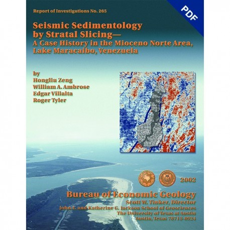
Seismic Sedimentology by Stratal Slicing...Mioceno Norte Area, Lake Maracaibo, Venezuela. Digital Download
RI0265D
For a print version: RI0265.
RI0265D. Seismic Sedimentology by Stratal Slicing--A Case History in the Mioceno Norte Area, Lake Maracaibo, Venezuela, by Hongliu Zeng, W. A. Ambrose, Edgar Villalta, and Roger Tyler. 41 p., 25 figs., 1 appendix, 2002. doi.org/10.23867/RI0265D. Downloadable PDF.
To purchase this publication in book format, please order RI0265.
ABSTRACT
This report describes a case history in a densely drilled, but spatially restricted, area (47 km2) containing 240 wells in the Mioceno Norte Area of Lake Maracaibo, Venezuela. There, by means of seismic sedimentology, we extended a genetic-stratigraphic-unit-level (15 to 50 m) facies interpretation to a larger, sparsely drilled 3-D survey area (300 km2). Stratal slicing is the basic tool of seismic sedimentology, providing sequential seismic surface displays that tend to follow depositional (time) surfaces, and important distinctions between stratal slices and horizon slices are often useful. We emphasize these distinctions in this report and discuss the implications of their differences.
The three basic depositional settings represented in the Mioceno Norte Area that we derived from well-data analysis are shoreface, lacustrine delta, and fluvial. We extrapolated component elements in these systems across the 3-D seismic survey area by analyzing seismic amplitude patterns on stratal slices. We then performed a similar interpretation procedure by using horizon slices to demonstrate that horizon slicing does not provide the depositional details that stratal slicing does. Each depositional setting can be defined by unique seismic amplitude patterns on stratal slices, thus reducing the ambiguity of correlating conventional seismic facies with well log lithofacies distributions. We concluded that seismic sedimentology, because it improved our understanding of reservoir distribution and depositional history, is valuable in basin analysis, hydrocarbon exploration, and reservoir characterization for identifying reservoir sandstones in sparsely drilled or undrilled areas.
Keywords: facies, geomorphology, sedimentology, seismic, stratal slicing, Venezuela
CONTENTS
ABSTRACT
INTRODUCTION
SUMMARY OF DEPOSITIONAL FACIES ANALYSIS IN THE FIELD AREA
Shoreface (LR 60-LR 90 GSU)
Lithofacies
Sand-Body Geometry and Facies Interpretation
Lacustrine Delta (La1 10-La1 20 GSU)
Lithofacies
Sand-Body Geometry and Facies Interpretation
Meandering Fluvial System (BACHI 40-BACHI 50 GSU)
Lithofacies
Sand-Body Geometry and Facies Interpretation
STRATAL SLICING IN THE 3-D SURVEY AREA
Methods
Step 1: Select Geologic-Time-Parallel Reference Seismic Events
Step 2: Build a Stratal-Time Model
Step 3: Build a Stratal-Slice Volume
Comparison with Horizon Slicing
Error Analysis
ADDITIONAL REQUIREMENTS
SEISMIC SEDIMENTOLOGICAL INTERPRETATION
Methodology
Link of Stratal Slices to Basic Depositional Systems
Shoreface (LR 60-LR 90 GSU)
Lacustrine Delta (La1 10-La1 20 GSU)
Meandering Fluvial System (BACHI 40-BACHI 50 GSU)
Secondary Changes in Depositional Architecture and Style
Shoreface to Lower Coastal Plain
Lacustrine Delta to Fan Delta
Anastomosing, Meandering, and Braided Fluvial Systems
Depositional History
DISCUSSION
CONCLUSIONS
ACKNOWLEDGMENTS
REFERENCES
APPENDIX A. ERROR OF HORIZON SLICING
Figures
1. 3-D seismic volume across Mioceno Norte field and surrounding area
2. Stratigraphic framework in the Mioceno Norte Area
3. Regional early Miocene sediment-dispersal directions in the Maracaibo Basin
4. Core description of LR 60-LR 90 shoreface sandstones in well PB-161
5. Percent-sandstone map of LR 60-LR 90 genetic stratigraphic unit showing northeast-trending shoreface and northwest-trending tidal-distributary channels
6. Aerial photograph of the mouth of the Santee River, entering a wave-dominated coastline in South Carolina, a modern analog of wave-dominated shoreline depositional systems in LR 60-LR 90 GSU in sequence C
7. Percent-sandstone map of La1 10-La1 20 GSU showing distributary channels and lobes in a lacustrine delta
8. Core description of fluvial deposits in BACHI 40-BACHI 50 GSU and vicinity in well TJ-1094
9. Net-sandstone map of BACHI 40-BACHI 50 GSU showing meandering fluvial system
10. Stratal-slice volume in Mioceno Norte field and surrounding area
11. Vertical seismic profile A-A' showing picked reference seismic events and position of the stratal slice in figure 12
12. Stratal slice depicting meandering fluvial system
13. Horizon slices made by slicing parallel to LaS 90 in the stratal interval covering the meandering fluvial system in figure 12
14. Horizon slices made by slicing parallel to BACHS 10 in the stratal interval covering the meandering fluvial system in figure 12
15. Error of horizon slicing in section A-A', calculated from equations A-1 and A-2
16. Linear relationship between acoustic impedance and effective porosity in the Miocene sandstone-shale deposits in well TJ-697
17. Amplitude stratal slice SSI 1408 in LR 60-LR 90 GSU, with well-based sandstone map superimposed
18. Amplitude stratal slice SSI 1088 in LA1 10-LA1 20 GSU, with well-based sandstone map superimposed
19. Amplitude stratal slice SSI 456 in BACHI 40-BACHI 50 GSU, with well-based sandstone map superimposed
20. Amplitude stratal slice SSI 1304 in LL 40-LL 50 GSU, with well-based sandstone map superimposed
21. Amplitude stratal slice SSI 712 in LaS 30-LaS 60 GSU, with well-based sandstone map superimposed
22. Amplitude stratal slice SSI 640 in LaS 60-LaS 90 GSU, with well-based sandstone map superimposed
23. Amplitude stratal slice SSI 376 in BACHI 50-BACHI 60 GSU, with well-based sandstone map superimposed
A-1. Parameters for calculating thickness gradient
Citation
Zeng, Hongliu, Ambrose, W. A., Villalta, Edgar, and Tyler, Roger, 2002, Seismic Sedimentology by Stratal Slicing--A Case History in the Mioceno Norte Area, Lake Maracaibo, Venezuela: The University of Texas at Austin, Bureau of Economic Geology Report of Investigations No. 265, 41 p. doi.org/10.23867/RI0265D.


