Reports of Investigations
-
Books & Reports
- Reports of Investigations
- Guidebooks
- Udden Series
- Geological Circulars
- Down To Earth
- Atlases of Major Oil and Gas Reservoirs
- Texas Memorial Museum Publications
- Environmental Geologic Atlas of the Texas Coastal Zone
- Mineral Resource Circulars
- Other Reports
- Seminars and Workshops
- Handbooks
- Submerged Lands of Texas
- Symposia
- Annual Reports
- Open File Reports
-
Maps & Cross Sections
- Thematic Maps
- Miscellaneous Maps, Charts & Sections
- Geologic Atlas of Texas
- STATEMAP Project Maps
- Geologic Quadrangle Maps
- Cross Sections
- Highway Geology Map
- Energy and Mineral Resource Maps
- Shoreline Change and Other Posters
- Wilcox Group, East Texas, Geological / Hydrological Folios
- Bouguer Gravity Atlas of Texas
- River Basin Regional Studies
- Featured Maps
- Posters
- Teachers & the Public
-
Geological Society Publications
- Gulf Coast Association of Geological Societies
- Alabama Geological Society
- Austin Geological Society
- Corpus Christi Geological Society
- Houston Geological Society
- Lafayette Geological Society
- Mississippi Geological Society
- New Orleans Geological Society
- South Texas Geological Society
- GCS SEPM Publications
- Historic BEG & UT Series
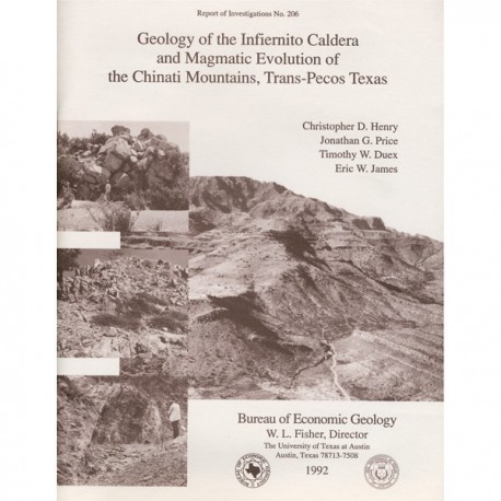
Geology of the Infiernito Caldera and Magmatic Evolution of the Chinati Mountains, Trans-Pecos Texas
RI0206
For a downloadable, digital version: RI0206D.
RI0206. Geology of the Infiernito Caldera and Magmatic Evolution of the Chinati Mountains, Trans-Pecos Texas, by C. D. Henry, J. G. Price, T. W. Duex, and E. W. James. 56 p., 29 figs., 5 tables, 1 color plate in pocket, 1992. Print.
To purchase this publication as a downloadable PDF, please order RI0206D.
ABSTRACT
The 37-Ma-old Infiernito caldera of the northern Chinati Mountains is a major eruptive center of the mid-Tertiary volcanic field of Trans-Pecos Texas. Volcanism in the Chinati Mountains began with eruption of a sequence of rhyolitic to trachytic lavas, the precollapse lavas. These lavas progress stratigraphically upward from aphyric or sparsely porphyritic rhyolite to abundantly porphyritic trachyte; they appear to represent tapping of a compositionally zoned magma chamber.
Eruption of the peralkaline to metaluminous Infiernito Tuff induced contemporaneous collapse of the Infiernito caldera, which is at least 12 km (7.5 mi) in diameter. The Infiernito Tuff ponded within the caldera to a possible maximum thickness of 1,800 m (5,900 ft). Caldera collapse breccias, derived from the caldera wall during eruption, are interbedded with the tuff. The tuff spread at least 20 km (12 mi) to the northwest from the caldera and unknown distances in other directions, where the tuff is largely covered by younger deposits. In contrast to its great intracaldera thickness, the tuff outside the caldera is no more than 20 m (66 ft) thick.
After ash-flow eruption, the Infiernito caldera was filled by a quartz trachyte lava flow and interbedded sandstones and debris-flow deposits that represent continued failure of the caldera wall. The entire caldera-fill sequence, as well as precollapse lavas and underlying Cretaceous and Permian sedimentary rocks, was uplifted and tilted outward by the Ojo Bonito quartz monzonite intrusion. This intrusion represents resurgence of the magma chamber and the last major igneous activity of the caldera. Extensive hydrothermal alteration associated with the intrusion produced numerous mineral prospects, including epithermal veins, skarns, and porphyry-type mineralization.
Volcanism continued episodically in the Chinati Mountains area for another 5 m.y. About 34 Ma ago, several rhyolite intrusions were emplaced west of the Infiernito caldera, and a moderate-volume ash-flow tuff, here named the Shely Tuff, erupted from sources now buried beneath the Chinati Mountains caldera. Volcanism in the Chinati Mountains culminated with eruption of the 32-Ma-old Mitchell Mesa Rhyolite, the largest ash-flow tuff in Trans-Pecos Texas. Eruption of the Mesa induced collapse of the Chinati Mountains caldera, the largest caldera in the region. The caldera was subsequently filled by a complex sequence of mafic to silicic lavas and ash-flow tuff and was then intruded by the composite West Chinati stock.
Keywords: ash-flow tuffs, calderas, Chinati Mountains, K-Ar, magmatism, ore deposits, Tertiary, Trans-Pecos Texas
CONTENTS
Contents
Abstract
Introduction
Regional Setting
Previous Work
Purpose
Stratigraphy
Paleozoic Rocks
Pennsylvanian
Cieneguita Formation (Pc)
Permian
Alta Formation. (Pa) 8
Pinto Canyon Formation (Ppc)
Cretaceous Rocks
Yucca Formation (Ky)
Bluff Formation (Kb)
Cox Sandstone (Kc)
Finlay Limestone (Kf)
Tertiary Volcanic Rocks
Early Rhyolite Dome
Jeff Conglomerate, Colmena Tuff, Buckshot lgnimbrite, and Chambers Tuff
Areal extent and volume of the Buckshot Ignimbrite
The Buckshot problem
Precollapse Lavas (Tl)
Sparsely porphyritic, high-silica rhyolite (Tl rl) Debris-flow deposits (T 1 rx)
Sparsely porphyritic trachyte (Tltl)
Porphyritic, /ow-silica rhyo/ite (Tlr2)
Porphyritic quartz trachyte (Tlq)
Porphyritic trachyte (Tlt2)
Infiemito Tuff (f2t)
Stratigraphic relations
Jntracaldera tuff
Outcrop characteristics
Petrography
Interbedded caldera-collapse breccia (T2bx)
Outflow·tuff
Outcrop characteristics
Petrography
Areal extent and volume
Coarsely Porphyritic Quartz Trachyte Lava (T2f)
Caldera-Fill Sediments (T2s)
Intrusive Rocks of the Infiernito Caldera
Ojo Bonito quartz 1nonzonite (Tob)
Ring-fracture rhyolite (Tir)
Conglomerate Derived from the Infiernito Caldera (Tnc)
Tuffaceous Sediments (Tts)
Lava of Shely Rim (Tls) Shely Tuff (Ts) Units 2 and 3 of Morita Ranch Formation
Rocks of the Chinati Mountains Caldera Mitchell Mesa Rhyolite (Tmm)
Caldera-fill volcanic rocks
Petan Trachyte (Tpe) and upper part of unit 4, Morita Ranch Formation
Perdiz Conglomerate (Tpc)
Geochemistry
Structure
Laramide Folding and Thrusting
Caldera Structure
Precollapse Doming
Collapse
Resurgent Doming
Basin and Range Faulting
Economic Geology
Epithermal Veins
Porphyry-Type Mineralization Associated with Ojo Bonito Apophysis
Skarn Mineralization
Additional Areas of Hydrothermal Alteration
Uranium Mineralization Associated with Rhyolite Domes
Potential for Manto-Type Silver-Lead Deposits
History of Volcanism in the Chinati Mountains Area
Acknowledgments
References
Figures
1. Map of southwestern Trans-Pecos Texas showing location of the Infiemito and Chinati Mountains calderas
2. Generalized tectonic map of Trans-Pecos Texas showing outline of area around the Infiemito caldera mapped during this study
3. Regional setting of Trans~Pecos volcanic field showing distribution of mid-Tertiary volcanic rocks
of southwestern North America and boundaries of the Basin and Range province
4. Index of previous geologic mapping in and around the Chinati Mountains
5. Stratigraphy of Paleozoic rocks near the Infiemito caldera
6. Aerial photograph showing Paleozoic and Cretaceous rocks dipping away from the Ojo'Bonito intrusion
7. Stratigraphy of Cretaceous rocks in the Pinto Canyon and Shafter areas of the Chinati Mountains
8. Stratigraphy of Tertiary volcanic and volcaniclastic rocks in and around the Chinati Mountains
9. Generalized geologic map of the Chinati Mountains area
10. Stratigraphic relations among Tertiary volcanic and voicaniclastic rocks north of Pinto Canyon
11. Distribution and thickness of the Buckshot lgnimbrite
12. Occurrence of phenocrysts in precollapse lavas as a function of Si02 content
13. Outcrop, thickness, and inferred original distribution of the Infiemito Tuff
14. Photograph of interbedded Infiernito Tuff and caldera-collapse breccia within the Infiernito caldera
15. Phenocryst assemblage of Infiernito Tuff, coarsely porphyritic quartz trachyte lava, and Ojo Bonito quartz monzonite as a function of Si02 content
16. Photograph of the vent at hill 5140, source of unit T2f, coarsely porphyritic quartz trachyte lava
17. Aeromagnetic map of Chinati Mountains area
18. Photograph of outcrop of Ojo Bonito quartz monzonite, the resurgent intrusion of the Infiernito caldera
19. Distribution and thickness map of the Shely Tuff
20. Photograph of Shely Tuff along the western edge of the Shely Rim overlooking Pinto Canyon
21. Distribution map of the Mitchell Mesa Rbyolite
22. Compositional variations of rocks of the Chinati Mountains area
23. Plot of total alkalies (Na2O + K2O) and CaO versus Si02 for all analyses
24. Basin and Range faults around the Chinati Mountains
25. Geologic settings of mineral deposits in and near Trans-Pecos calderas
26. Results of X-ray diffraction of samples from diamond drill hole No. 1
27. Geologic map of the hydrothermal alteration area surrounding the apophysis of the Ojo Bonito intrusion north of Cerro Infiemito
28. Photograph of stock work veining in the apophysis of the Ojo Bonito intrusion north of Cerro Infiernito
29. Plots showing abundance of trace elements in fresh and altered rocks of the Infiemito caldera relative to average granite
Tables
1. Magmatic-tectonic phases in Trans-Pecos Texas
2. Chemical analyses of igneous rocks of the Infiemito and Chinati Mountains calderas
3. Nomenclature of the Chinati Mountains Group
4. Trace-element analyses of altered or unmineralized rocks
5. K-Ar isotopic data of igneous rocks of the Chinati Mountains area
Plate
1. Geologic map of Infiernito caldera, Trans-Pecos Texas
Citation
Henry, C. D., Price, J. G., Duex, T. W., and James, E. W., 1992, Geology of the Infiernito Caldera and Magmatic Evolution of the Chinati Mountains, Trans-Pecos Texas: The University of Texas at Austin, Bureau of Economic Geology, Report of Investigations No. 206, 56 p.
