Reports of Investigations
-
Books & Reports
- Reports of Investigations
- Guidebooks
- Udden Series
- Geological Circulars
- Down To Earth
- Atlases of Major Oil and Gas Reservoirs
- Texas Memorial Museum Publications
- Environmental Geologic Atlas of the Texas Coastal Zone
- Mineral Resource Circulars
- Other Reports
- Seminars and Workshops
- Handbooks
- Submerged Lands of Texas
- Symposia
- Annual Reports
- Open File Reports
-
Maps & Cross Sections
- Thematic Maps
- Miscellaneous Maps, Charts & Sections
- Geologic Atlas of Texas
- STATEMAP Project Maps
- Geologic Quadrangle Maps
- Cross Sections
- Highway Geology Map
- Energy and Mineral Resource Maps
- Shoreline Change and Other Posters
- Wilcox Group, East Texas, Geological / Hydrological Folios
- Bouguer Gravity Atlas of Texas
- River Basin Regional Studies
- Featured Maps
- Posters
- Teachers & the Public
-
Geological Society Publications
- Gulf Coast Association of Geological Societies
- Alabama Geological Society
- Austin Geological Society
- Corpus Christi Geological Society
- Houston Geological Society
- Lafayette Geological Society
- Mississippi Geological Society
- New Orleans Geological Society
- South Texas Geological Society
- GCS SEPM Publications
- Historic BEG & UT Series
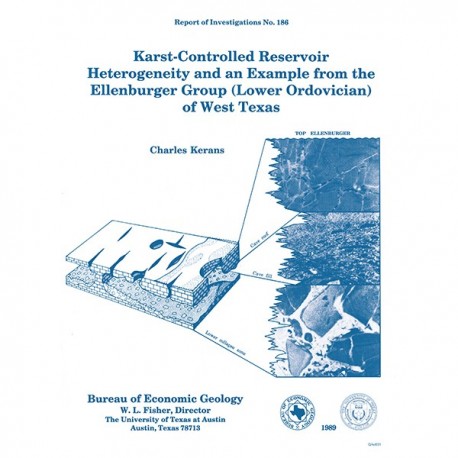
Karst-Controlled Reservoir Heterogeneity ... Example from the Ellenburger... of West Texas
RI0186
For a downloadable, digital version: RI0186D.
RI0186. Karst-Controlled Reservoir Heterogeneity and an Example from the Ellenburger (Lower Ordovician) of West Texas, by Charles Kerans. 40 p., 25 figs., 1989. ISSN: 0082335X: Print.
To purchase this publication as a PDF downloald, please order RI0186D.
ABSTRACT
This study is a product of ongoing Bureau of Economic Geology investigations, by means of geologic and petrophysical modeling, into the nature of reservoir compartmentalization or heterogeneity. The model has been designed to provide a basis for subsequent infill drilling in the reservoirs in question along trends of greatest geologic potential, rather than according to geometrically defined well spacings.
The Lower Ordovician Ellenburger Group was the site of the investigations from which more than 10,000 ft (3,050 m) of core from 63 wells was logged. Identification of six facies assemblages resulted: (1) lithic arenite, (2) mixed siliciclastic-carbonate packstone, (3) ooid-peloid grainstone, (4) mottled mudstone, (5) laminated mudstone, and (6) gastropod/peloid packstone. These facies assemblages record initial transgression and subsequent progradation and aggradation, indicating that paleoslope was generally southerly and easterly from the Texas Arch toward the Ouachita and Marathon orogenic belts. It was also found that all facies assemblages, with the local exception of the ooid-peloid grainstone assemblage, have low intergranular and intercrystalline porosity.
The karst model, constructed by means of cross sections and then an isometric projection of the Ellenburger surface at Emma field
hung on the cross-section data, illustrates that porosity development in Ellenburger Group carbonates is directly related to a prolonged period of subaerial exposure that coincided with a Middle Ordovician eustatic lowstand. This latter period occurred before transgression of Simpson Group siliciclastics, during which a widespread system of caves, sinkholes, joint-controlled solution features, and collapse breccias and related fractures developed. Of particular importance to reservoir development was the formation of a regionally extensive cave system between 100 and 300 ft (30 and 90 m) beneath the exposed Ellenburger surface. Infill of this cave system by Simpson Group sand and clay segmented the upper Ellenburger into three karst facies, which are, in descending order, (1) cave-roof dolostones (fracture and mosaic breccias), (2) laterally persistent cave-fill facies (siliciclastic-matrix-supported and carbonate-matrix-supported breccias), and (3) lower collapse facies (chaotic clast-supported breccias) of the cave floor.
Pronounced vertical segregation of permeable zones defined by the three karst facies is evident in the Emma, Andector, Martin, and University Block 13 fields and in several other major Ellenburger reservoirs. Lateral reservoir heterogeneities formed by localized, vertically restricted collapse structures, such as those that appear in the Shafter Lake Ellenburger reservoir, also contribute to compartmentalization of producing zones within the upper Ellenburger Group. Secondary and tertiary recovery programs in these Ellenburger reservoirs can be improved by the integration of concepts of lateral and vertical heterogeneity inferred by the karst model.
Keywords: depositional facies, Ellenburger Group, karst, Lower Ordovician, oil reservoirs, paleokarst models, reservoir heterogeneity, West Texas
CONTENTS
Abstract
Introduction
Regional Setting
Stratigraphic Framework
Structures Marginal to the Palo Duro Basin
Amarillo Uplift
Whittenburg 'Trough
Oldham-Harmon Trend
Bravo Dome
Bush Dome
Donley positive
Plaska structure
Matador Arch
Structures in Eastern New Mexico
Roosevelt positive
Surface faults in eastern New Mexico
Alamosa Creek fault
Bonita fault
San Jon high
Garcia Lake high
Structures within the Palo Duro Basin
Castro County
Arney positive
Castro Trough
Central Randall County
Lamb County
Structures of Nontectonic Origin
Subsurface Structures
Surface Structures
Summary
Acknowledgments
References
Figures
1. Tectonic elements of West Texas and adjacent states
2. Stratigraphic column and general lithologies, Palo Duro Basin and Amarillo Uplift
3. Location of seismic lines in the Palo Duro Basin
4. Structure-contour map, top of basement. southern Texas Panhandle
5. Structure-contour map. top of basement. Amarillo Uplift
6. Basement lithologies in Castro County and in the Sun Oil Company No. 1 Herring well
7. Pre-Middle Devonian subcrop map and isopach map of the Arbuckle and Ellenburger Groups
8. Isolith map of Pennsylvanian and Lower Permian arkosic
9. Structure-contour map, top of the Alibates interval, Palo Duro Basin
10. South-north cross section A-A' of western Amarillo Uplift
11. Surface geology and structure-contour map of the base of the Ogallala Formation, western Amarillo Uplift
12. Photograph of Ogallala Formation outcrop
13. Photograph of basal Ogallala Formation gravels
14. South-north cross section B-B' and structure-contour map of the base of the Ogallala Formation in Carson County
15. Isopach map of the pre-Permian Palo Duro Basin
16. Isopach map of the Leonardian Series, showing the Whittenburg Trough and western Amarillo Uplift
17. Photograph of Rita Blanca beds (Pliocene) dipping southwestward into the Whittenburg Trough from the Channing Dome
18. Structure-contour map, top of the Tubb interval, Palo Duro Basin
19. Isopach map of the middle and Upper Permian, Palo Duro Basin
20. Isopach map of the Permian System, Palo Duro Basin
21. Percent carbonate in the Upper Pennsylvanian. Palo Duro Basin
22. Structure-contour map. top of basement. Matador Arch
23. Structure-contour map, top of the San Andres Formation, east-central New Mexico
24. West-east cross section C-C' of the Alamosa Creek fault
25. West-east cross section D-D' of the Bonita fault
26. West-east cross section E-E' of the Garcia Lake high
27. Isopach map of the Mississippian System, Palo Duro Basin
28. Cross sections, Castro Trough
29. Subsurface maps, Castro Trough
30. Seismic reflection profile G-G', central Randall high
31. West-east cross section H-H' of structural low in southern Lamb County
Table
1. Structural features within or adjoining the Palo Duro Basin
Citation
Kerans, Charles, 1989, Karst-Controlled Reservoir Heterogeneity and an Example from the Ellenburger (Lower Ordovician) of West Texas: The University of Texas at Austin, Bureau of Economic Geology, Report of Investigations No. 186, 40 p.
