Reports of Investigations
-
Books & Reports
- Reports of Investigations
- Guidebooks
- Udden Series
- Geological Circulars
- Down To Earth
- Atlases of Major Oil and Gas Reservoirs
- Texas Memorial Museum Publications
- Environmental Geologic Atlas of the Texas Coastal Zone
- Mineral Resource Circulars
- Other Reports
- Seminars and Workshops
- Handbooks
- Submerged Lands of Texas
- Symposia
- Annual Reports
- Open File Reports
-
Maps & Cross Sections
- Thematic Maps
- Miscellaneous Maps, Charts & Sections
- Geologic Atlas of Texas
- STATEMAP Project Maps
- Geologic Quadrangle Maps
- Cross Sections
- Highway Geology Map
- Energy and Mineral Resource Maps
- Shoreline Change and Other Posters
- Wilcox Group, East Texas, Geological / Hydrological Folios
- Bouguer Gravity Atlas of Texas
- River Basin Regional Studies
- Featured Maps
- Posters
- Teachers & the Public
-
Geological Society Publications
- Gulf Coast Association of Geological Societies
- Alabama Geological Society
- Austin Geological Society
- Corpus Christi Geological Society
- Houston Geological Society
- Lafayette Geological Society
- Mississippi Geological Society
- New Orleans Geological Society
- South Texas Geological Society
- GCS SEPM Publications
- Historic BEG & UT Series
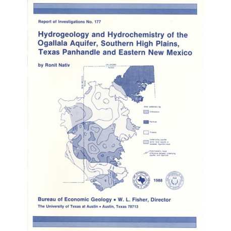
Hydrogeology and Hydrochemistry of the Ogallala Aquifer, Southern High Plains, Texas Panhandle and Eastern New Mexico
RI0177
For a downloadable, digital version: RI0177D.
RI0177. Hydrogeology and Hydrochemistry of the Ogallala Aquifer, Southern High Plains, Texas Panhandle and Eastern New Mexico, by Ronit Nativ. 64 p., 35 figs., 1 table, 1988. ISSN: 0082335X: Print.
To purchase this publication as a downloadable PDF, please order RI0177D.
ABSTRACT
The Ogallala aquifer, which underlies the Southern High Plains, consists of the saturated sediments of the Neogene Ogallala Formation. The aquifer is the main source of water for the High Plains of Texas and New Mexico and is being severely depleted by extensive pumpage for irrigation. Contamination from evaporating saline lakes, agricultural chemicals and fertilizers, and oil field brines is locally affecting the chemical composition of Ogallala ground water. The impact of chemicals and brines may increase in the future because many of these contaminants may still be moving downward through the unsaturated zone toward the water table. Furthermore, the aquifer overlies Permian evaporites that were being considered as a potential repository for the isolation of high-level nuclear wastes. All of these concerns necessitated the characterization of the hydrogeology and hydrochemistry of the Ogallala aquifer, which are controlled primarily by the subjacent paleotopography and by the thickness, permeability, and mineralogy of the Ogallala Formation.
Two different hydrogeologic provinces were observed in the study area. Increased thickness of formation and saturated section, as well as higher porosity and hydraulic conductivity values, characterize the first province, which is located along paleovalleys filled with coarse fluvial sediments. These paleovalleys trend from northwest to southeast, and ground-water flow lines follow their orientations. Within this first province the hydrochemical composition is relatively constant (Ca-HCO3 to mixed-cation-HCO3 water, depleted in δ18O, δD, and tritium). In the second hydrogeologic province the formation is thinner and less permeable and sediments are mainly fine-grained eolian clastics. In this province ground water discharges into the overlying Ogallala Formation from the Cretaceous, Triassic, and Permian aquifers. In the second province cross-formational movement of water and low permeability in the Ogallala Formation result in variable hydrochemical facies and isotopic composition that differ from those of the first hydrogeologic province. Superimposed permeable strata in the Ogallala and underlying formations and hydraulic-head differences locally allow cross-formational flow, as documented by chemical and isotopic similarities of ground water in the study area.
On the basis of both the rapid recharge rates calculated using tritium as a tracer and the slightly enriched values of δ18O and δD in ground water with respect to precipitation, it is assumed that the most likely method of ground-water recharge is focused percolation of partly evaporated playa-lake water.
Keywords: discharge, eastern New Mexico, hydrochemistry, hydrogeology, isotopes, Ogallala aquifer,oil field brines, playa lakes, recharge, saline lakes, Southern High Plains, Texas Panhandle, Texas
CONTENTS
Abstract
Introduction
Data and Methods
Hydrologic Setting
Physiography and climate
General hydrology of the Ogallala aquifer
Geologic Framework
Quaternary strata
Tertiary Ogallala Formation
Cretaceous strata
Triassic strata
Permian strata
Hydrogeology
Distribution of porosity and hydraulic conductivity
Potentiometric surface
Recharge
Discharge
Vadose and saturated zones
Hydrochemistry
Chemical and isotopic composition of Ogallala ground water
Effects of lithology and structure
Effects of the thickness of the vadose zone
Effects of natural recharge from precipitation
Effects of underlying aquifers
Cretaceous aquifers
Triassic Dockum aquifer
Permian aquifers
Effects of oil field brine contamination
Conclusions
Acknowledgments
References
Appendices
1. Mean values for chemical parameters of ground water in the major aquifers, Southern High Plains
2. Analytical data from ground-water samples from the Southern High Plains aquifers, 1984-85
3. Mean values for chemical parameters of brines in various stratigraphic units, Southern High Plains
4. Isotopic analyses of precipitation samples collected in the Southern High Plains and Rolling Plains
5. Calculation of recharge rate based on tritium values in ground water in the Ogallala aquifer, Southern High Plains
Figures
1. Location map of the study area, precipitation sampling stations, and wells sampled for ground water
2. Generalized soil map of the study area
3. Mean annual precipitation map of the study area
4. Subcrop map at the base of the Ogallala Formation
5. Isopach map of Ogallala and Quaternary deposits
6. Percent-sand and gravel map of Ogallala and Quaternary deposits
7. Estimates of permeability at the base of the Triassic
8. Estimates of permeability at the top of the Permian
9. Estimates of permeability at the base of the Cretaceous and the top of the Triassic
10. Specific yield map of the Ogallala aquifer
11. Hydraulic conductivity map of the Ogallala aquifer
12. Water-table-surface map of the Ogallala aquifer
13. Graphs of Potentiometric surface versus ground-level elevation in the Ogallala aquifer
14. Map showing changes in Potentiometric surface in the Ogallala aquifer, predevelopment through 1980
15. Map showing Potentiometric surfaces of ground water in the Cretaceous and Permian aquifers where they underlie the Ogallala Formation
16. Potentiometric-head-difference map between the Ogallala aquifer and each of the underlying aquifers
17. Plot of isotopic composition of precipitation and ground water in the study area
18. Distribution map of tritium values in Ogallala ground water
19. Map showing present-day flowing springs in the study area
20. Map showing annual pumpage and recharge of the Ogallala aquifer
21. Map showing thickness of the vadose zone above the Ogallala water table
22. Map showing approximate saturated thickness of the Ogallala Formation
23. Plot of change in saturated thickness of the Ogallala aquifer between 1960 and 1980
24. Map showing total dissolved solids content in Ogallala ground water
25. Map showing hydrochemical facies of Ogallala ground water
26. Piper diagrams of ground water in the Ogallala and Cretaceous aquifers
27. Salinity diagram of mean ion concentration in ground water in various aquifers, Southern High Plains
28. Distribution map of δ18O values in the study area
29. Distribution map of δ34S values in the study area
30. Plot of hydrochemical facies versus saturated thickness, Ogallala aquifer
31. Map showing arsenic concentrations in Ogallala ground water
32. Salinity diagrams of Ogallala water contaminated by saline lakes and oil field brines
33. Salinity diagrams of ground water in Ogallala, Cretaceous, and Triassic rocks
34. Piper diagram of oil field brines from 16 formations in the Southern High Plains
35. Bivariate plots of oil field brines in the study area
Table
1. Estimates of annual recharge into the Ogallala aquifer, Southern High Plains
Citation
Nativ, Ronit, 1988, Hydrogeology and Hydrochemistry of the Ogallala Aquifer, Southern High Plains, Texas Panhandle and Eastern New Mexico: The University of Texas at Austin, Bureau of Economic Geology, Report of Investigations No. 177, 64 p.
