Reports of Investigations
-
Books & Reports
- Reports of Investigations
- Guidebooks
- Udden Series
- Geological Circulars
- Down To Earth
- Atlases of Major Oil and Gas Reservoirs
- Texas Memorial Museum Publications
- Environmental Geologic Atlas of the Texas Coastal Zone
- Mineral Resource Circulars
- Other Reports
- Seminars and Workshops
- Handbooks
- Submerged Lands of Texas
- Symposia
- Annual Reports
- Open File Reports
-
Maps & Cross Sections
- Thematic Maps
- Miscellaneous Maps, Charts & Sections
- Geologic Atlas of Texas
- STATEMAP Project Maps
- Geologic Quadrangle Maps
- Cross Sections
- Highway Geology Map
- Energy and Mineral Resource Maps
- Shoreline Change and Other Posters
- Wilcox Group, East Texas, Geological / Hydrological Folios
- Bouguer Gravity Atlas of Texas
- River Basin Regional Studies
- Featured Maps
- Posters
- Teachers & the Public
-
Geological Society Publications
- Gulf Coast Association of Geological Societies
- Alabama Geological Society
- Austin Geological Society
- Corpus Christi Geological Society
- Houston Geological Society
- Lafayette Geological Society
- Mississippi Geological Society
- New Orleans Geological Society
- South Texas Geological Society
- GCS SEPM Publications
- Historic BEG & UT Series


Morphometric Studies of Subhumid and Semiarid Drainage Basins, Texas Panhandle and Northeastern New Mexico
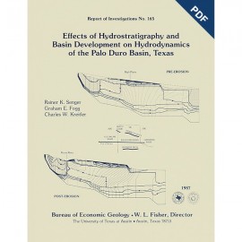
RI0163
For a downloadable, digital version: RI0163D.
RI0163. Morphometric Studies of Subhumid and Semiarid Drainage Basins Texas Panhandle and Northeastern New Mexico, by R. W. Baumgardner, Jr. 68 p., 35 figs., 15 tables, 1 appendix, 1987. ISSN: 0082335X: Print.
To purchase this publication as a downloadable PDF, please order RI0163D.
ABSTRACT
Data from five drainage basins in the Texas Panhandle and northeastern New Mexico characterize the recent history of regional drainage basin formation and landscape development around the margins of the Southern High Plains. Because stream flow records for most streams in the area are only available for the last 15 yr, morphometric (shape) measurements are used to obtain a long-term, basinwide view of the geomorphic history of these watersheds.
Several lines of evidence suggest that the Little Red River basin has developed more rapidly than other basins in the study and that it may continue to do so in the future. Hypsometric analysis of topographic maps and isopach maps of salt-bearing formations reveals that the Little Red River basin has had the fastest rate of denudation and that a thicker section of Permian salt has dissolved beneath that basin than beneath Duck Creek or Alamogordo Creek basins. Comparison of drainage density values for basin headwaters only along the Caprock Escarpment suggests that the Little Red River basin will have the fastest rate of scarp retreat in the future. Similarly, ruggedness numbers for entire basins suggest that the Little Red River basin has the highest potential for future erosion, whereas Duck Creek basin has the lowest. However, relief ratios of the basins imply that, other things being equal, Alamogordo Creek could export more sediment through its channel than the other streams examined.
Examination of ruggedness number and magnitude shows that each basin has moderate flood potential. Flooding occurs as a function of rainfall intensity and duration and of land surface slope and dissection by stream channels.
Long-term rates of denudation based on hypsometric analysis range from 4 to 21 inches/1,000 yr (10 to 53 cm/1,000 yr) for the last 290,000 to 600,000 yr. These rates are about 16 percent of the most rapid present-day rates. During the same period, lowering of the ground surface caused by subsidence and denudation has occurred at a rate of 10 to 36 inches/1,000 yr (25 to 91 cm/1,000 yr).
Keywords: denudation, drainage basin morphometry, drainage density, ephemeral streams, erosion rates, geomorphology, hypsometric analysis, northeastern New Mexico, relief ratio, ruggedness number, scarp retreat, Texas Panhandle, Texas
CONTENTS
ABSTRACT
INTRODUCTION
Background of Morphometric Studies
Scope of Study
Purpose of Study
Geology and Soils of Basins
Alamogordo Creek Basin
Dixon Creek Basin
Duck Creek Basin
Little Red River Basin
McClellan Creek Basin
Categories of Morphometric Parameters
METHODS
Basic Measurements
Principal Variables
Gradient and relief
Relief ratio
Ruggedness number
Hypsometric integral
Main channel slope
Drainage network features
Network maps
Stream order
Magnitude
Drainage density
Statistical Methods
RESULTS
Basic Measurements
Basin area.
Basin length
Basin relief
Principal Variables
Relief ratio and estimated sediment delivery ratio
Ruggedness number
Hypsometric integral
Background
Representative basins
Age differences
Long-term estimate of denudation
Stream order and magnitude
Background
Magnitude and local relief
Drainage density
Climatic control (worldwide scale)
Geologic control (basinwide scale)
Gradient control
Land use control
Drainage density and magnitude
Drainage density and stream flow
Effect of climate
Stream flow and sediment load
Stream flow and drainage basin parameters
Total stream length
Mean drainage density
Slope of main stream channel
Length of main stream channel Gauged basin area and relief
Summary
USING MORPHOMETRIC PARAMETERS TO DESCRIBE AND PREDICT GEOMORPHIC PROCESSES
Relationships Between Morphometric Parameters
Morphometric Parameters and Short-Term Geomorphic Processes
Morphometric Parameters and Long-Term Geomorphic Processes
Hypsometric integral and denudation
Drainage density and scarp retreat
CONCLUSIONS
ACKNOWLEDGMENTS
REFERENCES
APPENDIX: Definitions of symbols used in this report
Figures
1. Drainage basins examined in the Texas Panhandle and northeastern New Mexico study area
2. Geologic map of Alamogordo Creek basin
3. Geologic map of Dixon Creek basin
4. Geologic map of Duck Creek basin
5. Geologic map of Little Red River basin
6. Geologic map of McClellan Creek basin
7. Block diagram showing basic morphometric measurements obtained from topographic maps
8. Method of hypsometric (area/relief) analysis of a drainage basin
9. Stream-ordering system used in this study
10. Little Red River catchment with fifth-order basins outlined
11. Colluvial and alluvial deposits in the Little Red River valley
12. Alamogordo Creek basin, values of ruggedness number and magnitude
13. Dixon Creek basin, values of ruggedness number and magnitude
14. Duck Creek basin, values of ruggedness number and magnitude
15. Little Red River basin, values of ruggedness number and magnitude
16. McClellan Creek basin, values of ruggedness number and magnitude
17. Ruggedness number versus magnitude for drainage basins in the study area and elsewhere
18. Hypsometric curves and integrals derived from sequential (nested) subbasins in the Little Red River basin
19. Original and present-day hypsometric curves and integrals for the five basins in this study
20. Present-day extent of Seymour Formation in North-Central Texas
21. Dissolution fronts in Permian salt-bearing formations, Texas Panhandle and northeastern New Mexico
22. Alamogordo Creek basin, values of drainage density and local relief
23. Dixon Creek basin, values of drainage density and local relief
24. Duck Creek basin, values of drainage density and local relief
25. Little Red River basin, values of drainage density and local relief
26. McClellan Creek basin, values of drainage density and local relief
27. Linear regression analysis of magnitude and local relief for each of the five basins in this study and for all basins combined
28. Degrees of topographic texture as defined by drainage density
29. Mean annual rainfall in the Texas Panhandle and in northeastern New Mexico, 1951-1980
30. Linear regression analysis of drainage density and local relief for each of the five basins in this study and for all basins combined
31. Linear regression analysis of drainage density and magnitude for each of the five basins in this study and for all basins combined
32. Rainfall in the headwaters and mean daily discharge in the Little Red River basin in water year 1979
33. Linear regression analysis of stream flow and basin parameters for four basins in this study
34. Linear regression analysis of stream flow and main channel length for four basins in this study
35. Relation between scarp stability or retreat and geomorphic and geologic conditions in the study area
Tables
1. Elements of drainage basin morphometry examined in this study
2. Basinwide values of morphometric data for the five basins in the study area
3. Data from fifth-order drainage basins in the Little Red River catchment
4. Mean values of selected parameters for groups of fifth-order basins in the Little Red River catchment
5. Log10-transformed values of ruggedness number for the five basins in the study area
6. Values of ruggedness number, drainage density, and local relief from studies using 1:24,000-scale topographic maps
7. Hypsometric data for nested subbasins within the Little Red River drainage basin
8. Hypsometric data for the five basins in the study area
9. Volume of material removed from present drainage basin areas
10. Volume of salt underlying three drainage basins in the study area
11. Log10-transformed values of local relief, magnitude, and drainage density for the five basins in the study area
12. Range of drainage density values obtained by using the contour-crenulation method
13. Mean values of logia-transformed values of drainage density and local relief for the five basins in the study
14. Difference between correlation coefficients for regression of drainage density and local relief for the five basins in the study area
15. Data from gauged basin areas in four of the basins in the study area
Citation
Baumgardner, R. W., 1987, Morphometric Studies of Subhumid and Semiarid Drainage Basins Texas Panhandle and Northeastern New Mexico: The University of Texas at Austin, Bureau of Economic Geology, Report of Investigations No. 163, 68 p.